How to get to Networking Group Usa - Gateway Chapter -Wareham, MA by bus?
Click on the bus route to see step by step directions with maps, line arrival times and updated time schedules.
Bus stops near Networking Group Usa - Gateway Chapter -Wareham, MA in Boston
Train station near Networking Group Usa - Gateway Chapter -Wareham, MA in Boston
- Wareham Village, 58 min walk,VIEW
Bus lines to Networking Group Usa - Gateway Chapter -Wareham, MA in Boston
What are the closest stations to Networking Group Usa - Gateway Chapter -Wareham, MA?
The closest stations to Networking Group Usa - Gateway Chapter -Wareham, MA are:
- Cvs Cranberry is 935 yards away, 11 min walk.
- Depot St. is 1003 yards away, 12 min walk.
- Cranberry Plaza is 2664 yards away, 31 min walk.
- Wareham Village is 4970 yards away, 58 min walk.
Which bus lines stop near Networking Group Usa - Gateway Chapter -Wareham, MA?
These bus lines stop near Networking Group Usa - Gateway Chapter -Wareham, MA: L2, WNB, WP.
What’s the nearest bus station to Networking Group Usa - Gateway Chapter -Wareham, MA in Boston?
The nearest bus station to Networking Group Usa - Gateway Chapter -Wareham, MA in Boston is Cvs Cranberry. It’s a 11 min walk away.
What time is the first bus to Networking Group Usa - Gateway Chapter -Wareham, MA in Boston?
The L4 is the first bus that goes to Networking Group Usa - Gateway Chapter -Wareham, MA in Boston. It stops nearby at 6:00 AM.
What time is the last bus to Networking Group Usa - Gateway Chapter -Wareham, MA in Boston?
The L4 is the last bus that goes to Networking Group Usa - Gateway Chapter -Wareham, MA in Boston. It stops nearby at 6:51 PM.
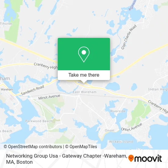
See Networking Group Usa - Gateway Chapter -Wareham, MA, Boston, on the map
Public Transit to Networking Group Usa - Gateway Chapter -Wareham, MA in Boston
Wondering how to get to Networking Group Usa - Gateway Chapter -Wareham, MA in Boston? Moovit helps you find the best way to get to Networking Group Usa - Gateway Chapter -Wareham, MA with step-by-step directions from the nearest public transit station.
Moovit provides free maps and live directions to help you navigate through your city. View schedules, routes, timetables, and find out how long does it take to get to Networking Group Usa - Gateway Chapter -Wareham, MA in real time.
Looking for the nearest stop or station to Networking Group Usa - Gateway Chapter -Wareham, MA? Check out this list of stops closest to your destination: Cvs Cranberry; Depot St.; Cranberry Plaza; Wareham Village.
Bus: L2, WNB, WP, L1, L4, WARE.Train: CAPEFLYER.
Want to see if there’s another route that gets you there at an earlier time? Moovit helps you find alternative routes or times. Get directions from and directions to Networking Group Usa - Gateway Chapter -Wareham, MA easily from the Moovit App or Website.
We make riding to Networking Group Usa - Gateway Chapter -Wareham, MA easy, which is why over 1.7 million users, including users in Boston, trust Moovit as the best app for public transit. You don’t need to download an individual bus app or train app, Moovit is your all-in-one transit app that helps you find the best bus time or train time available.
For information on prices of bus and train, costs and ride fares to Networking Group Usa - Gateway Chapter -Wareham, MA, please check the Moovit app.
Use the app to navigate to popular places including to the airport, hospital, stadium, grocery store, mall, coffee shop, school, college, and university.
Location: Boston
- The Fan Club Wareham Ma,
- Coin Cloud Bitcoin ATM,
- Agawam River,
- Smartwax Professional,
- East Wareham, Massachusetts,
- Retreat at Union Pond,
- Agawam,
- House Of Thai Flr 1,
- Upper Cape Realty - Wareham Office,
- East Wareham Station (historical),
- Gia Auto Sales,
- Big Joe's Car Wash,
- East Wareham Roofing & Gutter Installation Roofing,
- USPS Collection Box - Po Lobby,
- Radioshack,
- Wareham Recycling Center,
- Exxon,
- Best Friends Learning Center,
- Wareham Exit 2 Park & Ride,
- New Depot Crossing
Places Near Networking Group Usa - Gateway Chapter -Wareham, MA (Boston)
- House Of Blues, Boston,
- Wang Theater, Boston,
- Quincy Market, Boston,
- Massachusetts General Hospital, Boston,
- Seaport District, Boston,
- Boston Convention & Exhibition Center, Boston,
- Wilbur Theatre, Boston,
- Leader Bank Pavilion (Leader Bank Pavillion), Boston,
- Boston Medical Center, Boston,
- North End, Boston,
- Mgm Music Hall, Boston,
- Museum Of Science, Boston,
- Prudential Center, Boston,
- Boston Children's Hospital, Boston,
- Boston Common, Boston,
- Isabella Stewart Gardner Museum, Boston,
- Td Garden, Boston,
- Cheers, Boston,
- Castle Island, Boston,
- Faneuil Hall, Boston
How to get to popular places in Boston with public transit
Get around Boston by public transit!
Traveling around Boston has never been so easy. See step by step directions as you travel to any attraction, street or major public transit station. View bus and train schedules, arrival times, service alerts and detailed routes on a map, so you know exactly how to get to anywhere in Boston.
When traveling to any destination around Boston use Moovit's Live Directions with Get Off Notifications to know exactly where and how far to walk, how long to wait for your line, and how many stops are left. Moovit will alert you when it's time to get off — no need to constantly re-check whether yours is the next stop.
Wondering how to use public transit in Boston or how to pay for public transit in Boston? Moovit public transit app can help you navigate your way with public transit easily, and at minimum cost. It includes public transit fees, ticket prices, and costs. Looking for a map of Boston public transit lines? Moovit public transit app shows all public transit maps in Boston with all Bus, Train, Subway and Ferry routes and stops on an interactive map.
Boston has 4 transit type(s), including: Bus, Train, Subway and Ferry, operated by several transit agencies, including MBTA, Southeastern Regional Transit Authority, MetroWest Regional Transit Authority, Rhode Island Public Transit Authority, WRTA, Lowell Regional Transit Authority, Merrimack Valley Transit, Montachusett Regional Transit Authority, Cape Cod Regional Transit Authority, Brockton Area Transit Authority, Martha's Vineyard Transit Authority, the WAVE - Nantucket Regional Transit Authority, GATRA, Cape Ann Transportation Authority and Massport