Directions to New Balance (Boston) with public transportation
The following transit lines have routes that pass near New Balance
 Bus: 88, BB, PETER PAN, BT, DV.
- Subway: BLUE LINE.
- Ferry: HINGHAM/HULL FERRY, QUINCY FERRY, WINTHROP FERRY, WINTHROP/QUINCY FERRY.
How to get to New Balance by bus?
Click on the bus route to see step by step directions with maps, line arrival times and updated time schedules.
From Forest Hills Station MBTA, Boston
59 minFrom New England Baptist Hospital, Boston
50 minFrom St. Elizabeth's, Boston
63 minFrom Sonia, Boston
73 minFrom 1010 MASS AVE, Boston
40 minFrom Assembly Square, Somerville
64 minFrom New Balance, Boston
71 minFrom Spaulding Rehabilitation Center, Boston
71 minFrom La Quinta Inn & Suites Boston Somerville, Somerville
70 minFrom Uphams Corner, Boston
55 min
How to get to New Balance by subway?
Click on the subway route to see step by step directions with maps, line arrival times and updated time schedules.
From Sonia, Boston
80 minFrom La Quinta Inn & Suites Boston Somerville, Somerville
44 minFrom St. Elizabeth's, Boston
70 minFrom New England Baptist Hospital, Boston
65 minFrom Spaulding Rehabilitation Center, Boston
83 minFrom 1010 MASS AVE, Boston
57 minFrom Uphams Corner, Boston
57 minFrom New Balance, Boston
83 minFrom Assembly Square, Somerville
39 minFrom Forest Hills Station MBTA, Boston
42 min
Bus stops near New Balance in Boston
Ferry stations near New Balance in Boston
Subway station near New Balance in Boston
- Airport, 17 min walk,VIEW
Bus lines to New Balance in Boston
What are the closest stations to New Balance?
The closest stations to New Balance are:
- Terminal B Stop 1 – Lex Drop Off is 5 yards away, 1 min walk.
- Water Transportation Dock is 297 yards away, 4 min walk.
- Jeffries St @ Everett St is 527 yards away, 7 min walk.
- Logan Office Center is 530 yards away, 7 min walk.
- Logan Airport Ferry Terminal is 880 yards away, 11 min walk.
- Airport is 1432 yards away, 17 min walk.
- Lewis Mall Wharf is 2034 yards away, 25 min walk.
- Terminal B - Arrivals is 2385 yards away, 29 min walk.
Which bus lines stop near New Balance?
These bus lines stop near New Balance: 88, BB, PETER PAN.
Which subway line stops near New Balance?
BLUE LINE (Wonderland)
What’s the nearest subway station to New Balance in Boston?
The nearest subway station to New Balance in Boston is Airport. It’s a 17 min walk away.
What’s the nearest bus station to New Balance in Boston?
The nearest bus station to New Balance in Boston is Terminal B Stop 1 – Lex Drop Off. It’s a 1 min walk away.
What’s the nearest ferry station to New Balance in Boston?
The nearest ferry station to New Balance in Boston is Logan Airport Ferry Terminal. It’s a 11 min walk away.
What time is the first subway to New Balance in Boston?
The BLUE LINE is the first subway that goes to New Balance in Boston. It stops nearby at 5:12 AM.
What time is the last subway to New Balance in Boston?
The BLUE LINE is the last subway that goes to New Balance in Boston. It stops nearby at 1:59 AM.
What time is the first bus to New Balance in Boston?
The 44 is the first bus that goes to New Balance in Boston. It stops nearby at 3:05 AM.
What time is the last bus to New Balance in Boston?
The 44 is the last bus that goes to New Balance in Boston. It stops nearby at 2:55 AM.
What time is the first ferry to New Balance in Boston?
The EAST is the first ferry that goes to New Balance in Boston. It stops nearby at 5:55 AM.
What time is the last ferry to New Balance in Boston?
The HINGHAM/HULL FERRY is the last ferry that goes to New Balance in Boston. It stops nearby at 10:05 PM.
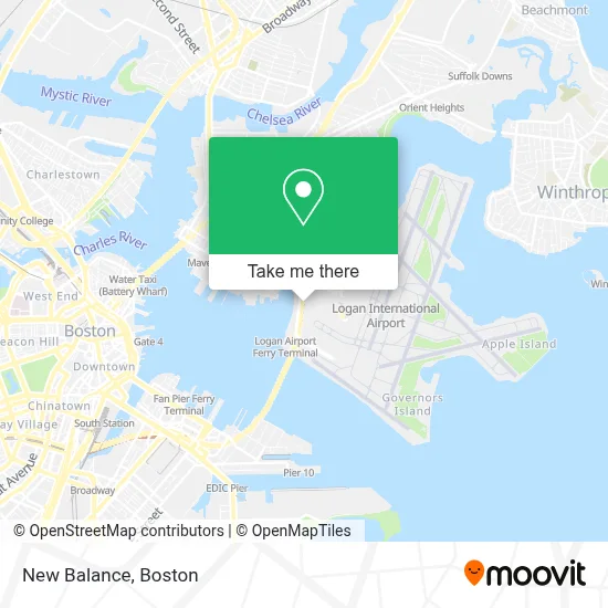
See New Balance, Boston, on the map
Public Transit to New Balance in Boston
Wondering how to get to New Balance in Boston? Moovit helps you find the best way to get to New Balance with step-by-step directions from the nearest public transit station.
Moovit provides free maps and live directions to help you navigate through your city. View schedules, routes, timetables, and find out how long does it take to get to New Balance in real time.
Looking for the nearest stop or station to New Balance? Check out this list of stops closest to your destination: Terminal B Stop 1 – Lex Drop Off; Water Transportation Dock; Jeffries St @ Everett St; Logan Office Center; Logan Airport Ferry Terminal; Airport; Lewis Mall Wharf; Terminal B - Arrivals.
Bus: 88, BB, PETER PAN, BT, DV, FH, WO, 44, 66, 41, 120.Subway: BLUE LINE.Ferry: HINGHAM/HULL FERRY, QUINCY FERRY, WINTHROP FERRY, WINTHROP/QUINCY FERRY.
Want to see if there’s another route that gets you there at an earlier time? Moovit helps you find alternative routes or times. Get directions from and directions to New Balance easily from the Moovit App or Website.
We make riding to New Balance easy, which is why over 1.7 million users, including users in Boston, trust Moovit as the best app for public transit. You don’t need to download an individual bus app or train app, Moovit is your all-in-one transit app that helps you find the best bus time or train time available.
For information on prices of bus, subway and train, costs and ride fares to New Balance, please check the Moovit app.
Use the app to navigate to popular places including to the airport, hospital, stadium, grocery store, mall, coffee shop, school, college, and university.
New Balance Address: 1 Harborside Dr street in Boston
- National Car Rental,
- Enterprise,
- Gate A16,
- Swatch Boston Logan International Airport Terminal B,
- Friendly's,
- Airport MBTA Station - Blue Line,
- Duty Free Boston Logan International Airport,
- Wahlburgers,
- Jetblue,
- Global Entry Enrollment Center,
- Lex Etix North Station,
- Massachusetts Port Authority (Massport),
- Gate A21,
- Terminal A Gates 13-22 Escalator,
- Yale Car,
- Berkshire Farms Market,
- Lex Etix Logan Termina,
- Alaska Airlines Terminal A,
- Xpresspa,
- Massport Harborwalk Park
Places Near New Balance (Boston)
- Quincy Market, Boston,
- Museum Of Science, Boston,
- Cheers, Boston,
- North End, Boston,
- Castle Island, Boston,
- Seaport District, Boston,
- Wilbur Theatre, Boston,
- Td Garden, Boston,
- Mgm Music Hall, Boston,
- Isabella Stewart Gardner Museum, Boston,
- Boston Children's Hospital, Boston,
- Boston Medical Center, Boston,
- Wang Theater, Boston,
- House Of Blues, Boston,
- Prudential Center, Boston,
- Faneuil Hall, Boston,
- Leader Bank Pavilion (Leader Bank Pavillion), Boston,
- Boston Common, Boston,
- Massachusetts General Hospital, Boston,
- Boston Convention & Exhibition Center, Boston
How to get to popular places in Boston with public transit
Get around Boston by public transit!
Traveling around Boston has never been so easy. See step by step directions as you travel to any attraction, street or major public transit station. View bus and train schedules, arrival times, service alerts and detailed routes on a map, so you know exactly how to get to anywhere in Boston.
When traveling to any destination around Boston use Moovit's Live Directions with Get Off Notifications to know exactly where and how far to walk, how long to wait for your line, and how many stops are left. Moovit will alert you when it's time to get off — no need to constantly re-check whether yours is the next stop.
Wondering how to use public transit in Boston or how to pay for public transit in Boston? Moovit public transit app can help you navigate your way with public transit easily, and at minimum cost. It includes public transit fees, ticket prices, and costs. Looking for a map of Boston public transit lines? Moovit public transit app shows all public transit maps in Boston with all Bus, Train, Subway and Ferry routes and stops on an interactive map.
Boston has 4 transit type(s), including: Bus, Train, Subway and Ferry, operated by several transit agencies, including MBTA, Southeastern Regional Transit Authority, MetroWest Regional Transit Authority, Rhode Island Public Transit Authority, WRTA, Lowell Regional Transit Authority, Merrimack Valley Transit, Montachusett Regional Transit Authority, Cape Cod Regional Transit Authority, Brockton Area Transit Authority, Martha's Vineyard Transit Authority, the WAVE - Nantucket Regional Transit Authority, GATRA, Cape Ann Transportation Authority and Massport