Directions to New Bedford Gas And Edison Light Complex with public transportation
The following transit lines have routes that pass near New Bedford Gas And Edison Light Complex
 Bus: 201, 205, 9.
- Train: FALL RIVER/NEW BEDFORD.
- Ferry: CUTTYHUNK FERRY, SEASTREAK, SEASTREAK.
How to get to New Bedford Gas And Edison Light Complex by bus?
Click on the bus route to see step by step directions with maps, line arrival times and updated time schedules.
From Bedford Industrial Park
75 minFrom Amazon Fulfillment Bos7
116 minFrom Walmart Fall River Supercenter
81 minFrom Bristol Community College
68 minFrom B.M.C. Durfee High School
67 minFrom Lizzy Borden House
68 minFrom RMV New Bedford
73 minFrom Charlton Memorial Hospital
86 minFrom Falmouth MA USA
98 minFrom Mass Maritime Academy
125 min
How to get to New Bedford Gas And Edison Light Complex by train?
Click on the train route to see step by step directions with maps, line arrival times and updated time schedules.
Bus stops near New Bedford Gas And Edison Light Complex
Ferry stations near New Bedford Gas And Edison Light Complex
Train station near New Bedford Gas And Edison Light Complex
- New Bedford, 39 min walk,VIEW
What are the closest stations to New Bedford Gas And Edison Light Complex?
The closest stations to New Bedford Gas And Edison Light Complex are:
- Pleasant St And Wing St is 282 yards away, 4 min walk.
- Acushnet Ave And Walnut St is 401 yards away, 5 min walk.
- Cuttyhunk Ferry Pier, New Bedford, MA is 2497 yards away, 30 min walk.
- New Bedford, MA is 2598 yards away, 31 min walk.
- New Bedford is 3317 yards away, 39 min walk.
Which bus lines stop near New Bedford Gas And Edison Light Complex?
These bus lines stop near New Bedford Gas And Edison Light Complex: 201, 205, 9.
Which train line stops near New Bedford Gas And Edison Light Complex?
FALL RIVER/NEW BEDFORD (#2011 | New Bedford)
What’s the nearest bus station to New Bedford Gas And Edison Light Complex?
The nearest bus station to New Bedford Gas And Edison Light Complex is Pleasant St And Wing St. It’s a 4 min walk away.
What’s the nearest ferry station to New Bedford Gas And Edison Light Complex?
The nearest ferry station to New Bedford Gas And Edison Light Complex is Cuttyhunk Ferry Pier, New Bedford, MA. It’s a 30 min walk away.
What time is the first train to New Bedford Gas And Edison Light Complex?
The FALL RIVER/NEW BEDFORD is the first train that goes to New Bedford Gas And Edison Light Complex. It stops nearby at 4:16 AM.
What time is the last train to New Bedford Gas And Edison Light Complex?
The FALL RIVER/NEW BEDFORD is the last train that goes to New Bedford Gas And Edison Light Complex. It stops nearby at 1:38 AM.
What time is the first bus to New Bedford Gas And Edison Light Complex?
The 201 is the first bus that goes to New Bedford Gas And Edison Light Complex. It stops nearby at 5:22 AM.
What time is the last bus to New Bedford Gas And Edison Light Complex?
The 201 is the last bus that goes to New Bedford Gas And Edison Light Complex. It stops nearby at 9:45 PM.
What time is the first ferry to New Bedford Gas And Edison Light Complex?
The SEASTREAK is the first ferry that goes to New Bedford Gas And Edison Light Complex. It stops nearby at 8:20 AM.
What time is the last ferry to New Bedford Gas And Edison Light Complex?
The SEASTREAK is the last ferry that goes to New Bedford Gas And Edison Light Complex. It stops nearby at 8:40 PM.
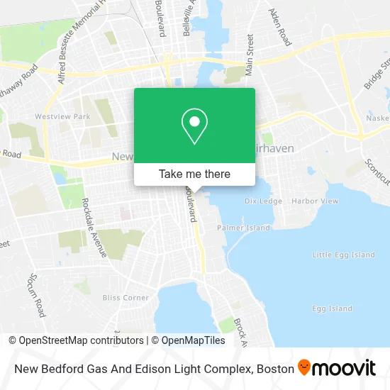
See New Bedford Gas And Edison Light Complex on the map
Public Transportation to New Bedford Gas And Edison Light Complex
Wondering how to get to New Bedford Gas And Edison Light Complex? Moovit helps you find the best way to get to New Bedford Gas And Edison Light Complex with step-by-step directions from the nearest public transit station.
Moovit provides free maps and live directions to help you navigate through your city. View schedules, routes, timetables, and find out how long does it take to get to New Bedford Gas And Edison Light Complex in real time.
Looking for the nearest stop or station to New Bedford Gas And Edison Light Complex? Check out this list of stops closest to your destination: Pleasant St And Wing St; Acushnet Ave And Walnut St; Cuttyhunk Ferry Pier; New Bedford, MA; New Bedford.
Bus: 201, 205, 9.Train: FALL RIVER/NEW BEDFORD.Ferry: CUTTYHUNK FERRY, SEASTREAK, SEASTREAK.
Want to see if there’s another route that gets you there at an earlier time? Moovit helps you find alternative routes or times. Get directions from and directions to New Bedford Gas And Edison Light Complex easily from the Moovit App or Website.
We make riding to New Bedford Gas And Edison Light Complex easy, which is why over 1.7 million users, including users in New Bedford, trust Moovit as the best app for public transit. You don’t need to download an individual bus app or train app, Moovit is your all-in-one transit app that helps you find the best bus time or train time available.
For information on prices of bus and train, costs and ride fares to New Bedford Gas And Edison Light Complex, please check the Moovit app.
Use the app to navigate to popular places including to the airport, hospital, stadium, grocery store, mall, coffee shop, school, college, and university.
Location: New Bedford, Boston
- Acushnet Avenue and Russell Street,
- Animal Rescue League,
- Luzo Fishing Gear Inc,
- Port of New Bedford,
- Baby Kenny's Tot Lot,
- Monte Park Basketball Courts,
- Griffin Street Cemetery,
- Ground Floor Coffee,
- Back Door Burgers & More,
- Boat Mary Anne Inc,
- Ultra Marine Band Club,
- The New Cape Verdean Ultramarine Band Club,
- Solange D Kleaner,
- Djecy Ramos Photography,
- Cape Verdean American Veterans Association Memorial Hall,
- Mini Dumpster Rent,
- The Black Whale,
- Diversified Marketing Group,
- Tavares Handy Man,
- The Bisca Club
Places Near New Bedford Gas And Edison Light Complex
- Boston Common, Boston,
- Faneuil Hall, Boston,
- Castle Island, Boston,
- Wilbur Theatre, Boston,
- Td Garden, Boston,
- Cheers, Boston,
- Boston Children's Hospital, Boston,
- Museum Of Science, Boston,
- Boston Convention & Exhibition Center, Boston,
- Prudential Center, Boston,
- Wang Theater, Boston,
- Isabella Stewart Gardner Museum, Boston,
- Seaport District, Boston,
- Mgm Music Hall, Boston,
- Massachusetts General Hospital, Boston,
- House Of Blues, Boston,
- North End, Boston,
- Leader Bank Pavilion (Leader Bank Pavillion), Boston,
- Boston Medical Center, Boston,
- Quincy Market, Boston
How to get to popular places in Boston with public transit
Get around New Bedford by public transit!
Traveling around New Bedford has never been so easy. See step by step directions as you travel to any attraction, street or major public transit station. View bus and train schedules, arrival times, service alerts and detailed routes on a map, so you know exactly how to get to anywhere in New Bedford.
When traveling to any destination around New Bedford use Moovit's Live Directions with Get Off Notifications to know exactly where and how far to walk, how long to wait for your line, and how many stops are left. Moovit will alert you when it's time to get off — no need to constantly re-check whether yours is the next stop.
Wondering how to use public transit in New Bedford or how to pay for public transit in New Bedford? Moovit public transit app can help you navigate your way with public transit easily, and at minimum cost. It includes public transit fees, ticket prices, and costs. Looking for a map of New Bedford public transit lines? Moovit public transit app shows all public transit maps in New Bedford with all Bus, Train, Subway and Ferry routes and stops on an interactive map.
Boston has 4 transit type(s), including: Bus, Train, Subway and Ferry, operated by several transit agencies, including MBTA, Southeastern Regional Transit Authority, MetroWest Regional Transit Authority, Rhode Island Public Transit Authority, WRTA, Lowell Regional Transit Authority, Merrimack Valley Transit, Montachusett Regional Transit Authority, Cape Cod Regional Transit Authority, Brockton Area Transit Authority, Martha's Vineyard Transit Authority, the WAVE - Nantucket Regional Transit Authority, GATRA, Cape Ann Transportation Authority and Massport