Directions to New England Community Project (Boston) with public transportation
The following transit lines have routes that pass near New England Community Project
 Bus: 16, 19, 23.
- Train: FAIRMOUNT, FRANKLIN/FOXBORO, FAIRMOUNT LINE SHUTTLE, PROVIDENCE/STOUGHTON.
- Subway: RED LINE.
How to get to New England Community Project by bus?
Click on the bus route to see step by step directions with maps, line arrival times and updated time schedules.
From South Shore Plaza, Braintree Town
83 minFrom Encore Boston Harbor, Everett
93 minFrom Winter Hill, Somerville
98 minFrom Costco Wholesale, Everett
105 minFrom TownePlace Suites Boston Logan Airport/Chelsea, Chelsea
75 minFrom Boston Omni Parker House Hotel, Boston
38 minFrom Santarpio's Pizza, Boston
78 minFrom Watertown Mall, Watertown Town
80 minFrom Modern Pastry Shop, Boston
48 minFrom KNL, Cambridge
53 min
How to get to New England Community Project by train?
Click on the train route to see step by step directions with maps, line arrival times and updated time schedules.
How to get to New England Community Project by subway?
Click on the subway route to see step by step directions with maps, line arrival times and updated time schedules.
From Encore Boston Harbor, Everett
77 minFrom Winter Hill, Somerville
80 minFrom Costco Wholesale, Everett
76 minFrom TownePlace Suites Boston Logan Airport/Chelsea, Chelsea
76 minFrom Boston Omni Parker House Hotel, Boston
47 minFrom Santarpio's Pizza, Boston
64 minFrom Modern Pastry Shop, Boston
51 minFrom KNL, Cambridge
57 min
Bus stops near New England Community Project in Boston
Train stations near New England Community Project in Boston
- Talbot Avenue, 6 min walk,VIEW
Subway station near New England Community Project in Boston
- Fields Corner, 28 min walk,VIEW
Bus lines to New England Community Project in Boston
What are the closest stations to New England Community Project?
The closest stations to New England Community Project are:
- Washington St @ Columbia Rd is 129 yards away, 2 min walk.
- Columbia Rd @ Washington St is 160 yards away, 2 min walk.
- Talbot Avenue is 460 yards away, 6 min walk.
- Blue Hill Ave @ Pasadena Rd is 573 yards away, 7 min walk.
- Fields Corner is 2333 yards away, 28 min walk.
Which bus lines stop near New England Community Project?
These bus lines stop near New England Community Project: 16, 19, 23.
Which train line stops near New England Community Project?
FAIRMOUNT (#1619 | Fairmount)
Which subway line stops near New England Community Project?
RED LINE (Ashmont/Braintree)
What’s the nearest subway station to New England Community Project in Boston?
The nearest subway station to New England Community Project in Boston is Fields Corner. It’s a 28 min walk away.
What’s the nearest train station to New England Community Project in Boston?
The nearest train station to New England Community Project in Boston is Talbot Avenue. It’s a 6 min walk away.
What’s the nearest bus station to New England Community Project in Boston?
The nearest bus stations to New England Community Project in Boston are Washington St @ Columbia Rd and Columbia Rd @ Washington St. The closest one is a 2 min walk away.
What time is the first subway to New England Community Project in Boston?
The RED LINE is the first subway that goes to New England Community Project in Boston. It stops nearby at 5:18 AM.
What time is the last subway to New England Community Project in Boston?
The RED LINE is the last subway that goes to New England Community Project in Boston. It stops nearby at 2:01 AM.
What time is the first train to New England Community Project in Boston?
The FAIRMOUNT is the first train that goes to New England Community Project in Boston. It stops nearby at 4:41 AM.
What time is the last train to New England Community Project in Boston?
The FAIRMOUNT is the last train that goes to New England Community Project in Boston. It stops nearby at 12:03 AM.
What time is the first bus to New England Community Project in Boston?
The 28 is the first bus that goes to New England Community Project in Boston. It stops nearby at 3:16 AM.
What time is the last bus to New England Community Project in Boston?
The 23 is the last bus that goes to New England Community Project in Boston. It stops nearby at 2:35 AM.
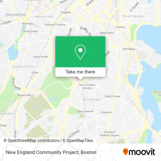
See New England Community Project, Boston, on the map
Public Transit to New England Community Project in Boston
Wondering how to get to New England Community Project in Boston? Moovit helps you find the best way to get to New England Community Project with step-by-step directions from the nearest public transit station.
Moovit provides free maps and live directions to help you navigate through your city. View schedules, routes, timetables, and find out how long does it take to get to New England Community Project in real time.
Looking for the nearest stop or station to New England Community Project? Check out this list of stops closest to your destination: Washington St @ Columbia Rd; Columbia Rd @ Washington St; Talbot Avenue; Blue Hill Ave @ Pasadena Rd; Fields Corner.
Bus: 16, 19, 23.Train: FAIRMOUNT, FRANKLIN/FOXBORO, FAIRMOUNT LINE SHUTTLE, PROVIDENCE/STOUGHTON.Subway: RED LINE.
Want to see if there’s another route that gets you there at an earlier time? Moovit helps you find alternative routes or times. Get directions from and directions to New England Community Project easily from the Moovit App or Website.
We make riding to New England Community Project easy, which is why over 1.7 million users, including users in Boston, trust Moovit as the best app for public transit. You don’t need to download an individual bus app or train app, Moovit is your all-in-one transit app that helps you find the best bus time or train time available.
For information on prices of bus, subway and train, costs and ride fares to New England Community Project, please check the Moovit app.
Use the app to navigate to popular places including to the airport, hospital, stadium, grocery store, mall, coffee shop, school, college, and university.
New England Community Project Address: 102 Columbia Rd street in Boston
- Bulldog Towing Service,
- Jeremiah E Burke High School,
- Brothers Supermarket (Brother's Supermarket),
- Boston Public Library Grove Hall Branch,
- Figueroa Mini Market,
- Yawkey Center,
- St Katharine Drexel,
- Redbox,
- Ramzo African Market,
- Walaikum's Burger,
- Lilyp African Hair Braiding,
- Bebe's African Hair Braiding Salon,
- Wings and Tingz Caters,
- Law Office of Susan T Aguiar (Law Offices of Susan T. Aguiar),
- Blue Hill Ave & Georgia St,
- Kingdom Hall of Jehovah's Witnesses,
- Dorchester,
- The Guild,
- Boston Lights: A Lantern Experience,
- Franklin Park Zoo XD Theatre
Places Near New England Community Project (Boston)
- Museum Of Science, Boston,
- Massachusetts General Hospital, Boston,
- Td Garden, Boston,
- Cheers, Boston,
- House Of Blues, Boston,
- Leader Bank Pavilion (Leader Bank Pavillion), Boston,
- Isabella Stewart Gardner Museum, Boston,
- Boston Children's Hospital, Boston,
- North End, Boston,
- Wilbur Theatre, Boston,
- Seaport District, Boston,
- Boston Medical Center, Boston,
- Boston Common, Boston,
- Wang Theater, Boston,
- Castle Island, Boston,
- Mgm Music Hall, Boston,
- Boston Convention & Exhibition Center, Boston,
- Prudential Center, Boston,
- Faneuil Hall, Boston,
- Quincy Market, Boston
How to get to popular places in Boston with public transit
Get around Boston by public transit!
Traveling around Boston has never been so easy. See step by step directions as you travel to any attraction, street or major public transit station. View bus and train schedules, arrival times, service alerts and detailed routes on a map, so you know exactly how to get to anywhere in Boston.
When traveling to any destination around Boston use Moovit's Live Directions with Get Off Notifications to know exactly where and how far to walk, how long to wait for your line, and how many stops are left. Moovit will alert you when it's time to get off — no need to constantly re-check whether yours is the next stop.
Wondering how to use public transit in Boston or how to pay for public transit in Boston? Moovit public transit app can help you navigate your way with public transit easily, and at minimum cost. It includes public transit fees, ticket prices, and costs. Looking for a map of Boston public transit lines? Moovit public transit app shows all public transit maps in Boston with all Bus, Train, Subway and Ferry routes and stops on an interactive map.
Boston has 4 transit type(s), including: Bus, Train, Subway and Ferry, operated by several transit agencies, including MBTA, Southeastern Regional Transit Authority, MetroWest Regional Transit Authority, Rhode Island Public Transit Authority, WRTA, Lowell Regional Transit Authority, Merrimack Valley Transit, Montachusett Regional Transit Authority, Cape Cod Regional Transit Authority, Brockton Area Transit Authority, Martha's Vineyard Transit Authority, the WAVE - Nantucket Regional Transit Authority, GATRA, Cape Ann Transportation Authority and Massport