Directions to New England Orthopedic Surgeons (Boston) with public transportation
The following transit lines have routes that pass near New England Orthopedic Surgeons
 Bus: 31, G73E, R44.
- Train: VERMONTER, VALLEY FLYER.
How to get to New England Orthopedic Surgeons by bus?
Click on the bus route to see step by step directions with maps, line arrival times and updated time schedules.
From Palladium, Worcester
176 minFrom Quinsigamond Community College, Worcester
164 minFrom Foxwoods, Worcester
176 minFrom Worcester, MA, Worcester
171 minFrom South High Community School, Worcester
243 minFrom Registry Of Motor Vehicles (Rmv) Branch Office, Worcester
175 minFrom Gardner, MA, Gardner
179 min
How to get to New England Orthopedic Surgeons by train?
Click on the train route to see step by step directions with maps, line arrival times and updated time schedules.
Bus stops near New England Orthopedic Surgeons in Boston
Train station near New England Orthopedic Surgeons in Boston
- Northampton, 57 min walk,VIEW
Bus lines to New England Orthopedic Surgeons in Boston
What are the closest stations to New England Orthopedic Surgeons?
The closest stations to New England Orthopedic Surgeons are:
- King / Church is 289 yards away, 4 min walk.
- King St And Lia Of Northampton (N) is 1016 yards away, 13 min walk.
- Northampton is 4820 yards away, 57 min walk.
Which bus lines stop near New England Orthopedic Surgeons?
These bus lines stop near New England Orthopedic Surgeons: 31, G73E, R44.
Which train line stops near New England Orthopedic Surgeons?
VERMONTER (St Albans)
What’s the nearest bus station to New England Orthopedic Surgeons in Boston?
The nearest bus station to New England Orthopedic Surgeons in Boston is King / Church. It’s a 4 min walk away.
What time is the first train to New England Orthopedic Surgeons in Boston?
The VALLEY FLYER is the first train that goes to New England Orthopedic Surgeons in Boston. It stops nearby at 6:30 AM.
What time is the last train to New England Orthopedic Surgeons in Boston?
The VALLEY FLYER is the last train that goes to New England Orthopedic Surgeons in Boston. It stops nearby at 10:07 PM.
What time is the first bus to New England Orthopedic Surgeons in Boston?
The 31 is the first bus that goes to New England Orthopedic Surgeons in Boston. It stops nearby at 5:38 AM.
What time is the last bus to New England Orthopedic Surgeons in Boston?
The R44 is the last bus that goes to New England Orthopedic Surgeons in Boston. It stops nearby at 8:59 PM.
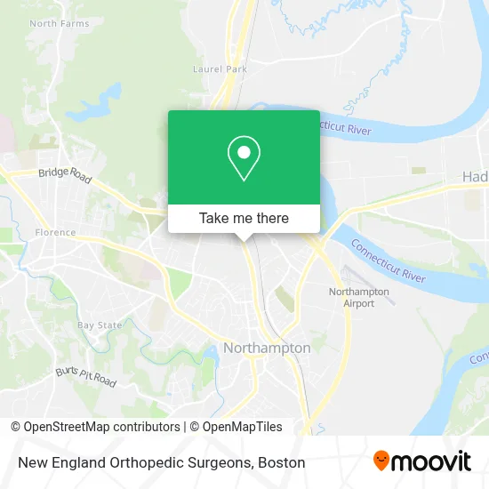
See New England Orthopedic Surgeons, Boston, on the map
Public Transit to New England Orthopedic Surgeons in Boston
Wondering how to get to New England Orthopedic Surgeons in Boston? Moovit helps you find the best way to get to New England Orthopedic Surgeons with step-by-step directions from the nearest public transit station.
Moovit provides free maps and live directions to help you navigate through your city. View schedules, routes, timetables, and find out how long does it take to get to New England Orthopedic Surgeons in real time.
Looking for the nearest stop or station to New England Orthopedic Surgeons? Check out this list of stops closest to your destination: King / Church; King St And Lia Of Northampton (N); Northampton.
Bus: 31, G73E, R44.Train: VERMONTER, VALLEY FLYER.
Want to see if there’s another route that gets you there at an earlier time? Moovit helps you find alternative routes or times. Get directions from and directions to New England Orthopedic Surgeons easily from the Moovit App or Website.
We make riding to New England Orthopedic Surgeons easy, which is why over 1.7 million users, including users in Boston, trust Moovit as the best app for public transit. You don’t need to download an individual bus app or train app, Moovit is your all-in-one transit app that helps you find the best bus time or train time available.
For information on prices of bus and train, costs and ride fares to New England Orthopedic Surgeons, please check the Moovit app.
Use the app to navigate to popular places including to the airport, hospital, stadium, grocery store, mall, coffee shop, school, college, and university.
New England Orthopedic Surgeons Address: 325 King St street in Boston
- Starbucks,
- Papa Gino's,
- Yankee Mattress Company,
- Mobile Mart,
- Personal Touch Pilates,
- Bankesb,
- Lora D. Grimes, MD,
- Ann S Cooper-Ciccarelli, do,
- Baystate Medical Practices - Obstetrics & Gynecology,
- Jaime Aryn Onofrey, CNP,
- Harvey M Lederman, MD,
- Bridgestone,
- Firestone,
- River Valley Co-OP,
- Kia,
- Neos Northampton,
- Barrett St Marsh,
- Sakura,
- Northampton Spine Medicine,
- Casey Mark Phys
Places Near New England Orthopedic Surgeons (Boston)
- North End, Boston,
- Cheers, Boston,
- Quincy Market, Boston,
- Wang Theater, Boston,
- Isabella Stewart Gardner Museum, Boston,
- House Of Blues, Boston,
- Leader Bank Pavilion (Leader Bank Pavillion), Boston,
- Boston Medical Center, Boston,
- Massachusetts General Hospital, Boston,
- Boston Common, Boston,
- Td Garden, Boston,
- Wilbur Theatre, Boston,
- Mgm Music Hall, Boston,
- Boston Children's Hospital, Boston,
- Castle Island, Boston,
- Museum Of Science, Boston,
- Faneuil Hall, Boston,
- Prudential Center, Boston,
- Seaport District, Boston,
- Boston Convention & Exhibition Center, Boston
How to get to popular places in Boston with public transit
Get around Boston by public transit!
Traveling around Boston has never been so easy. See step by step directions as you travel to any attraction, street or major public transit station. View bus and train schedules, arrival times, service alerts and detailed routes on a map, so you know exactly how to get to anywhere in Boston.
When traveling to any destination around Boston use Moovit's Live Directions with Get Off Notifications to know exactly where and how far to walk, how long to wait for your line, and how many stops are left. Moovit will alert you when it's time to get off — no need to constantly re-check whether yours is the next stop.
Wondering how to use public transit in Boston or how to pay for public transit in Boston? Moovit public transit app can help you navigate your way with public transit easily, and at minimum cost. It includes public transit fees, ticket prices, and costs. Looking for a map of Boston public transit lines? Moovit public transit app shows all public transit maps in Boston with all Bus, Train, Subway and Ferry routes and stops on an interactive map.
Boston has 4 transit type(s), including: Bus, Train, Subway and Ferry, operated by several transit agencies, including MBTA, Southeastern Regional Transit Authority, MetroWest Regional Transit Authority, Rhode Island Public Transit Authority, WRTA, Lowell Regional Transit Authority, Merrimack Valley Transit, Montachusett Regional Transit Authority, Cape Cod Regional Transit Authority, Brockton Area Transit Authority, Martha's Vineyard Transit Authority, the WAVE - Nantucket Regional Transit Authority, GATRA, Cape Ann Transportation Authority and Massport