Directions to New England Sign Group Inc. (Worcester) with public transportation
The following transit lines have routes that pass near New England Sign Group Inc.
 Bus: 14, 15, 33, CLINTON-WORCESTER COMMUTER SHUTTLE, GREYHOUND US0230.
- Train: FRAMINGHAM/WORCESTER.
How to get to New England Sign Group Inc. by bus?
Click on the bus route to see step by step directions with maps, line arrival times and updated time schedules.
Bus stops near New England Sign Group Inc. in Worcester
Bus lines to New England Sign Group Inc. in Worcester
- 5, Grafton Street,VIEW
- 12, Southwest Commons DTA Offices,VIEW
- 16, Lincoln Plz- Hamiliton St,VIEW
- B79, Amherst,VIEW
- 1, Walmart Route 146,VIEW
- 14, Central Hub,VIEW
- 15, Julio Drive Shrewsbury,VIEW
- FRAMINGHAM/WORCESTER, Framingham/Worcester,VIEW
- CLINTON-WORCESTER COMMUTER SHUTTLE, Clinton-Worcester Commuter Shuttle,VIEW
- LAKE SHORE LIMITED, Lake Shore Limited,VIEW
- PETER PAN, BOSTON - WORCESTER - SPRINGFIELD - NORTHAMPTON - AMHERST,VIEW
- PETER PAN, WORCESTER - NEWARK,VIEW
- PETER PAN, NEW YORK - WATERBURY - HARTFORD - WORCESTER - BOSTON Express Service,VIEW
- PETER PAN, BOSTON - WORCESTER - HARTFORD - WATERBURY - NEW YORK Express Service,VIEW
- PETER PAN, AMHERST - NORTHAMPTON - BOSTON College Express,VIEW
- PETER PAN, AMHERST - NORTHAMPTON - SPRINGFIELD - WORCESTER - BOSTON,VIEW
- PETER PAN, PROVIDENCE - SPRINGFIELD - ALBANY,VIEW
- PETER PAN, NEWARK - WORCESTER,VIEW
- PETER PAN, ALBANY - SPRINGFIELD - PROVIDENCE,VIEW
- FLIXBUS 2693, Boston - Albany,VIEW
What are the closest stations to New England Sign Group Inc.?
The closest stations to New England Sign Group Inc. are:
- Grafton St + Waverly St is 57 yards away, 1 min walk.
- Union Station Garage is 86 yards away, 2 min walk.
- Worcester Union Station is 178 yards away, 3 min walk.
Which bus lines stop near New England Sign Group Inc.?
These bus lines stop near New England Sign Group Inc.: 14, 15, 33, CLINTON-WORCESTER COMMUTER SHUTTLE, GREYHOUND US0230.
Which train line stops near New England Sign Group Inc.?
FRAMINGHAM/WORCESTER (#525 | Worcester)
What’s the nearest bus station to New England Sign Group Inc. in Worcester?
The nearest bus station to New England Sign Group Inc. in Worcester is Grafton St + Waverly St. It’s a 1 min walk away.
What time is the first train to New England Sign Group Inc. in Worcester?
The FRAMINGHAM/WORCESTER is the first train that goes to New England Sign Group Inc. in Worcester. It stops nearby at 4:15 AM.
What time is the last train to New England Sign Group Inc. in Worcester?
The LAKE SHORE LIMITED is the last train that goes to New England Sign Group Inc. in Worcester. It stops nearby at 7:32 PM.
What time is the first bus to New England Sign Group Inc. in Worcester?
The GREYHOUND US0235 is the first bus that goes to New England Sign Group Inc. in Worcester. It stops nearby at 4:10 AM.
What time is the last bus to New England Sign Group Inc. in Worcester?
The GREYHOUND US0235 is the last bus that goes to New England Sign Group Inc. in Worcester. It stops nearby at 4:10 AM.
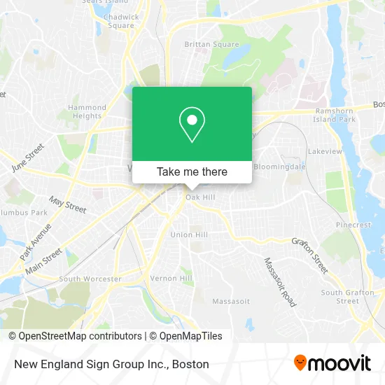
See New England Sign Group Inc., Worcester, on the map
Public Transit to New England Sign Group Inc. in Worcester
Wondering how to get to New England Sign Group Inc. in Worcester? Moovit helps you find the best way to get to New England Sign Group Inc. with step-by-step directions from the nearest public transit station.
Moovit provides free maps and live directions to help you navigate through your city. View schedules, routes, timetables, and find out how long does it take to get to New England Sign Group Inc. in real time.
Looking for the nearest stop or station to New England Sign Group Inc.? Check out this list of stops closest to your destination: Grafton St + Waverly St; Union Station Garage; Worcester Union Station.
Bus: 14, 15, 33, CLINTON-WORCESTER COMMUTER SHUTTLE, GREYHOUND US0230, 5, 12, 16, B79, 1, FRAMINGHAM/WORCESTER, LAKE SHORE LIMITED, PETER PAN, PETER PAN, FLIXBUS 2693, GREYHOUND US0231, GREYHOUND US0235, GREYHOUND US0240.Train: FRAMINGHAM/WORCESTER.
Want to see if there’s another route that gets you there at an earlier time? Moovit helps you find alternative routes or times. Get directions from and directions to New England Sign Group Inc. easily from the Moovit App or Website.
We make riding to New England Sign Group Inc. easy, which is why over 1.7 million users, including users in Worcester, trust Moovit as the best app for public transit. You don’t need to download an individual bus app or train app, Moovit is your all-in-one transit app that helps you find the best bus time or train time available.
For information on prices of bus and train, costs and ride fares to New England Sign Group Inc., please check the Moovit app.
Use the app to navigate to popular places including to the airport, hospital, stadium, grocery store, mall, coffee shop, school, college, and university.
New England Sign Group Inc. Address: 33 Arctic St street in Worcester
- Flexographic Printing Plate Co. (Flex-O-Graphic Printing Plate),
- Hmea,
- Wrta bus 26,
- Conrail Foremans Office,
- CSX Intermodal,
- J and T Rental,
- Walsh Chuck Hvac,
- Extreme Styles Barber Shop,
- Hyper Active Efx,
- Chandler Auto Body,
- Bar None,
- Exit 19/Shrewsbury St/E,
- CSX,
- Consolidated Freightways,
- Chris's Auto Repair,
- CSX Terminal - Worcester, MA,
- Union Station Parking Garage,
- MBTA Commuter Rail Commuter Rail to South Station,
- Grafton Hill Package,
- Worcester MBTA Commuter Rail Station
Places Near New England Sign Group Inc. (Worcester)
- House Of Blues, Boston,
- Isabella Stewart Gardner Museum, Boston,
- North End, Boston,
- Prudential Center, Boston,
- Td Garden, Boston,
- Mgm Music Hall, Boston,
- Wilbur Theatre, Boston,
- Boston Common, Boston,
- Boston Medical Center, Boston,
- Boston Children's Hospital, Boston,
- Wang Theater, Boston,
- Massachusetts General Hospital, Boston,
- Castle Island, Boston,
- Faneuil Hall, Boston,
- Boston Convention & Exhibition Center, Boston,
- Seaport District, Boston,
- Cheers, Boston,
- Museum Of Science, Boston,
- Quincy Market, Boston,
- Leader Bank Pavilion (Leader Bank Pavillion), Boston
How to get to popular places in Boston with public transit
Get around Worcester by public transit!
Traveling around Worcester has never been so easy. See step by step directions as you travel to any attraction, street or major public transit station. View bus and train schedules, arrival times, service alerts and detailed routes on a map, so you know exactly how to get to anywhere in Worcester.
When traveling to any destination around Worcester use Moovit's Live Directions with Get Off Notifications to know exactly where and how far to walk, how long to wait for your line, and how many stops are left. Moovit will alert you when it's time to get off — no need to constantly re-check whether yours is the next stop.
Wondering how to use public transit in Worcester or how to pay for public transit in Worcester? Moovit public transit app can help you navigate your way with public transit easily, and at minimum cost. It includes public transit fees, ticket prices, and costs. Looking for a map of Worcester public transit lines? Moovit public transit app shows all public transit maps in Worcester with all Bus, Train, Subway and Ferry routes and stops on an interactive map.
Boston has 4 transit type(s), including: Bus, Train, Subway and Ferry, operated by several transit agencies, including MBTA, Southeastern Regional Transit Authority, MetroWest Regional Transit Authority, Rhode Island Public Transit Authority, WRTA, Lowell Regional Transit Authority, Merrimack Valley Transit, Montachusett Regional Transit Authority, Cape Cod Regional Transit Authority, Brockton Area Transit Authority, Martha's Vineyard Transit Authority, the WAVE - Nantucket Regional Transit Authority, GATRA, Cape Ann Transportation Authority and Massport