How to get to New Entry Food Hub by bus?
Click on the bus route to see step by step directions with maps, line arrival times and updated time schedules.
How to get to New Entry Food Hub by train?
Click on the train route to see step by step directions with maps, line arrival times and updated time schedules.
Bus stops near New Entry Food Hub in Lowell
- Central St & Jackson St, 2 min walk,VIEW
- Middlesex Street & Moulton Avenue, 3 min walk,VIEW
- Merrimack St & Dutton St, 4 min walk,VIEW
- Bridge & Vfw Parkway, 4 min walk,VIEW
- Dutton St & Market St, 5 min walk,VIEW
- Merrimack St & John St, 5 min walk,VIEW
- Paige St And Kirk St - Lowell High School, 8 min walk,VIEW
Bus lines to New Entry Food Hub in Lowell
- 9, Loop,VIEW
- 18, Kennedy Center,VIEW
- 24, Robert B. Kennedy Transfer Center,VIEW
- 6, Broadway/UMass Lowell,VIEW
- 7, Pawtucketville/UMass Lowell North,VIEW
- 1, Kennedy Center,VIEW
- 10, Kennedy Center,VIEW
- 20, Umass Lowell North Campus,VIEW
- 8, Hannaford (Stop And Shop),VIEW
- 2, White Dove Plaza,VIEW
- 3, North Billerica Train Station,VIEW
- 4, Lowell High School,VIEW
- 5, Paige And Kirk Streets,VIEW
- 13, Gorham Street,VIEW
- 16, Cross Point Tower,VIEW
- 17, Walmart,VIEW
What are the closest stations to New Entry Food Hub?
The closest stations to New Entry Food Hub are:
- Central St & Jackson St is 108 yards away, 2 min walk.
- Middlesex Street & Moulton Avenue is 196 yards away, 3 min walk.
- Merrimack St & Dutton St is 284 yards away, 4 min walk.
- Bridge & Vfw Parkway is 285 yards away, 4 min walk.
- Dutton St & Market St is 332 yards away, 5 min walk.
- Merrimack St & John St is 387 yards away, 5 min walk.
- Paige St And Kirk St - Lowell High School is 611 yards away, 8 min walk.
Which bus lines stop near New Entry Food Hub?
These bus lines stop near New Entry Food Hub: 12, 24.
Which train line stops near New Entry Food Hub?
LOWELL (#331 | Lowell)
What’s the nearest bus station to New Entry Food Hub in Lowell?
The nearest bus station to New Entry Food Hub in Lowell is Central St & Jackson St. It’s a 2 min walk away.
What time is the first bus to New Entry Food Hub in Lowell?
The 24 is the first bus that goes to New Entry Food Hub in Lowell. It stops nearby at 5:35 AM.
What time is the last bus to New Entry Food Hub in Lowell?
The 24 is the last bus that goes to New Entry Food Hub in Lowell. It stops nearby at 9:36 PM.
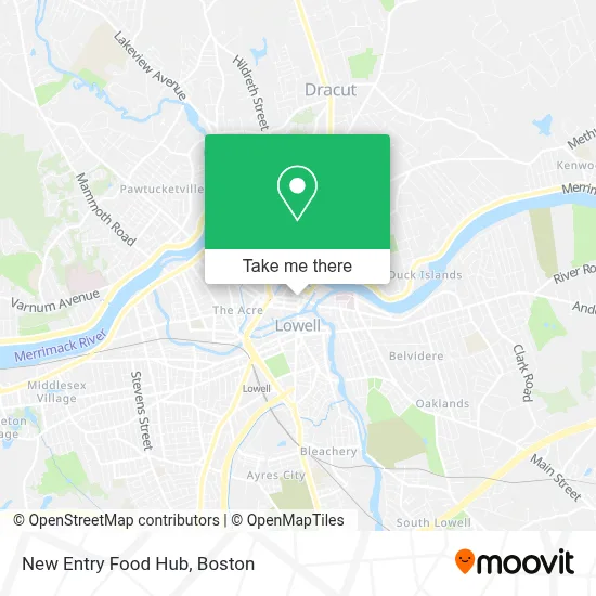
See New Entry Food Hub, Lowell, on the map
Public Transit to New Entry Food Hub in Lowell
Wondering how to get to New Entry Food Hub in Lowell? Moovit helps you find the best way to get to New Entry Food Hub with step-by-step directions from the nearest public transit station.
Moovit provides free maps and live directions to help you navigate through your city. View schedules, routes, timetables, and find out how long does it take to get to New Entry Food Hub in real time.
Looking for the nearest stop or station to New Entry Food Hub? Check out this list of stops closest to your destination: Central St & Jackson St; Middlesex Street & Moulton Avenue; Merrimack St & Dutton St; Bridge & Vfw Parkway; Dutton St & Market St; Merrimack St & John St; Paige St And Kirk St - Lowell High School.
Bus: 12, 24, 9, 18, 1, 6, 7, 10, 20, 8.Train: LOWELL.
Want to see if there’s another route that gets you there at an earlier time? Moovit helps you find alternative routes or times. Get directions from and directions to New Entry Food Hub easily from the Moovit App or Website.
We make riding to New Entry Food Hub easy, which is why over 1.7 million users, including users in Lowell, trust Moovit as the best app for public transit. You don’t need to download an individual bus app or train app, Moovit is your all-in-one transit app that helps you find the best bus time or train time available.
For information on prices of bus and train, costs and ride fares to New Entry Food Hub, please check the Moovit app.
Use the app to navigate to popular places including to the airport, hospital, stadium, grocery store, mall, coffee shop, school, college, and university.
New Entry Food Hub Address: 45 Merrimack St street in Lowell
- Osawa Lowell,
- Fiesta Eastern Fusion,
- Auto Ignition & Key Locksmith,
- Bright Bankruptcy Firm,
- Kung Fu Tea Lowell,
- Walgreens,
- Kung Fu Tea Shop,
- MoneyGram,
- BMO Harris Bank,
- Rainbowshops,
- William J Hamilton,
- George N Panas,
- Full Life Christian Center Lowell,
- Classic Convenience,
- Galeria De Los Andes,
- Victory Chapel of Lowell,
- Red Antler Apothecary,
- Cartridge Cave Video Games,
- A Damn Shame Records,
- Full Life Christian Center
Places Near New Entry Food Hub (Lowell)
- Prudential Center, Boston,
- Massachusetts General Hospital, Boston,
- Boston Convention & Exhibition Center, Boston,
- Cheers, Boston,
- Boston Common, Boston,
- House Of Blues, Boston,
- Isabella Stewart Gardner Museum, Boston,
- Leader Bank Pavilion (Leader Bank Pavillion), Boston,
- Seaport District, Boston,
- Museum Of Science, Boston,
- Wang Theater, Boston,
- Quincy Market, Boston,
- Td Garden, Boston,
- North End, Boston,
- Mgm Music Hall, Boston,
- Wilbur Theatre, Boston,
- Boston Medical Center, Boston,
- Boston Children's Hospital, Boston,
- Castle Island, Boston,
- Faneuil Hall, Boston
How to get to popular places in Boston with public transit
Get around Lowell by public transit!
Traveling around Lowell has never been so easy. See step by step directions as you travel to any attraction, street or major public transit station. View bus and train schedules, arrival times, service alerts and detailed routes on a map, so you know exactly how to get to anywhere in Lowell.
When traveling to any destination around Lowell use Moovit's Live Directions with Get Off Notifications to know exactly where and how far to walk, how long to wait for your line, and how many stops are left. Moovit will alert you when it's time to get off — no need to constantly re-check whether yours is the next stop.
Wondering how to use public transit in Lowell or how to pay for public transit in Lowell? Moovit public transit app can help you navigate your way with public transit easily, and at minimum cost. It includes public transit fees, ticket prices, and costs. Looking for a map of Lowell public transit lines? Moovit public transit app shows all public transit maps in Lowell with all Bus, Train, Subway and Ferry routes and stops on an interactive map.
Boston has 4 transit type(s), including: Bus, Train, Subway and Ferry, operated by several transit agencies, including MBTA, Southeastern Regional Transit Authority, MetroWest Regional Transit Authority, Rhode Island Public Transit Authority, WRTA, Lowell Regional Transit Authority, Merrimack Valley Transit, Montachusett Regional Transit Authority, Cape Cod Regional Transit Authority, Brockton Area Transit Authority, Martha's Vineyard Transit Authority, the WAVE - Nantucket Regional Transit Authority, GATRA, Cape Ann Transportation Authority and Massport