Directions to New State Prison at Concord (West Concord) with public transportation
The following transit lines have routes that pass near New State Prison at Concord
 Bus: EMERSON HOSPITAL SHUTTLE, FITCHBURG LINE SHUTTLE.
- Train: FITCHBURG.
How to get to New State Prison at Concord by bus?
Click on the bus route to see step by step directions with maps, line arrival times and updated time schedules.
Train station near New State Prison at Concord in West Concord
- Concord, 20 min walk,VIEW
Bus stops near New State Prison at Concord in West Concord
Bus lines to New State Prison at Concord in West Concord
What are the closest stations to New State Prison at Concord?
The closest stations to New State Prison at Concord are:
- Concord is 1648 yards away, 20 min walk.
- West Concord is 3612 yards away, 42 min walk.
- Emerson Hospital Center For Specialty Care is 4170 yards away, 49 min walk.
Which bus line stops near New State Prison at Concord?
EMERSON HOSPITAL SHUTTLE (Shirley Senior Center (9 Parker Rd)→Emerson Hospital Center For Specialty Care)
Which train line stops near New State Prison at Concord?
FITCHBURG (#413 | Wachusett)
What’s the nearest train station to New State Prison at Concord in West Concord?
The nearest train station to New State Prison at Concord in West Concord is Concord. It’s a 20 min walk away.
What time is the first train to New State Prison at Concord in West Concord?
The FITCHBURG is the first train that goes to New State Prison at Concord in West Concord. It stops nearby at 5:11 AM.
What time is the last train to New State Prison at Concord in West Concord?
The FITCHBURG is the last train that goes to New State Prison at Concord in West Concord. It stops nearby at 12:33 AM.
What time is the first bus to New State Prison at Concord in West Concord?
The EMERSON HOSPITAL SHUTTLE is the first bus that goes to New State Prison at Concord in West Concord. It stops nearby at 8:00 AM.
What time is the last bus to New State Prison at Concord in West Concord?
The EMERSON HOSPITAL SHUTTLE is the last bus that goes to New State Prison at Concord in West Concord. It stops nearby at 4:20 PM.
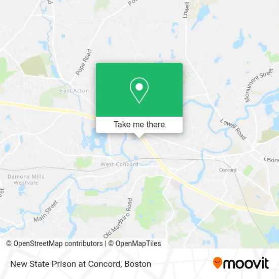
See New State Prison at Concord, West Concord, on the map
Public Transit to New State Prison at Concord in West Concord
Wondering how to get to New State Prison at Concord in West Concord? Moovit helps you find the best way to get to New State Prison at Concord with step-by-step directions from the nearest public transit station.
Moovit provides free maps and live directions to help you navigate through your city. View schedules, routes, timetables, and find out how long does it take to get to New State Prison at Concord in real time.
Looking for the nearest stop or station to New State Prison at Concord? Check out this list of stops closest to your destination: Concord; West Concord; Emerson Hospital Center For Specialty Care.
Bus: EMERSON HOSPITAL SHUTTLE, FITCHBURG LINE SHUTTLE.Train: FITCHBURG.
Want to see if there’s another route that gets you there at an earlier time? Moovit helps you find alternative routes or times. Get directions from and directions to New State Prison at Concord easily from the Moovit App or Website.
We make riding to New State Prison at Concord easy, which is why over 1.7 million users, including users in West Concord, trust Moovit as the best app for public transit. You don’t need to download an individual bus app or train app, Moovit is your all-in-one transit app that helps you find the best bus time or train time available.
For information on prices of bus, train and subway, costs and ride fares to New State Prison at Concord, please check the Moovit app.
Use the app to navigate to popular places including to the airport, hospital, stadium, grocery store, mall, coffee shop, school, college, and university.
Location: West Concord, Boston
- Lexington Eye Associates,
- Newport Legal Group,
- Concord Meadows Corporate Center,
- Spindle Mattress,
- Burpee del Simone LLC,
- Spring and Spring,
- Baystate Websites and Marketing,
- Onesource Information Services,
- Middlesex Insurance Agency, LLC,
- Steven W. Panagiotes Attorney at Law,
- Lexia Learning Systems,
- Dro Landscaping,
- Kramer Law Group,
- Tax Defense Network,
- Moor, Perlman & Gregg, LLC,
- Pete's Plumbing & Heating,
- McGeough Custom Homes,
- Regus - Massachusetts, Concord - Concord Meadows,
- Oxford Instruments,
- Cci 300 Baker
Places Near New State Prison at Concord (West Concord)
- Castle Island, Boston,
- Boston Convention & Exhibition Center, Boston,
- Seaport District, Boston,
- Prudential Center, Boston,
- Wilbur Theatre, Boston,
- Museum Of Science, Boston,
- Mgm Music Hall, Boston,
- Wang Theater, Boston,
- Faneuil Hall, Boston,
- Td Garden, Boston,
- Quincy Market, Boston,
- Massachusetts General Hospital, Boston,
- Boston Medical Center, Boston,
- North End, Boston,
- Leader Bank Pavilion (Leader Bank Pavillion), Boston,
- Cheers, Boston,
- Boston Children's Hospital, Boston,
- House Of Blues, Boston,
- Boston Common, Boston,
- Isabella Stewart Gardner Museum, Boston
How to get to popular places in Boston with public transit
Get around West Concord by public transit!
Traveling around West Concord has never been so easy. See step by step directions as you travel to any attraction, street or major public transit station. View bus and train schedules, arrival times, service alerts and detailed routes on a map, so you know exactly how to get to anywhere in West Concord.
When traveling to any destination around West Concord use Moovit's Live Directions with Get Off Notifications to know exactly where and how far to walk, how long to wait for your line, and how many stops are left. Moovit will alert you when it's time to get off — no need to constantly re-check whether yours is the next stop.
Wondering how to use public transit in West Concord or how to pay for public transit in West Concord? Moovit public transit app can help you navigate your way with public transit easily, and at minimum cost. It includes public transit fees, ticket prices, and costs. Looking for a map of West Concord public transit lines? Moovit public transit app shows all public transit maps in West Concord with all Bus, Train, Subway and Ferry routes and stops on an interactive map.
Boston has 4 transit type(s), including: Bus, Train, Subway and Ferry, operated by several transit agencies, including MBTA, Southeastern Regional Transit Authority, MetroWest Regional Transit Authority, Rhode Island Public Transit Authority, WRTA, Lowell Regional Transit Authority, Merrimack Valley Transit, Montachusett Regional Transit Authority, Cape Cod Regional Transit Authority, Brockton Area Transit Authority, Martha's Vineyard Transit Authority, the WAVE - Nantucket Regional Transit Authority, GATRA, Cape Ann Transportation Authority and Massport