Directions to New Trendz Clothing & Accessories (Minneapolis) with public transportation
The following transit lines have routes that pass near New Trendz Clothing & Accessories
 Bus: METRO B LINE, METRO D LINE, 2, 27, 5.
How to get to New Trendz Clothing & Accessories by bus?
Click on the bus route to see step by step directions with maps, line arrival times and updated time schedules.
From Walmart, Roseville
43 minFrom City of Roseville, Roseville
49 minFrom Ikea, Bloomington
33 minFrom Southdale State Fair Bus, Edina
40 minFrom MN State Fair Park & Ride (Best Buy HQ), Richfield
31 minFrom Grand Old Days, St. Paul
43 minFrom Richfield, MN, Richfield
27 minFrom HarMar Mall, Roseville
45 minFrom I-394 and Hwy 100, Golden Valley
45 min
Bus stops near New Trendz Clothing & Accessories in Minneapolis
Light Rail stations near New Trendz Clothing & Accessories in Minneapolis
Bus lines to New Trendz Clothing & Accessories in Minneapolis
What are the closest stations to New Trendz Clothing & Accessories?
The closest stations to New Trendz Clothing & Accessories are:
- 28th St E & Park Ave S is 197 yards away, 3 min walk.
- Lake & Chicago Station is 210 yards away, 3 min walk.
- Chicago Ave S & 28th St E is 258 yards away, 4 min walk.
- Chicago Lake Transit Center is 338 yards away, 5 min walk.
- West Bank Station is 1970 yards away, 24 min walk.
- Cedar-Riverside is 2592 yards away, 31 min walk.
Which bus lines stop near New Trendz Clothing & Accessories?
These bus lines stop near New Trendz Clothing & Accessories: METRO B LINE, METRO D LINE.
What’s the nearest light rail station to New Trendz Clothing & Accessories in Minneapolis?
The nearest light rail station to New Trendz Clothing & Accessories in Minneapolis is West Bank Station. It’s a 24 min walk away.
What’s the nearest bus station to New Trendz Clothing & Accessories in Minneapolis?
The nearest bus stations to New Trendz Clothing & Accessories in Minneapolis are 28th St E & Park Ave S and Lake & Chicago Station. The closest one is a 3 min walk away.
What time is the first light rail to New Trendz Clothing & Accessories in Minneapolis?
The METRO BLUE LINE is the first light rail that goes to New Trendz Clothing & Accessories in Minneapolis. It stops nearby at 3:19 AM.
What time is the last light rail to New Trendz Clothing & Accessories in Minneapolis?
The METRO BLUE LINE is the last light rail that goes to New Trendz Clothing & Accessories in Minneapolis. It stops nearby at 12:42 AM.
What time is the first bus to New Trendz Clothing & Accessories in Minneapolis?
The METRO B LINE is the first bus that goes to New Trendz Clothing & Accessories in Minneapolis. It stops nearby at 4:08 AM.
What time is the last bus to New Trendz Clothing & Accessories in Minneapolis?
The METRO B LINE is the last bus that goes to New Trendz Clothing & Accessories in Minneapolis. It stops nearby at 1:50 AM.
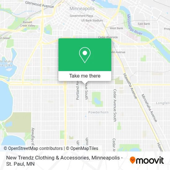
See New Trendz Clothing & Accessories, Minneapolis, on the map
Public Transit to New Trendz Clothing & Accessories in Minneapolis
Wondering how to get to New Trendz Clothing & Accessories in Minneapolis? Moovit helps you find the best way to get to New Trendz Clothing & Accessories with step-by-step directions from the nearest public transit station.
Moovit provides free maps and live directions to help you navigate through your city. View schedules, routes, timetables, and find out how long does it take to get to New Trendz Clothing & Accessories in real time.
Looking for the nearest stop or station to New Trendz Clothing & Accessories? Check out this list of stops closest to your destination: 28th St E & Park Ave S; Lake & Chicago Station; Chicago Ave S & 28th St E; Chicago Lake Transit Center; West Bank Station; Cedar-Riverside.
Bus: METRO B LINE, METRO D LINE, 2, 27, 5.
Want to see if there’s another route that gets you there at an earlier time? Moovit helps you find alternative routes or times. Get directions from and directions to New Trendz Clothing & Accessories easily from the Moovit App or Website.
We make riding to New Trendz Clothing & Accessories easy, which is why over 1.7 million users, including users in Minneapolis, trust Moovit as the best app for public transit. You don’t need to download an individual bus app or train app, Moovit is your all-in-one transit app that helps you find the best bus time or train time available.
For information on prices of bus and light rail, costs and ride fares to New Trendz Clothing & Accessories, please check the Moovit app.
Use the app to navigate to popular places including to the airport, hospital, stadium, grocery store, mall, coffee shop, school, college, and university.
New Trendz Clothing & Accessories Address: 719 E Lake St street in Minneapolis
- O'Reilly Auto Parts,
- Mirasol Express Lake,
- El Chuchi Market,
- Icc Wireless,
- U Two Nail,
- Chinese Restaurant Minneapolis MN Online Order,
- Minneapolis DVS (MN DVS Deputy Registrar Office),
- Gichitwaa Kateri Catholic Church,
- Chicago-Lake Transit Station,
- Snack N Gas Tobacco,
- Uncle Hugo's Science Fiction Bookstore,
- Midtown Global Market,
- Goodyear Auto Service Center,
- Oasis Market and Deli,
- Midtown Exchange,
- Allina Health,
- Abbott Northwestern Hospital - Purple Parking Ramp,
- 2837 Chicago Ave Parking,
- The 1887,
- Southside, Minneapolis
Places Near New Trendz Clothing & Accessories (Minneapolis)
- Surly Brewing Co., Minneapolis,
- 3m Arena at Mariucci, Minneapolis,
- Harriet Island Regional Park, St. Paul,
- Minnesota State Capitol, St. Paul,
- Grand Casino Hinckley,MN, Minneapolis,
- Orpheum Theatre (Minneapolis, Minnesota), Minneapolis,
- Huntington Bank Stadium, Minneapolis,
- Bishop Henry Whipple Federal Building,
- Mpls. Convention Center, Minneapolis,
- Mystic lake casino bus, Minneapolis,
- Target Center, Minneapolis,
- Target Field, Minneapolis,
- St. Paul College, St. Paul,
- Minneapolis Sculpture Garden, Minneapolis,
- Abbott Northwestern Piper Building, Minneapolis,
- Minneapolis Institute of Art, Minneapolis,
- Northrop Auditorium, Minneapolis,
- Treasure Island Resort & Casino, St. Paul,
- Xcel Energy Center, St. Paul,
- Minnehaha Falls, Minneapolis
How to get to popular places in Minneapolis - St. Paul, MN with public transit
Get around Minneapolis by public transit!
Traveling around Minneapolis has never been so easy. See step by step directions as you travel to any attraction, street or major public transit station. View bus and train schedules, arrival times, service alerts and detailed routes on a map, so you know exactly how to get to anywhere in Minneapolis.
When traveling to any destination around Minneapolis use Moovit's Live Directions with Get Off Notifications to know exactly where and how far to walk, how long to wait for your line, and how many stops are left. Moovit will alert you when it's time to get off — no need to constantly re-check whether yours is the next stop.
Wondering how to use public transit in Minneapolis or how to pay for public transit in Minneapolis? Moovit public transit app can help you navigate your way with public transit easily, and at minimum cost. It includes public transit fees, ticket prices, and costs. Looking for a map of Minneapolis public transit lines? Moovit public transit app shows all public transit maps in Minneapolis with all Bus, Train and Light Rail routes and stops on an interactive map.
Minneapolis - St. Paul, MN has 3 transit type(s), including: Bus, Train and Light Rail, operated by several transit agencies, including Metro Transit , Metro Transit, MVTA, Plymouth Metrolink, SouthWest Transit, Maple Grove, University of Minnesota, Airport (MAC), Amtrak, Mankato Transit System, SMART, FlixBus-us and Greyhound-us