See New York State Armory (Poughkeepsie), Poughkeepsie, Ny, on the map
Directions to New York State Armory (Poughkeepsie) (Poughkeepsie, Ny) with public transportation
The following transit lines have routes that pass near New York State Armory (Poughkeepsie)
 Bus:
Bus: - Train:
How to get to New York State Armory (Poughkeepsie) by train?
Click on the train route to see step by step directions with maps, line arrival times and updated time schedules.
Which bus lines stop near New York State Armory (Poughkeepsie)?
These bus lines stop near New York State Armory (Poughkeepsie): A, B, D.
Which train line stops near New York State Armory (Poughkeepsie)?
HUDSON
See New York State Armory (Poughkeepsie), Poughkeepsie, Ny, on the map
Public Transit to New York State Armory (Poughkeepsie) in Poughkeepsie, Ny
Wondering how to get to New York State Armory (Poughkeepsie) in Poughkeepsie, Ny, United States? Moovit helps you find the best way to get to New York State Armory (Poughkeepsie) with step-by-step directions from the nearest public transit station.
Moovit provides free maps and live directions to help you navigate through your city. View schedules, routes, timetables, and find out how long does it take to get to New York State Armory (Poughkeepsie) in real time.
Bus:Train:
Want to see if there’s another route that gets you there at an earlier time? Moovit helps you find alternative routes or times. Get directions from and directions to New York State Armory (Poughkeepsie) easily from the Moovit App or Website.
We make riding to New York State Armory (Poughkeepsie) easy, which is why over 1.5 million users, including users in Poughkeepsie, Ny, trust Moovit as the best app for public transit. You don’t need to download an individual bus app or train app, Moovit is your all-in-one transit app that helps you find the best bus time or train time available.
For information on prices of train and bus, costs and ride fares to New York State Armory (Poughkeepsie), please check the Moovit app.
Use the app to navigate to popular places including to the airport, hospital, stadium, grocery store, mall, coffee shop, school, college, and university.
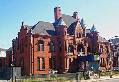
New York State Armory (Poughkeepsie) Address: 61 Market St street in Poughkeepsie, Ny
Attractions near New York State Armory (Poughkeepsie)
Union Tavern Pok,Market 55,Mar RT-55,Market RT-55,Market St US-44,Market St and 55,Planned Parenthood Mid Hudson Valley,ATM,United Way of Dutchess,Danee Bard,Montalto Law Firm,Sall David B Esq,Binder Bail Bonds,Bardavon Opera House,Uscso,Corbally Gartland and Rappleyea,Wolf & Wolf,Rudolph P Russo Attorney,35 Market Street,BardavonHow to get to popular attractions in Poughkeepsie, Ny with public transit
Beauty & Essex, Manhattan,Red Rooster, Manhattan,LIRR - Babylon Station, Babylon, Ny,Upper West Side, Manhattan,Top of The Standard, Manhattan,Newark Liberty International Airport (EWR), Newark, Nj,MTA Subway - Broadway (N/W), Queens,J.G. Melon, Manhattan,Gregory's Coffee, Manhattan,The 13th Step, Manhattan,The Dead Rabbit, Manhattan,Ace Hotel Lobby Bar, Manhattan,Jackson Heights, NY, Queens,Veselka, Manhattan,Grimaldi's Pizzeria,Wingate by Wyndham Manhattan Midtown, Manhattan,Lombardi's Coal Oven Pizza, Manhattan,Nassau Community College, East Garden City, Ny,Caesars Atlantic City Hotel and Casino, Atlantic City, Nj,Ferrara Bakery, ManhattanGet around Poughkeepsie, Ny by public transit!
Traveling around Poughkeepsie, Ny has never been so easy. See step by step directions as you travel to any attraction, street or major public transit station. View bus and train schedules, arrival times, service alerts and detailed routes on a map, so you know exactly how to get to anywhere in Poughkeepsie, Ny.
When traveling to any destination around Poughkeepsie, Ny use Moovit's Live Directions with Get Off Notifications to know exactly where and how far to walk, how long to wait for your line, and how many stops are left. Moovit will alert you when it's time to get off — no need to constantly re-check whether yours is the next stop.
Wondering how to use public transit in Poughkeepsie, Ny or how to pay for public transit in Poughkeepsie, Ny? Moovit public transit app can help you navigate your way with public transit easily, and at minimum cost. It includes public transit fees, ticket prices, and costs. Looking for a map of Poughkeepsie, Ny public transit lines? Moovit public transit app shows all public transit maps in Poughkeepsie, Ny with all train or bus routes and stops on an interactive map.
Poughkeepsie, Ny has 2 transit type(s), including: train or bus, operated by several transit agencies, including MTA Subway, Metro-North Railroad, LIRR, PATH, Shore Line East, MTA Bus Company, MTA New York City Transit - Express routes, MTA Bus, NJ Transit, NYC Ferry, NICE bus, Bee-Line Bus, NJ Transit Rail, NJ Transit Rail and Norwalk Transit District