Directions to Newest Fashion Trends (Dedham) with public transportation
The following transit lines have routes that pass near Newest Fashion Trends
 Bus: 36, 52.
- Train: NEEDHAM, FRANKLIN/FOXBORO.
How to get to Newest Fashion Trends by bus?
Click on the bus route to see step by step directions with maps, line arrival times and updated time schedules.
From Mission Hill, Boston
62 minFrom Beth Israel Deaconess Medical Center, Brookline
67 minFrom Rosenberg Building Bidmc, Boston
78 minFrom Roxbury Community College, Boston
96 minFrom Beth Israel Deaconess Medical Center, West Campus - Farr Building, Boston
78 minFrom FOUR POINTS BY SHERATON Boston Newton, Newton
52 minFrom Beth Israel Deaconess Hospital-Milton, Milton
88 minFrom Lasell College, Newton
100 minFrom VA Medical Center, Boston (Jamaica Plain), Boston
60 minFrom The Monument, Boston
48 min
How to get to Newest Fashion Trends by train?
Click on the train route to see step by step directions with maps, line arrival times and updated time schedules.
Train stations near Newest Fashion Trends in Dedham
What are the closest stations to Newest Fashion Trends?
The closest stations to Newest Fashion Trends are:
- West Roxbury is 2843 yards away, 34 min walk.
- Endicott is 2854 yards away, 34 min walk.
Which bus lines stop near Newest Fashion Trends?
These bus lines stop near Newest Fashion Trends: 36, 52.
Which train line stops near Newest Fashion Trends?
NEEDHAM (#625 | Needham Heights)
What time is the first train to Newest Fashion Trends in Dedham?
The NEEDHAM is the first train that goes to Newest Fashion Trends in Dedham. It stops nearby at 7:16 AM.
What time is the last train to Newest Fashion Trends in Dedham?
The NEEDHAM is the last train that goes to Newest Fashion Trends in Dedham. It stops nearby at 6:24 PM.
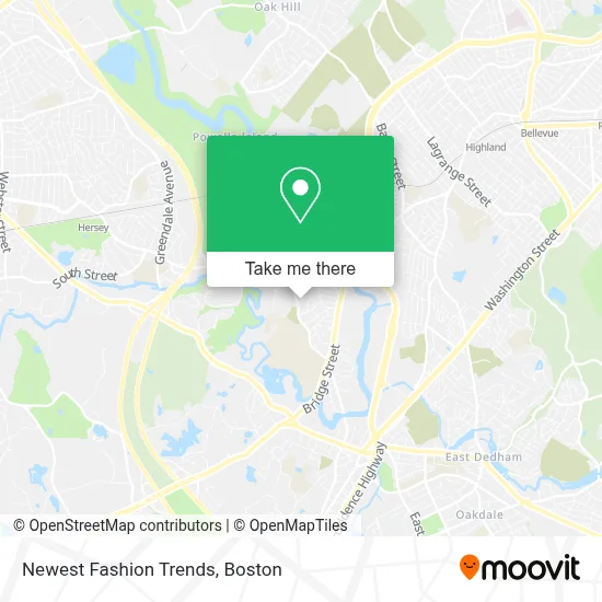
See Newest Fashion Trends, Dedham, on the map
Public Transit to Newest Fashion Trends in Dedham
Wondering how to get to Newest Fashion Trends in Dedham? Moovit helps you find the best way to get to Newest Fashion Trends with step-by-step directions from the nearest public transit station.
Moovit provides free maps and live directions to help you navigate through your city. View schedules, routes, timetables, and find out how long does it take to get to Newest Fashion Trends in real time.
Looking for the nearest stop or station to Newest Fashion Trends? Check out this list of stops closest to your destination: West Roxbury; Endicott.
Bus: 36, 52.Train: NEEDHAM, FRANKLIN/FOXBORO.
Want to see if there’s another route that gets you there at an earlier time? Moovit helps you find alternative routes or times. Get directions from and directions to Newest Fashion Trends easily from the Moovit App or Website.
We make riding to Newest Fashion Trends easy, which is why over 1.7 million users, including users in Dedham, trust Moovit as the best app for public transit. You don’t need to download an individual bus app or train app, Moovit is your all-in-one transit app that helps you find the best bus time or train time available.
For information on prices of bus, subway and train, costs and ride fares to Newest Fashion Trends, please check the Moovit app.
Use the app to navigate to popular places including to the airport, hospital, stadium, grocery store, mall, coffee shop, school, college, and university.
Location: Dedham, Boston
- Noble And Greenough School,
- Rivadale,
- Pause-It Music Productions,
- Riverview Office Park,
- Locksource Locksmith,
- Thrifty,
- Downes Kelly Esq,
- Riverdale, Massachusetts,
- Just Juice It,
- Flagship Motors,
- Jack Audy,
- Dedham Water Trail,
- New Bridge On The Charles,
- Newbridge on the Charles (New Bridge on the Charles Independent Living),
- Northeastern University Dedham Campus,
- Listing Courtesy of Listing Agent,
- VFW Pkwy,
- riverdale,
- Mission on Fire,
- Newbridge on the Charles – Assisted Living And Memory Care
Places Near Newest Fashion Trends (Dedham)
- House Of Blues, Boston,
- Prudential Center, Boston,
- Wang Theater, Boston,
- Boston Convention & Exhibition Center, Boston,
- Wilbur Theatre, Boston,
- Boston Children's Hospital, Boston,
- North End, Boston,
- Boston Medical Center, Boston,
- Boston Common, Boston,
- Museum Of Science, Boston,
- Td Garden, Boston,
- Mgm Music Hall, Boston,
- Massachusetts General Hospital, Boston,
- Faneuil Hall, Boston,
- Seaport District, Boston,
- Quincy Market, Boston,
- Isabella Stewart Gardner Museum, Boston,
- Cheers, Boston,
- Leader Bank Pavilion (Leader Bank Pavillion), Boston,
- Castle Island, Boston
How to get to popular places in Boston with public transit
Get around Dedham by public transit!
Traveling around Dedham has never been so easy. See step by step directions as you travel to any attraction, street or major public transit station. View bus and train schedules, arrival times, service alerts and detailed routes on a map, so you know exactly how to get to anywhere in Dedham.
When traveling to any destination around Dedham use Moovit's Live Directions with Get Off Notifications to know exactly where and how far to walk, how long to wait for your line, and how many stops are left. Moovit will alert you when it's time to get off — no need to constantly re-check whether yours is the next stop.
Wondering how to use public transit in Dedham or how to pay for public transit in Dedham? Moovit public transit app can help you navigate your way with public transit easily, and at minimum cost. It includes public transit fees, ticket prices, and costs. Looking for a map of Dedham public transit lines? Moovit public transit app shows all public transit maps in Dedham with all Bus, Train, Subway and Ferry routes and stops on an interactive map.
Boston has 4 transit type(s), including: Bus, Train, Subway and Ferry, operated by several transit agencies, including MBTA, Southeastern Regional Transit Authority, MetroWest Regional Transit Authority, Rhode Island Public Transit Authority, WRTA, Lowell Regional Transit Authority, Merrimack Valley Transit, Montachusett Regional Transit Authority, Cape Cod Regional Transit Authority, Brockton Area Transit Authority, Martha's Vineyard Transit Authority, the WAVE - Nantucket Regional Transit Authority, GATRA, Cape Ann Transportation Authority and Massport