How to get to Newport Hidden Cove Charters by bus?
Click on the bus route to see step by step directions with maps, line arrival times and updated time schedules.
From Charlton Memorial Hospital, Fall River
96 minFrom Bristol Community College, Fall River
78 minFrom B.M.C. Durfee High School, Fall River
77 minFrom Barahona Express, Providence
105 minFrom Lizzy Borden House, Fall River
58 minFrom Amazon Fulfillment Bos7, Fall River
108 minFrom Walmart Fall River Supercenter, Fall River
91 min
Bus stops near Newport Hidden Cove Charters in Boston
Bus lines to Newport Hidden Cove Charters in Boston
What are the closest stations to Newport Hidden Cove Charters?
The closest stations to Newport Hidden Cove Charters are:
- Marlborough Before Farewell is 241 yards away, 3 min walk.
- Newport Transit Center (Stop C) is 594 yards away, 8 min walk.
- Newport Transit Center (Stop D) is 722 yards away, 9 min walk.
Which bus lines stop near Newport Hidden Cove Charters?
These bus lines stop near Newport Hidden Cove Charters: 24L, 60.
What’s the nearest bus station to Newport Hidden Cove Charters in Boston?
The nearest bus station to Newport Hidden Cove Charters in Boston is Marlborough Before Farewell. It’s a 3 min walk away.
What time is the first bus to Newport Hidden Cove Charters in Boston?
The 14 is the first bus that goes to Newport Hidden Cove Charters in Boston. It stops nearby at 4:26 AM.
What time is the last bus to Newport Hidden Cove Charters in Boston?
The 60 is the last bus that goes to Newport Hidden Cove Charters in Boston. It stops nearby at 1:24 AM.
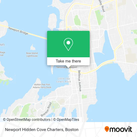
See Newport Hidden Cove Charters, Boston, on the map
Public Transit to Newport Hidden Cove Charters in Boston
Wondering how to get to Newport Hidden Cove Charters in Boston? Moovit helps you find the best way to get to Newport Hidden Cove Charters with step-by-step directions from the nearest public transit station.
Moovit provides free maps and live directions to help you navigate through your city. View schedules, routes, timetables, and find out how long does it take to get to Newport Hidden Cove Charters in real time.
Looking for the nearest stop or station to Newport Hidden Cove Charters? Check out this list of stops closest to your destination: Marlborough Before Farewell; Newport Transit Center (Stop C); Newport Transit Center (Stop D).
Bus: 24L, 60, 63, 67, 68, 64, 14.
Want to see if there’s another route that gets you there at an earlier time? Moovit helps you find alternative routes or times. Get directions from and directions to Newport Hidden Cove Charters easily from the Moovit App or Website.
We make riding to Newport Hidden Cove Charters easy, which is why over 1.7 million users, including users in Boston, trust Moovit as the best app for public transit. You don’t need to download an individual bus app or train app, Moovit is your all-in-one transit app that helps you find the best bus time or train time available.
For information on prices of bus, costs and ride fares to Newport Hidden Cove Charters, please check the Moovit app.
Use the app to navigate to popular places including to the airport, hospital, stadium, grocery store, mall, coffee shop, school, college, and university.
Newport Hidden Cove Charters Address: 1 Sayers Wharf street in Boston
- Amazing Grace,
- Newport Lemonade,
- The Skybar Dining Room at the Clarke Cooke House,
- Xstyles,
- Tradewinds Sunglass,
- Saltwater Living,
- Schooner Adirondack II,
- Amazing Grace Harbor Tours,
- The Stadium Store,
- Fish House - New,
- Restaurant Rivalry,
- Wharf Fishhouse,
- Bohlin,
- Luke's Lobster Newport,
- Jason,
- Kiel James Patrick,
- Newport Sailing Lessons,
- Florida State Georgia Tech,
- Stadium Gallery,
- Museum Shop
Places Near Newport Hidden Cove Charters (Boston)
- Isabella Stewart Gardner Museum, Boston,
- Wang Theater, Boston,
- House Of Blues, Boston,
- Cheers, Boston,
- Faneuil Hall, Boston,
- Leader Bank Pavilion (Leader Bank Pavillion), Boston,
- Td Garden, Boston,
- Castle Island, Boston,
- Massachusetts General Hospital, Boston,
- Mgm Music Hall, Boston,
- Prudential Center, Boston,
- North End, Boston,
- Museum Of Science, Boston,
- Seaport District, Boston,
- Boston Children's Hospital, Boston,
- Quincy Market, Boston,
- Boston Common, Boston,
- Boston Medical Center, Boston,
- Boston Convention & Exhibition Center, Boston,
- Wilbur Theatre, Boston
How to get to popular places in Boston with public transit
Get around Boston by public transit!
Traveling around Boston has never been so easy. See step by step directions as you travel to any attraction, street or major public transit station. View bus and train schedules, arrival times, service alerts and detailed routes on a map, so you know exactly how to get to anywhere in Boston.
When traveling to any destination around Boston use Moovit's Live Directions with Get Off Notifications to know exactly where and how far to walk, how long to wait for your line, and how many stops are left. Moovit will alert you when it's time to get off — no need to constantly re-check whether yours is the next stop.
Wondering how to use public transit in Boston or how to pay for public transit in Boston? Moovit public transit app can help you navigate your way with public transit easily, and at minimum cost. It includes public transit fees, ticket prices, and costs. Looking for a map of Boston public transit lines? Moovit public transit app shows all public transit maps in Boston with all Bus, Train, Subway and Ferry routes and stops on an interactive map.
Boston has 4 transit type(s), including: Bus, Train, Subway and Ferry, operated by several transit agencies, including MBTA, Southeastern Regional Transit Authority, MetroWest Regional Transit Authority, Rhode Island Public Transit Authority, WRTA, Lowell Regional Transit Authority, Merrimack Valley Transit, Montachusett Regional Transit Authority, Cape Cod Regional Transit Authority, Brockton Area Transit Authority, Martha's Vineyard Transit Authority, the WAVE - Nantucket Regional Transit Authority, GATRA, Cape Ann Transportation Authority and Massport