Directions to Newstart Better Living Center (Boston) with public transportation
The following transit lines have routes that pass near Newstart Better Living Center
 Bus: 10, 4, 7, 9, SL3.
- Train: FRAMINGHAM/WORCESTER.
- Subway: RED LINE.
- Ferry: FAST FERRY, QUINCY FERRY, WINTHROP FERRY, WINTHROP/QUINCY FERRY, EAST.
How to get to Newstart Better Living Center by bus?
Click on the bus route to see step by step directions with maps, line arrival times and updated time schedules.
From Allston, Boston
65 minFrom MBTA Alewife Station, Cambridge
102 minFrom MBTA / Alewife #6, Cambridge
102 minFrom Massachusetts, Boston
79 minFrom Beth Israel Deaconess Medical Center, West Campus - Farr Building, Boston
61 minFrom Market Basket, Revere
85 minFrom Beth Israel Deaconess Medical Center (Shapiro Garage), Boston
50 minFrom Hyatt Regency Cambridge - Overlooking Boston, Cambridge
68 minFrom Alumni Stadium, Boston
84 minFrom Four Points by Sheraton Boston Logan Airport, Revere
98 min
How to get to Newstart Better Living Center by train?
Click on the train route to see step by step directions with maps, line arrival times and updated time schedules.
How to get to Newstart Better Living Center by subway?
Click on the subway route to see step by step directions with maps, line arrival times and updated time schedules.
From Allston, Boston
60 minFrom MBTA Alewife Station, Cambridge
46 minFrom MBTA / Alewife #6, Cambridge
47 minFrom Massachusetts, Boston
82 minFrom Beth Israel Deaconess Medical Center, West Campus - Farr Building, Boston
60 minFrom Beth Israel Deaconess Medical Center (Shapiro Garage), Boston
59 minFrom Hyatt Regency Cambridge - Overlooking Boston, Cambridge
56 minFrom Alumni Stadium, Boston
85 min
Bus stops near Newstart Better Living Center in Boston
Subway station near Newstart Better Living Center in Boston
- Broadway, 11 min walk,VIEW
Ferry stations near Newstart Better Living Center in Boston
Bus lines to Newstart Better Living Center in Boston
What are the closest stations to Newstart Better Living Center?
The closest stations to Newstart Better Living Center are:
- W Broadway @ F St is 86 yards away, 2 min walk.
- E Broadway @ G St is 206 yards away, 3 min walk.
- Summer St @ Pappas Way is 260 yards away, 4 min walk.
- Broadway is 849 yards away, 11 min walk.
- World Trade Center Pier, Boston, MA is 942 yards away, 12 min walk.
- Seaport (Fan Pier) is 1381 yards away, 17 min walk.
Which bus lines stop near Newstart Better Living Center?
These bus lines stop near Newstart Better Living Center: 10, 4, 7, 9, SL3.
Which train line stops near Newstart Better Living Center?
FRAMINGHAM/WORCESTER (#518 | South Station)
Which subway line stops near Newstart Better Living Center?
RED LINE (Ashmont/Braintree)
What’s the nearest subway station to Newstart Better Living Center in Boston?
The nearest subway station to Newstart Better Living Center in Boston is Broadway. It’s a 11 min walk away.
What’s the nearest bus station to Newstart Better Living Center in Boston?
The nearest bus station to Newstart Better Living Center in Boston is W Broadway @ F St. It’s a 2 min walk away.
What’s the nearest ferry station to Newstart Better Living Center in Boston?
The nearest ferry station to Newstart Better Living Center in Boston is World Trade Center Pier, Boston, MA. It’s a 12 min walk away.
What time is the first subway to Newstart Better Living Center in Boston?
The RED LINE is the first subway that goes to Newstart Better Living Center in Boston. It stops nearby at 5:28 AM.
What time is the last subway to Newstart Better Living Center in Boston?
The RED LINE is the last subway that goes to Newstart Better Living Center in Boston. It stops nearby at 1:51 AM.
What time is the first bus to Newstart Better Living Center in Boston?
The 10 is the first bus that goes to Newstart Better Living Center in Boston. It stops nearby at 4:53 AM.
What time is the last bus to Newstart Better Living Center in Boston?
The 10 is the last bus that goes to Newstart Better Living Center in Boston. It stops nearby at 1:37 AM.
What time is the first ferry to Newstart Better Living Center in Boston?
The EAST is the first ferry that goes to Newstart Better Living Center in Boston. It stops nearby at 6:01 AM.
What time is the last ferry to Newstart Better Living Center in Boston?
The FAST FERRY is the last ferry that goes to Newstart Better Living Center in Boston. It stops nearby at 9:05 PM.
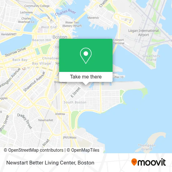
See Newstart Better Living Center, Boston, on the map
Public Transit to Newstart Better Living Center in Boston
Wondering how to get to Newstart Better Living Center in Boston? Moovit helps you find the best way to get to Newstart Better Living Center with step-by-step directions from the nearest public transit station.
Moovit provides free maps and live directions to help you navigate through your city. View schedules, routes, timetables, and find out how long does it take to get to Newstart Better Living Center in real time.
Looking for the nearest stop or station to Newstart Better Living Center? Check out this list of stops closest to your destination: W Broadway @ F St; E Broadway @ G St; Summer St @ Pappas Way; Broadway; World Trade Center Pier; Seaport (Fan Pier).
Bus: 10, 4, 7, 9, SL3.Train: FRAMINGHAM/WORCESTER.Subway: RED LINE.Ferry: FAST FERRY, QUINCY FERRY, WINTHROP FERRY, WINTHROP/QUINCY FERRY, EAST, LOVEJOY - FAN PIER - PIER 10.
Want to see if there’s another route that gets you there at an earlier time? Moovit helps you find alternative routes or times. Get directions from and directions to Newstart Better Living Center easily from the Moovit App or Website.
We make riding to Newstart Better Living Center easy, which is why over 1.7 million users, including users in Boston, trust Moovit as the best app for public transit. You don’t need to download an individual bus app or train app, Moovit is your all-in-one transit app that helps you find the best bus time or train time available.
For information on prices of bus, subway and train, costs and ride fares to Newstart Better Living Center, please check the Moovit app.
Use the app to navigate to popular places including to the airport, hospital, stadium, grocery store, mall, coffee shop, school, college, and university.
Newstart Better Living Center Address: 653 Summer St street in Boston
- 647 Summer Street,
- Publico Street Bistro (Publico Boston),
- The Distillery Gallery,
- D's Keys Dueling Pianos,
- All American Party Bus Tours,
- Element Boston Seaport,
- Element Boston Seaport District,
- Alma Gaucha,
- Aloft Boston Seaport,
- W 3rd St & E St,
- Aloft-Boston Seaport Dist,
- City Hall To Go,
- The Yoga and Dance Studio,
- Lawn On D,
- The Luxury Box,
- The Lawn on D,
- The Goodwill Store,
- Lincoln Tavern & Restaurant,
- Capo Restaurant & Supper Club,
- Supper Club at Capo
Places Near Newstart Better Living Center (Boston)
- Wang Theater, Boston,
- Boston Children's Hospital, Boston,
- Seaport District, Boston,
- Faneuil Hall, Boston,
- Cheers, Boston,
- Massachusetts General Hospital, Boston,
- Td Garden, Boston,
- Boston Common, Boston,
- Museum Of Science, Boston,
- Isabella Stewart Gardner Museum, Boston,
- North End, Boston,
- Mgm Music Hall, Boston,
- Wilbur Theatre, Boston,
- House Of Blues, Boston,
- Boston Convention & Exhibition Center, Boston,
- Boston Medical Center, Boston,
- Castle Island, Boston,
- Quincy Market, Boston,
- Prudential Center, Boston,
- Leader Bank Pavilion (Leader Bank Pavillion), Boston
How to get to popular places in Boston with public transit
Get around Boston by public transit!
Traveling around Boston has never been so easy. See step by step directions as you travel to any attraction, street or major public transit station. View bus and train schedules, arrival times, service alerts and detailed routes on a map, so you know exactly how to get to anywhere in Boston.
When traveling to any destination around Boston use Moovit's Live Directions with Get Off Notifications to know exactly where and how far to walk, how long to wait for your line, and how many stops are left. Moovit will alert you when it's time to get off — no need to constantly re-check whether yours is the next stop.
Wondering how to use public transit in Boston or how to pay for public transit in Boston? Moovit public transit app can help you navigate your way with public transit easily, and at minimum cost. It includes public transit fees, ticket prices, and costs. Looking for a map of Boston public transit lines? Moovit public transit app shows all public transit maps in Boston with all Bus, Train, Subway and Ferry routes and stops on an interactive map.
Boston has 4 transit type(s), including: Bus, Train, Subway and Ferry, operated by several transit agencies, including MBTA, Southeastern Regional Transit Authority, MetroWest Regional Transit Authority, Rhode Island Public Transit Authority, WRTA, Lowell Regional Transit Authority, Merrimack Valley Transit, Montachusett Regional Transit Authority, Cape Cod Regional Transit Authority, Brockton Area Transit Authority, Martha's Vineyard Transit Authority, the WAVE - Nantucket Regional Transit Authority, GATRA, Cape Ann Transportation Authority and Massport