Directions to Nhu Lan Restaurant (Boston) with public transportation
The following transit lines have routes that pass near Nhu Lan Restaurant
 Bus: 15, 18, RED LINE SHUTTLE, RED LINE SHUTTLE, RED LINE SHUTTLE.
- Train: FAIRMOUNT, FALL RIVER/NEW BEDFORD, GREENBUSH, KINGSTON, FRANKLIN/FOXBORO.
- Subway: RED LINE.
How to get to Nhu Lan Restaurant by bus?
Click on the bus route to see step by step directions with maps, line arrival times and updated time schedules.
From Watertown Mall, Watertown Town
86 minFrom Winter Hill, Somerville
110 minFrom Little Italy, Boston
62 minFrom Gateway Center, Everett
120 minFrom MBTA Suffolk Downs Station, Boston
105 minFrom Brighton Music Hall, Boston
66 minFrom Wellington Station, Medford
114 minFrom VA Hospital, Boston
57 minFrom Mass Ave, Cambridge
62 minFrom Hampton Inn & Suites-Hampton Watertown Boston (Hampton Inn & Suites Watertown Boston), Watertown Town
83 min
How to get to Nhu Lan Restaurant by train?
Click on the train route to see step by step directions with maps, line arrival times and updated time schedules.
How to get to Nhu Lan Restaurant by subway?
Click on the subway route to see step by step directions with maps, line arrival times and updated time schedules.
Bus stops near Nhu Lan Restaurant in Boston
Subway station near Nhu Lan Restaurant in Boston
- Fields Corner, 2 min walk,VIEW
Train stations near Nhu Lan Restaurant in Boston
Bus lines to Nhu Lan Restaurant in Boston
What are the closest stations to Nhu Lan Restaurant?
The closest stations to Nhu Lan Restaurant are:
- Dorchester Ave @ Hoyt St is 93 yards away, 2 min walk.
- Fields Corner is 131 yards away, 2 min walk.
- Dorchester Ave @ Thornley Rd is 311 yards away, 4 min walk.
- Savin Hill - Dorchester Ave @ Bay St is 459 yards away, 6 min walk.
- Hancock St @ Bowdoin St is 604 yards away, 8 min walk.
- Jfk/Umass is 1795 yards away, 22 min walk.
- Uphams Corner is 1896 yards away, 23 min walk.
Which bus line stops near Nhu Lan Restaurant?
15 (Fields Corner)
Which train line stops near Nhu Lan Restaurant?
FAIRMOUNT (#1619 | Fairmount)
Which subway line stops near Nhu Lan Restaurant?
RED LINE (Ashmont/Braintree)
What’s the nearest subway station to Nhu Lan Restaurant in Boston?
The nearest subway station to Nhu Lan Restaurant in Boston is Fields Corner. It’s a 2 min walk away.
What’s the nearest train station to Nhu Lan Restaurant in Boston?
The nearest train station to Nhu Lan Restaurant in Boston is Jfk/Umass. It’s a 22 min walk away.
What’s the nearest bus station to Nhu Lan Restaurant in Boston?
The nearest bus station to Nhu Lan Restaurant in Boston is Dorchester Ave @ Hoyt St. It’s a 2 min walk away.
What time is the first subway to Nhu Lan Restaurant in Boston?
The RED LINE is the first subway that goes to Nhu Lan Restaurant in Boston. It stops nearby at 5:18 AM.
What time is the last subway to Nhu Lan Restaurant in Boston?
The RED LINE is the last subway that goes to Nhu Lan Restaurant in Boston. It stops nearby at 2:01 AM.
What time is the first train to Nhu Lan Restaurant in Boston?
The FAIRMOUNT is the first train that goes to Nhu Lan Restaurant in Boston. It stops nearby at 4:44 AM.
What time is the last train to Nhu Lan Restaurant in Boston?
The FAIRMOUNT is the last train that goes to Nhu Lan Restaurant in Boston. It stops nearby at 11:57 PM.
What time is the first bus to Nhu Lan Restaurant in Boston?
The 15 is the first bus that goes to Nhu Lan Restaurant in Boston. It stops nearby at 3:33 AM.
What time is the last bus to Nhu Lan Restaurant in Boston?
The 15 is the last bus that goes to Nhu Lan Restaurant in Boston. It stops nearby at 1:19 AM.
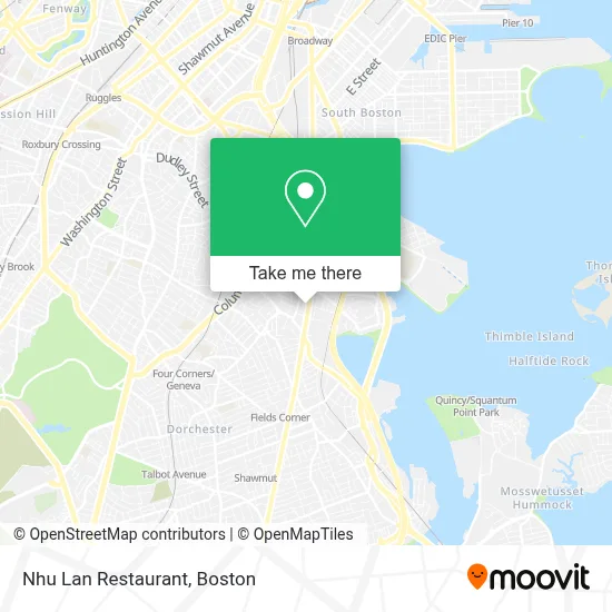
See Nhu Lan Restaurant, Boston, on the map
Public Transit to Nhu Lan Restaurant in Boston
Wondering how to get to Nhu Lan Restaurant in Boston? Moovit helps you find the best way to get to Nhu Lan Restaurant with step-by-step directions from the nearest public transit station.
Moovit provides free maps and live directions to help you navigate through your city. View schedules, routes, timetables, and find out how long does it take to get to Nhu Lan Restaurant in real time.
Looking for the nearest stop or station to Nhu Lan Restaurant? Check out this list of stops closest to your destination: Dorchester Ave @ Hoyt St; Fields Corner; Dorchester Ave @ Thornley Rd; Savin Hill - Dorchester Ave @ Bay St; Hancock St @ Bowdoin St; Jfk/Umass; Uphams Corner.
Bus: 15, 18, RED LINE SHUTTLE, RED LINE SHUTTLE, RED LINE SHUTTLE, RED/MATTAPAN LINE SHUTTLE, RED LINE SHUTTLE.Train: FAIRMOUNT, FALL RIVER/NEW BEDFORD, GREENBUSH, KINGSTON, FRANKLIN/FOXBORO, PROVIDENCE/STOUGHTON.Subway: RED LINE.
Want to see if there’s another route that gets you there at an earlier time? Moovit helps you find alternative routes or times. Get directions from and directions to Nhu Lan Restaurant easily from the Moovit App or Website.
We make riding to Nhu Lan Restaurant easy, which is why over 1.7 million users, including users in Boston, trust Moovit as the best app for public transit. You don’t need to download an individual bus app or train app, Moovit is your all-in-one transit app that helps you find the best bus time or train time available.
For information on prices of bus, subway and train, costs and ride fares to Nhu Lan Restaurant, please check the Moovit app.
Use the app to navigate to popular places including to the airport, hospital, stadium, grocery store, mall, coffee shop, school, college, and university.
Nhu Lan Restaurant Address: 1155 Dorchester Ave street in Boston
- Boys And Girls Clubs Of Dorchester Paul R. Mclaughlin Youth Center,
- Dudley Terrace Apartments,
- Melvinside Play Area,
- Savin Hill,
- Burger King,
- 93 Auto Exchange,
- Lagrange,
- Stop & Shop Pizzeria Uno Bakery,
- 24 Hour 7 Day Emergency Lockmsith,
- City of Boston School Department,
- Djadys Salon Full Barber Shop,
- Marpac Automotive,
- Dorchester,
- 2 Pearl St Parking,
- Boston Home Repair,
- Coin Cloud Bitcoin ATM,
- Association Paving and Masonry,
- Iron Man Locksmith,
- Ba le Dorchester,
- Kingston Gallery
Places Near Nhu Lan Restaurant (Boston)
- Prudential Center, Boston,
- Wilbur Theatre, Boston,
- Mgm Music Hall, Boston,
- North End, Boston,
- Td Garden, Boston,
- Boston Children's Hospital, Boston,
- Seaport District, Boston,
- Cheers, Boston,
- Castle Island, Boston,
- Boston Convention & Exhibition Center, Boston,
- Massachusetts General Hospital, Boston,
- House Of Blues, Boston,
- Isabella Stewart Gardner Museum, Boston,
- Boston Common, Boston,
- Wang Theater, Boston,
- Boston Medical Center, Boston,
- Leader Bank Pavilion (Leader Bank Pavillion), Boston,
- Faneuil Hall, Boston,
- Museum Of Science, Boston,
- Quincy Market, Boston
How to get to popular places in Boston with public transit
Get around Boston by public transit!
Traveling around Boston has never been so easy. See step by step directions as you travel to any attraction, street or major public transit station. View bus and train schedules, arrival times, service alerts and detailed routes on a map, so you know exactly how to get to anywhere in Boston.
When traveling to any destination around Boston use Moovit's Live Directions with Get Off Notifications to know exactly where and how far to walk, how long to wait for your line, and how many stops are left. Moovit will alert you when it's time to get off — no need to constantly re-check whether yours is the next stop.
Wondering how to use public transit in Boston or how to pay for public transit in Boston? Moovit public transit app can help you navigate your way with public transit easily, and at minimum cost. It includes public transit fees, ticket prices, and costs. Looking for a map of Boston public transit lines? Moovit public transit app shows all public transit maps in Boston with all Bus, Train, Subway and Ferry routes and stops on an interactive map.
Boston has 4 transit type(s), including: Bus, Train, Subway and Ferry, operated by several transit agencies, including MBTA, Southeastern Regional Transit Authority, MetroWest Regional Transit Authority, Rhode Island Public Transit Authority, WRTA, Lowell Regional Transit Authority, Merrimack Valley Transit, Montachusett Regional Transit Authority, Cape Cod Regional Transit Authority, Brockton Area Transit Authority, Martha's Vineyard Transit Authority, the WAVE - Nantucket Regional Transit Authority, GATRA, Cape Ann Transportation Authority and Massport