Directions to Nicole Riley Photography (Boston) with public transportation
The following transit lines have routes that pass near Nicole Riley Photography
 Bus: 17, 201, 202, 210, 19.
- Train: FAIRMOUNT.
- Subway: RED LINE, MATTAPAN LINE.
- Ferry: QUINCY FERRY, WINTHROP/QUINCY FERRY.
How to get to Nicole Riley Photography by bus?
Click on the bus route to see step by step directions with maps, line arrival times and updated time schedules.
From Beacon Hill, Boston
61 minFrom Schrafft's Center Shuttle, Boston
98 minFrom Beth Israel Deaconess Medical Center (Shapiro Garage), Boston
56 minFrom Spaulding Hospital, Cambridge
82 minFrom Edic Pier, Boston
73 minFrom Massachusetts, Boston
91 minFrom Brighton District Court, Boston
88 minFrom One Federal, Boston
67 minFrom Mass Ave, Cambridge
82 minFrom Acorn Street, Boston
65 min
How to get to Nicole Riley Photography by train?
Click on the train route to see step by step directions with maps, line arrival times and updated time schedules.
How to get to Nicole Riley Photography by subway?
Click on the subway route to see step by step directions with maps, line arrival times and updated time schedules.
From Beacon Hill, Boston
35 minFrom Schrafft's Center Shuttle, Boston
41 minFrom Beth Israel Deaconess Medical Center (Shapiro Garage), Boston
62 minFrom Spaulding Hospital, Cambridge
58 minFrom Edic Pier, Boston
53 minFrom Massachusetts, Boston
83 minFrom Brighton District Court, Boston
84 minFrom One Federal, Boston
35 minFrom Mass Ave, Cambridge
46 minFrom Acorn Street, Boston
41 min
Bus stops near Nicole Riley Photography in Boston
Subway stations near Nicole Riley Photography in Boston
Ferry station near Nicole Riley Photography in Boston
- Quincy, 43 min walk,VIEW
Bus lines to Nicole Riley Photography in Boston
What are the closest stations to Nicole Riley Photography?
The closest stations to Nicole Riley Photography are:
- Victory Rd @ Puritan Mall Driveway is 167 yards away, 2 min walk.
- Cedar Grove is 183 yards away, 3 min walk.
- Fields Corner is 357 yards away, 5 min walk.
- Adams St @ King St is 480 yards away, 6 min walk.
- Neponset Ave @ Victory Rd is 598 yards away, 8 min walk.
- Quincy is 3652 yards away, 43 min walk.
Which bus lines stop near Nicole Riley Photography?
These bus lines stop near Nicole Riley Photography: 17, 201, 202, 210.
Which train line stops near Nicole Riley Photography?
FAIRMOUNT (#1619 | Fairmount)
Which subway line stops near Nicole Riley Photography?
RED LINE (Ashmont/Braintree)
What’s the nearest subway station to Nicole Riley Photography in Boston?
The nearest subway station to Nicole Riley Photography in Boston is Cedar Grove. It’s a 3 min walk away.
What’s the nearest bus station to Nicole Riley Photography in Boston?
The nearest bus station to Nicole Riley Photography in Boston is Victory Rd @ Puritan Mall Driveway. It’s a 2 min walk away.
What time is the first subway to Nicole Riley Photography in Boston?
The MATTAPAN LINE is the first subway that goes to Nicole Riley Photography in Boston. It stops nearby at 5:10 AM.
What time is the last subway to Nicole Riley Photography in Boston?
The MATTAPAN LINE is the last subway that goes to Nicole Riley Photography in Boston. It stops nearby at 2:31 AM.
What time is the first bus to Nicole Riley Photography in Boston?
The 210 is the first bus that goes to Nicole Riley Photography in Boston. It stops nearby at 5:14 AM.
What time is the last bus to Nicole Riley Photography in Boston?
The 210 is the last bus that goes to Nicole Riley Photography in Boston. It stops nearby at 1:04 AM.
What time is the first ferry to Nicole Riley Photography in Boston?
The QUINCY FERRY is the first ferry that goes to Nicole Riley Photography in Boston. It stops nearby at 6:15 AM.
What time is the last ferry to Nicole Riley Photography in Boston?
The QUINCY FERRY is the last ferry that goes to Nicole Riley Photography in Boston. It stops nearby at 8:55 PM.
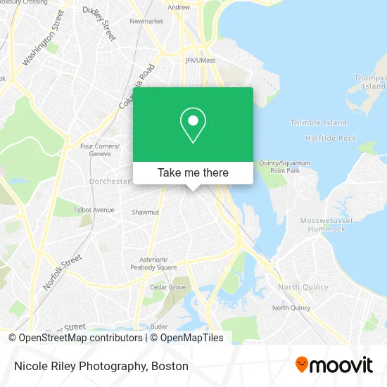
See Nicole Riley Photography, Boston, on the map
Public Transit to Nicole Riley Photography in Boston
Wondering how to get to Nicole Riley Photography in Boston? Moovit helps you find the best way to get to Nicole Riley Photography with step-by-step directions from the nearest public transit station.
Moovit provides free maps and live directions to help you navigate through your city. View schedules, routes, timetables, and find out how long does it take to get to Nicole Riley Photography in real time.
Looking for the nearest stop or station to Nicole Riley Photography? Check out this list of stops closest to your destination: Victory Rd @ Puritan Mall Driveway; Cedar Grove; Fields Corner; Adams St @ King St; Neponset Ave @ Victory Rd; Quincy.
Bus: 17, 201, 202, 210, 19.Train: FAIRMOUNT.Subway: RED LINE, MATTAPAN LINE.Ferry: QUINCY FERRY, WINTHROP/QUINCY FERRY.
Want to see if there’s another route that gets you there at an earlier time? Moovit helps you find alternative routes or times. Get directions from and directions to Nicole Riley Photography easily from the Moovit App or Website.
We make riding to Nicole Riley Photography easy, which is why over 1.7 million users, including users in Boston, trust Moovit as the best app for public transit. You don’t need to download an individual bus app or train app, Moovit is your all-in-one transit app that helps you find the best bus time or train time available.
For information on prices of bus, subway and train, costs and ride fares to Nicole Riley Photography, please check the Moovit app.
Use the app to navigate to popular places including to the airport, hospital, stadium, grocery store, mall, coffee shop, school, college, and university.
Nicole Riley Photography Address: 10 Agawam St street in Boston
- Steven le,
- RTW Essential Wellness,
- Chiropractors Homeopathic Medicine,
- Onestly Beyoutiful,
- Pine Street Inn,
- Skinny Boy Swag Club,
- Bryan's Lounge,
- Karol & Karol Counsellors at Law,
- SSG Lily Darling,
- DFD Service 2 Drains,
- Road Loads,
- Dorchester Locksmith,
- Barry Noone Electrician,
- CDS Electrical,
- Neponset Ave,
- Upali Convenience,
- Law Office of Brian Gunning,
- On Top Maids,
- Healing with Trust Therapy,
- Elegant Epoxy Flooring
Places Near Nicole Riley Photography (Boston)
- Massachusetts General Hospital, Boston,
- Boston Convention & Exhibition Center, Boston,
- Cheers, Boston,
- North End, Boston,
- Mgm Music Hall, Boston,
- Seaport District, Boston,
- Museum Of Science, Boston,
- Isabella Stewart Gardner Museum, Boston,
- Td Garden, Boston,
- Boston Children's Hospital, Boston,
- Castle Island, Boston,
- Prudential Center, Boston,
- Boston Common, Boston,
- Leader Bank Pavilion (Leader Bank Pavillion), Boston,
- Wang Theater, Boston,
- Faneuil Hall, Boston,
- Boston Medical Center, Boston,
- Quincy Market, Boston,
- House Of Blues, Boston,
- Wilbur Theatre, Boston
How to get to popular places in Boston with public transit
Get around Boston by public transit!
Traveling around Boston has never been so easy. See step by step directions as you travel to any attraction, street or major public transit station. View bus and train schedules, arrival times, service alerts and detailed routes on a map, so you know exactly how to get to anywhere in Boston.
When traveling to any destination around Boston use Moovit's Live Directions with Get Off Notifications to know exactly where and how far to walk, how long to wait for your line, and how many stops are left. Moovit will alert you when it's time to get off — no need to constantly re-check whether yours is the next stop.
Wondering how to use public transit in Boston or how to pay for public transit in Boston? Moovit public transit app can help you navigate your way with public transit easily, and at minimum cost. It includes public transit fees, ticket prices, and costs. Looking for a map of Boston public transit lines? Moovit public transit app shows all public transit maps in Boston with all Bus, Train, Subway and Ferry routes and stops on an interactive map.
Boston has 4 transit type(s), including: Bus, Train, Subway and Ferry, operated by several transit agencies, including MBTA, Southeastern Regional Transit Authority, MetroWest Regional Transit Authority, Rhode Island Public Transit Authority, WRTA, Lowell Regional Transit Authority, Merrimack Valley Transit, Montachusett Regional Transit Authority, Cape Cod Regional Transit Authority, Brockton Area Transit Authority, Martha's Vineyard Transit Authority, the WAVE - Nantucket Regional Transit Authority, GATRA, Cape Ann Transportation Authority and Massport