Directions to Night Rider Charters Of Boston with public transportation
The following transit lines have routes that pass near Night Rider Charters Of Boston
 Bus: 92, 93, SL5, 89/93.
- Train: FAIRMOUNT, FRAMINGHAM/WORCESTER, NEEDHAM, FITCHBURG, HAVERHILL.
- Subway: GREEN LINE D, ORANGE LINE, HAVERHILL LINE SHUTTLE, HAVERHILL LINE SHUTTLE, LOWELL LINE SHUTTLE.
- Ferry: CHARLESTOWN FERRY.
How to get to Night Rider Charters Of Boston by bus?
Click on the bus route to see step by step directions with maps, line arrival times and updated time schedules.
From St. Elizabeth's Medical Center
64 minFrom Roslindale
87 minFrom Hebrew Rehab Center
90 minFrom Chestnut Hill
79 minFrom Spaulding Rehab
92 minFrom Washington St
90 minFrom Hampton Inn Boston Logan Airport
40 minFrom Brookline High School (Brookline Town High School)
85 minFrom Malden Catholic High School
61 minFrom Best Western Adams Inn Quincy - Boston
112 min
How to get to Night Rider Charters Of Boston by train?
Click on the train route to see step by step directions with maps, line arrival times and updated time schedules.
How to get to Night Rider Charters Of Boston by subway?
Click on the subway route to see step by step directions with maps, line arrival times and updated time schedules.
From St. Elizabeth's Medical Center
71 minFrom Roslindale
58 minFrom Hebrew Rehab Center
61 minFrom Chestnut Hill
75 minFrom Spaulding Rehab
64 minFrom Washington St
53 minFrom Hampton Inn Boston Logan Airport
59 minFrom Brookline High School (Brookline Town High School)
52 minFrom Best Western Adams Inn Quincy - Boston
57 min
Ferry stations near Night Rider Charters Of Boston
Train station near Night Rider Charters Of Boston
- North Station, 2 min walk,VIEW
Subway station near Night Rider Charters Of Boston
- Causeway St (East), 3 min walk,VIEW
Bus stops near Night Rider Charters Of Boston
Bus lines to Night Rider Charters Of Boston
What are the closest stations to Night Rider Charters Of Boston?
The closest stations to Night Rider Charters Of Boston are:
- Charlestown Navy Yard is 116 yards away, 2 min walk.
- North Station is 138 yards away, 2 min walk.
- Causeway St (East) is 231 yards away, 3 min walk.
- Chelsea St @ Warren St is 280 yards away, 4 min walk.
- Main St @ Harvard St is 315 yards away, 4 min walk.
- Park St @ Warren St is 319 yards away, 4 min walk.
- Causeway St @ Medford St is 603 yards away, 8 min walk.
- North Station (Lovejoy Wharf) is 801 yards away, 10 min walk.
Which bus lines stop near Night Rider Charters Of Boston?
These bus lines stop near Night Rider Charters Of Boston: 92, 93, SL5.
Which train lines stop near Night Rider Charters Of Boston?
These train lines stop near Night Rider Charters Of Boston: FAIRMOUNT, FRAMINGHAM/WORCESTER, NEEDHAM.
Which subway lines stop near Night Rider Charters Of Boston?
These subway lines stop near Night Rider Charters Of Boston: GREEN LINE D, ORANGE LINE.
What’s the nearest subway station to Night Rider Charters Of Boston?
The nearest subway station to Night Rider Charters Of Boston is Causeway St (East). It’s a 3 min walk away.
What’s the nearest train station to Night Rider Charters Of Boston?
The nearest train station to Night Rider Charters Of Boston is North Station. It’s a 2 min walk away.
What’s the nearest bus station to Night Rider Charters Of Boston?
The nearest bus stations to Night Rider Charters Of Boston are Chelsea St @ Warren St, Main St @ Harvard St and Park St @ Warren St. The closest one is a 4 min walk away.
What’s the nearest ferry station to Night Rider Charters Of Boston?
The nearest ferry station to Night Rider Charters Of Boston is Charlestown Navy Yard. It’s a 2 min walk away.
What time is the first subway to Night Rider Charters Of Boston?
The GREEN LINE E is the first subway that goes to Night Rider Charters Of Boston. It stops nearby at 5:01 AM.
What time is the last subway to Night Rider Charters Of Boston?
The GREEN LINE E is the last subway that goes to Night Rider Charters Of Boston. It stops nearby at 2:24 AM.
What time is the first train to Night Rider Charters Of Boston?
The LOWELL is the first train that goes to Night Rider Charters Of Boston. It stops nearby at 5:20 AM.
What time is the last train to Night Rider Charters Of Boston?
The LOWELL is the last train that goes to Night Rider Charters Of Boston. It stops nearby at 12:34 AM.
What time is the first bus to Night Rider Charters Of Boston?
The 89/93 is the first bus that goes to Night Rider Charters Of Boston. It stops nearby at 4:51 AM.
What time is the last bus to Night Rider Charters Of Boston?
The 93 is the last bus that goes to Night Rider Charters Of Boston. It stops nearby at 1:44 AM.
What time is the first ferry to Night Rider Charters Of Boston?
The LOVEJOY - FAN PIER - PIER 10 is the first ferry that goes to Night Rider Charters Of Boston. It stops nearby at 6:20 AM.
What time is the last ferry to Night Rider Charters Of Boston?
The CHARLESTOWN FERRY is the last ferry that goes to Night Rider Charters Of Boston. It stops nearby at 8:15 PM.
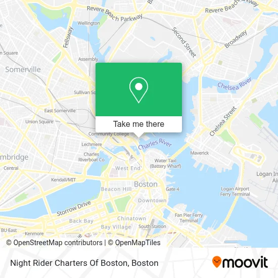
See Night Rider Charters Of Boston on the map
Public Transportation to Night Rider Charters Of Boston
Wondering how to get to Night Rider Charters Of Boston? Moovit helps you find the best way to get to Night Rider Charters Of Boston with step-by-step directions from the nearest public transit station.
Moovit provides free maps and live directions to help you navigate through your city. View schedules, routes, timetables, and find out how long does it take to get to Night Rider Charters Of Boston in real time.
Looking for the nearest stop or station to Night Rider Charters Of Boston? Check out this list of stops closest to your destination: Charlestown Navy Yard; North Station; Causeway St (East); Chelsea St @ Warren St; Main St @ Harvard St; Park St @ Warren St; Causeway St @ Medford St; North Station (Lovejoy Wharf).
Bus: 92, 93, SL5, 89/93.Train: FAIRMOUNT, FRAMINGHAM/WORCESTER, NEEDHAM, FITCHBURG, HAVERHILL, LOWELL, NEWBURYPORT/ROCKPORT, DOWNEASTER.Subway: GREEN LINE D, ORANGE LINE, HAVERHILL LINE SHUTTLE, HAVERHILL LINE SHUTTLE, LOWELL LINE SHUTTLE, LOWELL LINE SHUTTLE, NEWBURYPORT/ROCKPORT LINE SHUTTLE.Ferry: CHARLESTOWN FERRY.
Want to see if there’s another route that gets you there at an earlier time? Moovit helps you find alternative routes or times. Get directions from and directions to Night Rider Charters Of Boston easily from the Moovit App or Website.
We make riding to Night Rider Charters Of Boston easy, which is why over 1.7 million users, including users in Boston, trust Moovit as the best app for public transit. You don’t need to download an individual bus app or train app, Moovit is your all-in-one transit app that helps you find the best bus time or train time available.
For information on prices of bus, subway and train, costs and ride fares to Night Rider Charters Of Boston, please check the Moovit app.
Use the app to navigate to popular places including to the airport, hospital, stadium, grocery store, mall, coffee shop, school, college, and university.
Night Rider Charters Of Boston Address: 28 Constitution Rd street in Boston
- Constitution Marina,
- Residence Inn by Marriott Boston Harbor on Tudor Wharf,
- Charles River Ave & Water St,
- Charlestown Navy Yard,
- RNB Wellness,
- Brittany Carisella, Realtor,
- Charlestown District Court,
- Paul Revere Park,
- Polar Design,
- Gone Fishin',
- City Square Tunnel,
- Paul Revere Park Playground,
- Boston National Historical Park,
- Uss Constitution,
- Charlestown Navy Yard Visitor Center (Boston National Historical Park),
- Charlestown,
- Winthrop Square,
- USS Constitution (USS Constitution Museum),
- Citibank,
- Galvin Memorial Park
Places Near Night Rider Charters Of Boston
- Mgm Music Hall, Boston,
- Td Garden, Boston,
- Prudential Center, Boston,
- Castle Island, Boston,
- Seaport District, Boston,
- Boston Common, Boston,
- Cheers, Boston,
- House Of Blues, Boston,
- Wang Theater, Boston,
- Leader Bank Pavilion (Leader Bank Pavillion), Boston,
- Boston Children's Hospital, Boston,
- Museum Of Science, Boston,
- Massachusetts General Hospital, Boston,
- Wilbur Theatre, Boston,
- Faneuil Hall, Boston,
- Boston Convention & Exhibition Center, Boston,
- Quincy Market, Boston,
- Isabella Stewart Gardner Museum, Boston,
- Boston Medical Center, Boston,
- North End, Boston
How to get to popular places in Boston with public transit
Get around Boston by public transit!
Traveling around Boston has never been so easy. See step by step directions as you travel to any attraction, street or major public transit station. View bus and train schedules, arrival times, service alerts and detailed routes on a map, so you know exactly how to get to anywhere in Boston.
When traveling to any destination around Boston use Moovit's Live Directions with Get Off Notifications to know exactly where and how far to walk, how long to wait for your line, and how many stops are left. Moovit will alert you when it's time to get off — no need to constantly re-check whether yours is the next stop.
Wondering how to use public transit in Boston or how to pay for public transit in Boston? Moovit public transit app can help you navigate your way with public transit easily, and at minimum cost. It includes public transit fees, ticket prices, and costs. Looking for a map of Boston public transit lines? Moovit public transit app shows all public transit maps in Boston with all Bus, Train, Subway and Ferry routes and stops on an interactive map.
Boston has 4 transit type(s), including: Bus, Train, Subway and Ferry, operated by several transit agencies, including MBTA, Southeastern Regional Transit Authority, MetroWest Regional Transit Authority, Rhode Island Public Transit Authority, WRTA, Lowell Regional Transit Authority, Merrimack Valley Transit, Montachusett Regional Transit Authority, Cape Cod Regional Transit Authority, Brockton Area Transit Authority, Martha's Vineyard Transit Authority, the WAVE - Nantucket Regional Transit Authority, GATRA, Cape Ann Transportation Authority and Massport