Directions to Night Shift @ Herter Park (Boston) with public transportation
The following transit lines have routes that pass near Night Shift @ Herter Park
 Bus: 70, 86, 66.
- Train: FITCHBURG, FRAMINGHAM/WORCESTER.
- Subway: GREEN LINE B, RED LINE.
How to get to Night Shift @ Herter Park by bus?
Click on the bus route to see step by step directions with maps, line arrival times and updated time schedules.
From John F. Kennedy Presidential Library And Museum, Boston
94 minFrom Newton, MA, Newton
60 minFrom UMass Boston Campus Center, Boston
100 minFrom Boston Children's Hospital at Waltham, Waltham
57 minFrom Courtyard by Marriott Boston Logan Airport, Boston
88 minFrom JFK Library, Boston
99 minFrom JFK Library, Boston
93 minFrom Canopy by Hilton Boston Downtown, Boston
63 minFrom Hynes Convention Center MBTA Station, Boston
52 minFrom The Colonnade Hotel, Boston
44 min
How to get to Night Shift @ Herter Park by train?
Click on the train route to see step by step directions with maps, line arrival times and updated time schedules.
From John F. Kennedy Presidential Library And Museum, Boston
82 minFrom UMass Boston Campus Center, Boston
83 minFrom Boston Children's Hospital at Waltham, Waltham
82 minFrom JFK Library, Boston
83 minFrom JFK Library, Boston
82 minFrom Canopy by Hilton Boston Downtown, Boston
53 minFrom Hynes Convention Center MBTA Station, Boston
47 minFrom The Colonnade Hotel, Boston
41 min
How to get to Night Shift @ Herter Park by subway?
Click on the subway route to see step by step directions with maps, line arrival times and updated time schedules.
From John F. Kennedy Presidential Library And Museum, Boston
82 minFrom Newton, MA, Newton
68 minFrom UMass Boston Campus Center, Boston
83 minFrom Courtyard by Marriott Boston Logan Airport, Boston
82 minFrom JFK Library, Boston
83 minFrom JFK Library, Boston
82 minFrom Canopy by Hilton Boston Downtown, Boston
59 minFrom Hynes Convention Center MBTA Station, Boston
53 minFrom The Colonnade Hotel, Boston
59 min
Bus stops near Night Shift @ Herter Park in Boston
Subway stations near Night Shift @ Herter Park in Boston
Bus lines to Night Shift @ Herter Park in Boston
What are the closest stations to Night Shift @ Herter Park?
The closest stations to Night Shift @ Herter Park are:
- N Harvard St @ Franklin St is 22 yards away, 1 min walk.
- Western Ave @ Litchfield St is 145 yards away, 2 min walk.
- Harvard Square is 222 yards away, 3 min walk.
- Allston Street is 361 yards away, 5 min walk.
Which bus lines stop near Night Shift @ Herter Park?
These bus lines stop near Night Shift @ Herter Park: 70, 86.
Which train lines stop near Night Shift @ Herter Park?
These train lines stop near Night Shift @ Herter Park: FITCHBURG, FRAMINGHAM/WORCESTER.
Which subway lines stop near Night Shift @ Herter Park?
These subway lines stop near Night Shift @ Herter Park: GREEN LINE B, RED LINE.
What’s the nearest subway station to Night Shift @ Herter Park in Boston?
The nearest subway station to Night Shift @ Herter Park in Boston is Harvard Square. It’s a 3 min walk away.
What’s the nearest bus station to Night Shift @ Herter Park in Boston?
The nearest bus station to Night Shift @ Herter Park in Boston is N Harvard St @ Franklin St. It’s a 1 min walk away.
What time is the first subway to Night Shift @ Herter Park in Boston?
The GREEN LINE B is the first subway that goes to Night Shift @ Herter Park in Boston. It stops nearby at 5:13 AM.
What time is the last subway to Night Shift @ Herter Park in Boston?
The GREEN LINE B is the last subway that goes to Night Shift @ Herter Park in Boston. It stops nearby at 2:27 AM.
What time is the first bus to Night Shift @ Herter Park in Boston?
The 70 is the first bus that goes to Night Shift @ Herter Park in Boston. It stops nearby at 4:31 AM.
What time is the last bus to Night Shift @ Herter Park in Boston?
The 66 is the last bus that goes to Night Shift @ Herter Park in Boston. It stops nearby at 2:29 AM.
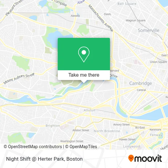
See Night Shift @ Herter Park, Boston, on the map
Public Transit to Night Shift @ Herter Park in Boston
Wondering how to get to Night Shift @ Herter Park in Boston? Moovit helps you find the best way to get to Night Shift @ Herter Park with step-by-step directions from the nearest public transit station.
Moovit provides free maps and live directions to help you navigate through your city. View schedules, routes, timetables, and find out how long does it take to get to Night Shift @ Herter Park in real time.
Looking for the nearest stop or station to Night Shift @ Herter Park? Check out this list of stops closest to your destination: N Harvard St @ Franklin St; Western Ave @ Litchfield St; Harvard Square; Allston Street.
Bus: 70, 86, 66.Train: FITCHBURG, FRAMINGHAM/WORCESTER.Subway: GREEN LINE B, RED LINE.
Want to see if there’s another route that gets you there at an earlier time? Moovit helps you find alternative routes or times. Get directions from and directions to Night Shift @ Herter Park easily from the Moovit App or Website.
We make riding to Night Shift @ Herter Park easy, which is why over 1.7 million users, including users in Boston, trust Moovit as the best app for public transit. You don’t need to download an individual bus app or train app, Moovit is your all-in-one transit app that helps you find the best bus time or train time available.
For information on prices of bus, subway and train, costs and ride fares to Night Shift @ Herter Park, please check the Moovit app.
Use the app to navigate to popular places including to the airport, hospital, stadium, grocery store, mall, coffee shop, school, college, and university.
Location: Boston
- Christian A Herter Park,
- Christian Herter Community Garden (Herter Park Amphitheater),
- Artesani Park,
- WBZ-TV ( CBS ),
- Studio Allston,
- Gordon Indoor Track- Harvard University,
- Days Hotel-Boston (Studio Allston Hotel),
- Artesani Park Wading Pool,
- Skating Club Of Boston,
- Night Shift Owl's Nest Allston,
- Hell's Half Acre,
- Miki Miki Japanese Sushi Restaurant (Maki Maki Japanese Sushi and Seafood Buffet Restaurant),
- Spring Shabu Shabu,
- Petco,
- William E. Smith Playground,
- Shields Mri Brighton,
- Smith Park Pumptrack,
- Cambridge Cemetery,
- Charles River Canoe & Kayak (Paddle Boston - Charles River Canoe & Kayak),
- Cambridge Public Works Dept
Places Near Night Shift @ Herter Park (Boston)
- Museum Of Science, Boston,
- Massachusetts General Hospital, Boston,
- Td Garden, Boston,
- Cheers, Boston,
- House Of Blues, Boston,
- Leader Bank Pavilion (Leader Bank Pavillion), Boston,
- Isabella Stewart Gardner Museum, Boston,
- Boston Children's Hospital, Boston,
- North End, Boston,
- Wilbur Theatre, Boston,
- Seaport District, Boston,
- Boston Medical Center, Boston,
- Boston Common, Boston,
- Wang Theater, Boston,
- Castle Island, Boston,
- Mgm Music Hall, Boston,
- Boston Convention & Exhibition Center, Boston,
- Prudential Center, Boston,
- Faneuil Hall, Boston,
- Quincy Market, Boston
How to get to popular places in Boston with public transit
Get around Boston by public transit!
Traveling around Boston has never been so easy. See step by step directions as you travel to any attraction, street or major public transit station. View bus and train schedules, arrival times, service alerts and detailed routes on a map, so you know exactly how to get to anywhere in Boston.
When traveling to any destination around Boston use Moovit's Live Directions with Get Off Notifications to know exactly where and how far to walk, how long to wait for your line, and how many stops are left. Moovit will alert you when it's time to get off — no need to constantly re-check whether yours is the next stop.
Wondering how to use public transit in Boston or how to pay for public transit in Boston? Moovit public transit app can help you navigate your way with public transit easily, and at minimum cost. It includes public transit fees, ticket prices, and costs. Looking for a map of Boston public transit lines? Moovit public transit app shows all public transit maps in Boston with all Bus, Train, Subway and Ferry routes and stops on an interactive map.
Boston has 4 transit type(s), including: Bus, Train, Subway and Ferry, operated by several transit agencies, including MBTA, Southeastern Regional Transit Authority, MetroWest Regional Transit Authority, Rhode Island Public Transit Authority, WRTA, Lowell Regional Transit Authority, Merrimack Valley Transit, Montachusett Regional Transit Authority, Cape Cod Regional Transit Authority, Brockton Area Transit Authority, Martha's Vineyard Transit Authority, the WAVE - Nantucket Regional Transit Authority, GATRA, Cape Ann Transportation Authority and Massport