See Nina Tower, 荃灣 Tsuen Wan, on the map
Directions to Nina Tower (荃灣 Tsuen Wan) with public transportation
The following transit lines have routes that pass near Nina Tower
 Bus:
Bus: - Subway:
- Ferry:
How to get to Nina Tower by bus?
Click on the bus route to see step by step directions with maps, line arrival times and updated time schedules.
How to get to Nina Tower by subway?
Click on the subway route to see step by step directions with maps, line arrival times and updated time schedules.
Bus stations near Nina Tower in 荃灣 Tsuen Wan
- 如心廣場 Nina Tower,3 min walk,
- 荃新天地 Citywalk,4 min walk,
- 萬景峯公共小巴總站 Vision City Plb Terminus,5 min walk,
- 荃灣體育館 Tsuen Wan Sports Centre,5 min walk,
- 楊屋道街市 Yeung Uk Rd. Market,5 min walk,
- 荃灣大會堂 Tsuen Wan Town Hall,6 min walk,
Ferry stations near Nina Tower in 荃灣 Tsuen Wan
- 荃灣 Tsuen Wan,5 min walk,
Subway stations near Nina Tower in 荃灣 Tsuen Wan
- 荃灣西 Tsuen Wan West,7 min walk,
- 荃灣 Tsuen Wan,15 min walk,
- 青衣 Tsing Yi,28 min walk,
Bus lines to Nina Tower in 荃灣 Tsuen Wan
- NR331S,荃灣(如心廣場) Tsuen Wan (Nina Tower),
- 上環(修打蘭街) — 荃灣(荃灣街市街),荃灣街市街(不停美孚) Tsuen Wan Market St (Omit Mei Foo),
- 荃灣(萬景峯) > 旺角/佐敦道,佐敦道 Jordan Rd,
- 38A,美孚 Mei Foo,
- 38B,碩門邨 Shek Mun Estate,
- 238M,荃灣站 Tsuen Wan Station,
- 荃灣(楊屋道街市) - 石圍角/老圍,石圍角及老圍(循環線) Shek Wai Kok & Lo Wai (Circular),
- NR92,錦綉花園巴士總站 Fairview Park Bus Terminal,
What are the closest stations to Nina Tower?
The closest stations to Nina Tower are:
- 如心廣場 Nina Tower is 162 meters away, 3 min walk.
- 荃新天地 Citywalk is 258 meters away, 4 min walk.
- 萬景峯公共小巴總站 Vision City Plb Terminus is 285 meters away, 5 min walk.
- 荃灣 Tsuen Wan is 345 meters away, 5 min walk.
- 荃灣體育館 Tsuen Wan Sports Centre is 355 meters away, 5 min walk.
- 楊屋道街市 Yeung Uk Rd. Market is 373 meters away, 5 min walk.
- 荃灣大會堂 Tsuen Wan Town Hall is 384 meters away, 6 min walk.
- 荃灣西 Tsuen Wan West is 441 meters away, 7 min walk.
- 青衣 Tsing Yi is 2136 meters away, 28 min walk.
Which bus lines stop near Nina Tower?
These bus lines stop near Nina Tower: 234X, 238X, 278X, 30X, E32A, 旺角(長沙街) > 荃灣(麗城花園).
Which subway line stops near Nina Tower?
西鐵綫 WEST RAIL LINE
What’s the nearest subway station to Nina Tower in 荃灣 Tsuen Wan?
The nearest subway station to Nina Tower in 荃灣 Tsuen Wan is 荃灣西 Tsuen Wan West. It’s a 7 min walk away.
What’s the nearest bus stop to Nina Tower in 荃灣 Tsuen Wan?
The nearest bus stop to Nina Tower in 荃灣 Tsuen Wan is 如心廣場 Nina Tower. It’s a 3 min walk away.
What’s the nearest ferry station to Nina Tower in 荃灣 Tsuen Wan?
The nearest ferry station to Nina Tower in 荃灣 Tsuen Wan is 荃灣 Tsuen Wan. It’s a 5 min walk away.
See Nina Tower, 荃灣 Tsuen Wan, on the map
Public Transit to Nina Tower in 荃灣 Tsuen Wan
Wondering how to get to Nina Tower in 荃灣 Tsuen Wan, Hong Kong? Moovit helps you find the best way to get to Nina Tower with step-by-step directions from the nearest public transit station.
Moovit provides free maps and live directions to help you navigate through your city. View schedules, routes, timetables, and find out how long does it take to get to Nina Tower in real time.
Looking for the nearest stop or station to Nina Tower? Check out this list of stops closest to your destination: 如心廣場 Nina Tower; 荃新天地 Citywalk; 萬景峯公共小巴總站 Vision City Plb Terminus; 荃灣 Tsuen Wan; 荃灣體育館 Tsuen Wan Sports Centre; 楊屋道街市 Yeung Uk Rd. Market; 荃灣大會堂 Tsuen Wan Town Hall; 荃灣西 Tsuen Wan West; 青衣 Tsing Yi.
Bus:Subway:Ferry:
Want to see if there’s another route that gets you there at an earlier time? Moovit helps you find alternative routes or times. Get directions from and directions to Nina Tower easily from the Moovit App or Website.
We make riding to Nina Tower easy, which is why over 1.5 million users, including users in 荃灣 Tsuen Wan, trust Moovit as the best app for public transit. You don’t need to download an individual bus app or train app, Moovit is your all-in-one transit app that helps you find the best bus time or train time available.
For information on prices of subway and bus, costs and ride fares to Nina Tower, please check the Moovit app.
Use the app to navigate to popular places including to the airport, hospital, stadium, grocery store, mall, coffee shop, school, college, and university.
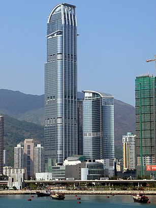
Nina Tower Address: Yeung Uk Road street in 荃灣 Tsuen Wan
Attractions near Nina Tower
L'Hotel Nina Et Convention Centre,Ru Chinese Restaurant 如粵滬中菜廳,L'hotel Nina et Convention Centre ,如心廣場商場 I Nina Mall I,Nina Mall I 如心廣埸I,Nina Tower Tsuen Wan,Sportful Garden Restaurant 陶源酒家,陶源酒家,759 Store 759 阿信屋,壹號食堂,8 Yeung Uk Road,Nina Fossil Garden 如心化石公園,如心广场巴士总站,如心海景酒店暨會議中心 L'Hotel Nina Et Convention Centre,L'hotel Nina et Convention Centre 如心海景酒店暨會議中心,荃灣 (如心廣場)巴士總站 Tsuen Wan (Nina Tower) Bus Terminus,Nina Tower 如心廣場,JPone,Tsuen Wan Nina Tower Bus Terminus 荃灣(如心廣場)巴士總站,如心广场总站How to get to popular attractions in 荃灣 Tsuen Wan with public transit
Starbucks 星巴克, 南區 Southern,麥當勞, 大埔 Tai Po,龍寶酒家, 深水埗 Sham Shui Po,黃埔新天地, 九龍 Kowloon City,Temple Street Night Market, 油尖旺 Yau Tsim Mong,廉政公署總部, 東區 Eastern,Eu Yan Sang 余仁生, 沙田 Sha Tin,銀礦灣泳灘, 香港島 Islands,Serenade Chinese Restaurant , 油尖旺 Yau Tsim Mong,浚湖樓,Sea and Sky Court 海天別墅, 南區 Southern,Avon Mall 碧湖商場, 北區 North,Maxim's Cakes 美心西餅, 沙田 Sha Tin,Chip and Dale Rehearsal Hall,Pacific Coffee 太平洋咖啡, 南區 Southern,海洋公園, 南區 Southern,Isquare, 油尖旺 Yau Tsim Mong,Budaoweng Hotpot Cuisine 不倒翁中日火鍋料理, 油尖旺 Yau Tsim Mong,新城市廣場三期 New Town Plaza Phase 3, 沙田 Sha Tin,Facesss, 油尖旺 Yau Tsim MongGet around 荃灣 Tsuen Wan by public transit!
Traveling around 荃灣 Tsuen Wan has never been so easy. See step by step directions as you travel to any attraction, street or major public transit station. View bus and train schedules, arrival times, service alerts and detailed routes on a map, so you know exactly how to get to anywhere in 荃灣 Tsuen Wan.
When traveling to any destination around 荃灣 Tsuen Wan use Moovit's Live Directions with Get Off Notifications to know exactly where and how far to walk, how long to wait for your line, and how many stops are left. Moovit will alert you when it's time to get off — no need to constantly re-check whether yours is the next stop.
Wondering how to use public transit in 荃灣 Tsuen Wan or how to pay for public transit in 荃灣 Tsuen Wan? Moovit public transit app can help you navigate your way with public transit easily, and at minimum cost. It includes public transit fees, ticket prices, and costs. Looking for a map of 荃灣 Tsuen Wan public transit lines? Moovit public transit app shows all public transit maps in 荃灣 Tsuen Wan with all subway or bus routes and stops on an interactive map.
荃灣 Tsuen Wan has 2 transit type(s), including: subway or bus, operated by several transit agencies, including 港鐵 MTR, 港鐵 MTR, 天星小輪 Star Ferry, 九巴 KMB, 城巴 Citybus, 城巴機場快線 Cityflyer, 龍運巴士 LWB, 九巴 KMB / 城巴 CTB, 龍運巴士 LWB / 城巴 CTB, 新大嶼山巴士 NLB, 愉景灣巴士 DB, 香港電車 Hong Kong Tramways, 港鐵 MTR, 香港中文大學 The Chinese University of Hong Kong and 港島區專線小巴 GMB HK Island