See No. 2 Road Bridge, Southwest British Columbia, on the map
Directions to No. 2 Road Bridge (Southwest British Columbia) with public transportation
The following transit lines have routes that pass near No. 2 Road Bridge
 Bus:
Bus: - SkyTrain:
How to get to No. 2 Road Bridge by bus?
Click on the bus route to see step by step directions with maps, line arrival times and updated time schedules.
How to get to No. 2 Road Bridge by SkyTrain?
Click on the SkyTrain route to see step by step directions with maps, line arrival times and updated time schedules.
Bus stations near No. 2 Road Bridge in Southwest British Columbia
- Westbound River Rd @ Hollybridge Way,6 min walk,
- Southbound Gilbert Rd @ Elmbridge Way,8 min walk,
- Westbound Westminster Hwy @ No. 2 Rd,9 min walk,
- Northbound Inglis Dr @ Airport Rd South,17 min walk,
Skytrain stations near No. 2 Road Bridge in Southwest British Columbia
- Aberdeen Station,8 min walk,
Bus lines to No. 2 Road Bridge in Southwest British Columbia
- 414,Brighouse Station,
- 407,Gilbert,
- 401,Brighouse Station,
- 412,Bridgeport Station,
What are the closest stations to No. 2 Road Bridge?
The closest stations to No. 2 Road Bridge are:
- Westbound River Rd @ Hollybridge Way is 392 meters away, 6 min walk.
- Aberdeen Station is 545 meters away, 8 min walk.
- Southbound Gilbert Rd @ Elmbridge Way is 554 meters away, 8 min walk.
- Westbound Westminster Hwy @ No. 2 Rd is 689 meters away, 9 min walk.
- Northbound Inglis Dr @ Airport Rd South is 1260 meters away, 17 min walk.
Which bus lines stop near No. 2 Road Bridge?
These bus lines stop near No. 2 Road Bridge: 401, 407, 412, 430.
Which SkyTrain line stops near No. 2 Road Bridge?
CANADA LINE
What’s the nearest SkyTrain station to No. 2 Road Bridge in Southwest British Columbia?
The nearest SkyTrain station to No. 2 Road Bridge in Southwest British Columbia is Aberdeen Station. It’s a 8 min walk away.
What’s the nearest bus stop to No. 2 Road Bridge in Southwest British Columbia?
The nearest bus stop to No. 2 Road Bridge in Southwest British Columbia is Westbound River Rd @ Hollybridge Way. It’s a 6 min walk away.
What time is the first SkyTrain to No. 2 Road Bridge in Southwest British Columbia?
The CANADA LINE is the first SkyTrain that goes to No. 2 Road Bridge in Southwest British Columbia. It stops nearby at 5:02 AM.
What time is the last SkyTrain to No. 2 Road Bridge in Southwest British Columbia?
The CANADA LINE is the last SkyTrain that goes to No. 2 Road Bridge in Southwest British Columbia. It stops nearby at 1:41 AM.
What time is the first bus to No. 2 Road Bridge in Southwest British Columbia?
The 401 is the first bus that goes to No. 2 Road Bridge in Southwest British Columbia. It stops nearby at 4:42 AM.
What time is the last bus to No. 2 Road Bridge in Southwest British Columbia?
The 401 is the last bus that goes to No. 2 Road Bridge in Southwest British Columbia. It stops nearby at 2:40 AM.
How much is the bus fare to No. 2 Road Bridge?
The bus fare to No. 2 Road Bridge costs about $2.60.
See No. 2 Road Bridge, Southwest British Columbia, on the map
Public Transit to No. 2 Road Bridge in Southwest British Columbia
How to get to No. 2 Road Bridge in Southwest British Columbia, Canada?
It’s easy with Moovit. Type in your street address and Moovit’s route finder will locate the fastest way to get you there! Not sure where to get off on the street? Download the Moovit App to find live directions (including where to get off on No. 2 Road Bridge), see timetables and get the estimated arrival times for your favorite bus or SkyTrain lines.
Looking for the nearest stop or station to No. 2 Road Bridge? Check out this list of closest stops available to your destination: Westbound River Rd @ Hollybridge Way; Aberdeen Station; Southbound Gilbert Rd @ Elmbridge Way; Westbound Westminster Hwy @ No. 2 Rd; Northbound Inglis Dr @ Airport Rd South.
Bus:SkyTrain:
Download the Moovit App to see the current schedule and routes available for Southwest British Columbia. No need to install a special bus app to check the bus time or a train app to get train time. Moovit is the only all-in-one transit app that helps you get where you need to go.
We make riding on public transit to No. 2 Road Bridge easy, which is why over 1.5 million users, including users in Southwest British Columbia trust Moovit as the best app for public transit.
Use the app to navigate to popular places including to the airport, hospital, stadium, grocery store, mall, coffee shop, school, college, and university.
Location: Southwest British Columbia
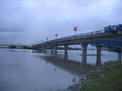
The No. 2 Road Bridge is a crossing over the middle arm of the Fraser River, and River Rd., in Metro Vancouver.Wiki
Streets near No. 2 Road Bridge, Southwest British Columbia
Number 2 Road Bridge, Unknown,Middle Arm Trail, Richmond,Brighouse Way, Richmond,Oval Way, Richmond,Inglis Drive, Richmond,Dover Crescent, Richmond,Thetis Place, Richmond,Russ Baker Way, Richmond,Inglis Drive, Unknown,Dinsmore Bridge, Richmond,Canim Place, Richmond,Pearson Way, Richmond,Hollybridge Way, Richmond,Dover Road, Richmond,Cowley Crescent, Unknown,Camsell Crescent, Richmond,Airport Road South, Richmond,Lynas Lane, Richmond,South Perimeter Road, Richmond,Azure Boulevard, RichmondGet around Southwest British Columbia by public transit!
Traveling around Southwest British Columbia has never been so easy. See step by step directions as you travel to any attraction, street or major public transit station. View bus and train schedules, arrival times, service alerts and detailed routes on a map, so you know exactly how to get to anywhere in Southwest British Columbia.
When traveling to any destination around Southwest British Columbia use Moovit's Live Directions with Get Off Notifications to know exactly where and how far to walk, how long to wait for your line, and how many stops are left. Moovit will alert you when it's time to get off — no need to constantly re-check whether yours is the next stop.
Wondering how to use public transit in Southwest British Columbia or how to pay for public transit in Southwest British Columbia? Moovit public transit app can help you navigate your way with public transit easily, and at minimum cost. It includes public transit fees, ticket prices, and costs. Looking for a map of Southwest British Columbia public transit lines? Moovit public transit app shows all public transit maps in Southwest British Columbia with all bus or SkyTrain routes and stops on an interactive map.
Southwest British Columbia has 2 transit type(s), including: bus or SkyTrain, operated by several transit agencies, including TransLink, TransLink, TransLink, TransLink, False Creek Ferries, BC Ferries, Aquabus, BC Transit - Central Fraser Valley Transit System, BCTransit, BC Transit - Comox Valley Transit System, BC Transit - Aggasiz-Harrison and Hope Transit System, BC Transit - Chilliwack Transit System, BC Transit - Squamish, BC Transit - Whistler Transit System and BC Transit - Cowichan Valley Regional Transit System