Directions to No Sweat Apparel (Watertown Town) with public transportation
The following transit lines have routes that pass near No Sweat Apparel
 Bus: 70, 554.
- Train: FITCHBURG, FRAMINGHAM/WORCESTER.
How to get to No Sweat Apparel by bus?
Click on the bus route to see step by step directions with maps, line arrival times and updated time schedules.
From VFW Parkway, Boston
57 minFrom The Cheesecake Factory, Boston
62 minFrom Embassy Suites by Hilton Boston Waltham, Waltham
51 minFrom The Monument, Boston
83 minFrom Harvard University, Cambridge
42 minFrom Mount Ida College, Newton
60 minFrom Boston Dynamics, Waltham
49 minFrom Matthews Arena, Boston
62 minFrom LEGOLAND Discovery Center Boston, Somerville
85 minFrom Boston Scientific Shuttle: Prudential Center Stop, Boston
62 min
How to get to No Sweat Apparel by train?
Click on the train route to see step by step directions with maps, line arrival times and updated time schedules.
Bus stops near No Sweat Apparel in Watertown Town
Train stations near No Sweat Apparel in Watertown Town
What are the closest stations to No Sweat Apparel?
The closest stations to No Sweat Apparel are:
- Main St @ Edenfield Ave is 71 yards away, 1 min walk.
- Beaver St @ Hollace St is 454 yards away, 6 min walk.
- Waltham is 1888 yards away, 22 min walk.
- Newtonville is 4139 yards away, 49 min walk.
Which bus line stops near No Sweat Apparel?
70 (Market Place Dr)
Which train lines stop near No Sweat Apparel?
These train lines stop near No Sweat Apparel: FITCHBURG, FRAMINGHAM/WORCESTER.
What’s the nearest train station to No Sweat Apparel in Watertown Town?
The nearest train station to No Sweat Apparel in Watertown Town is Waltham. It’s a 22 min walk away.
What’s the nearest bus station to No Sweat Apparel in Watertown Town?
The nearest bus station to No Sweat Apparel in Watertown Town is Main St @ Edenfield Ave. It’s a 1 min walk away.
What time is the first train to No Sweat Apparel in Watertown Town?
The FRAMINGHAM/WORCESTER is the first train that goes to No Sweat Apparel in Watertown Town. It stops nearby at 5:25 AM.
What time is the last train to No Sweat Apparel in Watertown Town?
The FRAMINGHAM/WORCESTER is the last train that goes to No Sweat Apparel in Watertown Town. It stops nearby at 12:17 AM.
What time is the first bus to No Sweat Apparel in Watertown Town?
The 70 is the first bus that goes to No Sweat Apparel in Watertown Town. It stops nearby at 4:42 AM.
What time is the last bus to No Sweat Apparel in Watertown Town?
The 70 is the last bus that goes to No Sweat Apparel in Watertown Town. It stops nearby at 12:47 AM.
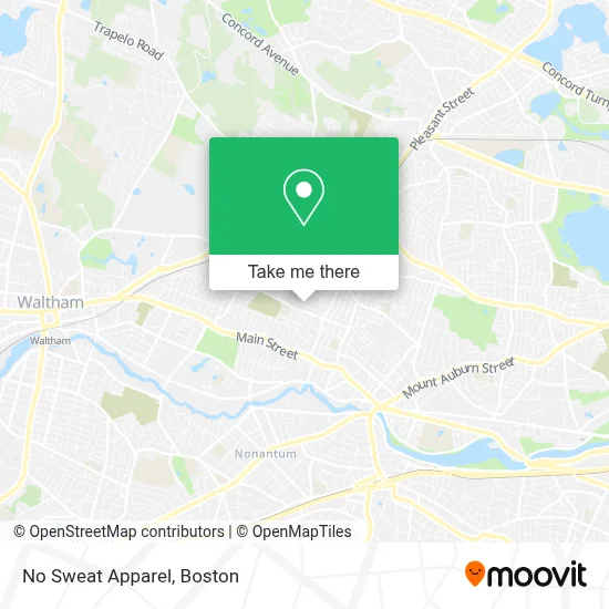
See No Sweat Apparel, Watertown Town, on the map
Public Transit to No Sweat Apparel in Watertown Town
Wondering how to get to No Sweat Apparel in Watertown Town? Moovit helps you find the best way to get to No Sweat Apparel with step-by-step directions from the nearest public transit station.
Moovit provides free maps and live directions to help you navigate through your city. View schedules, routes, timetables, and find out how long does it take to get to No Sweat Apparel in real time.
Looking for the nearest stop or station to No Sweat Apparel? Check out this list of stops closest to your destination: Main St @ Edenfield Ave; Beaver St @ Hollace St; Waltham; Newtonville.
Bus: 70, 554.Train: FITCHBURG, FRAMINGHAM/WORCESTER.
Want to see if there’s another route that gets you there at an earlier time? Moovit helps you find alternative routes or times. Get directions from and directions to No Sweat Apparel easily from the Moovit App or Website.
We make riding to No Sweat Apparel easy, which is why over 1.7 million users, including users in Watertown Town, trust Moovit as the best app for public transit. You don’t need to download an individual bus app or train app, Moovit is your all-in-one transit app that helps you find the best bus time or train time available.
For information on prices of bus, train and subway, costs and ride fares to No Sweat Apparel, please check the Moovit app.
Use the app to navigate to popular places including to the airport, hospital, stadium, grocery store, mall, coffee shop, school, college, and university.
No Sweat Apparel Address: 95 Carey Ave street in Watertown Town
- Mls Property Information Network, Inc.,
- Tim Roche,
- Sisters of Saint Joseph,
- E Joyce Munger Apartments,
- Watertown Housing Authority,
- Sylvia Frerk - Unitedhealthcare Licensed Sales Agent,
- Watertown Public Schools,
- Locksmith,
- Deborah K. Rosene Ph.D.,
- Armor Heating,
- Robinson Matthew J,
- Foxwoods,
- Montesin Enterprises,
- Charles River Greenway,
- Ryan, John A Skating Arena,
- Kids for Kids Tutoring,
- At Your Service Appliance Repair,
- Francis Market,
- Scalzi School of Dance,
- Lifebloom Candles
Places Near No Sweat Apparel (Watertown Town)
- Td Garden, Boston,
- Wang Theater, Boston,
- Museum Of Science, Boston,
- North End, Boston,
- Isabella Stewart Gardner Museum, Boston,
- Faneuil Hall, Boston,
- Boston Medical Center, Boston,
- Wilbur Theatre, Boston,
- Prudential Center, Boston,
- Cheers, Boston,
- Boston Common, Boston,
- Mgm Music Hall, Boston,
- House Of Blues, Boston,
- Massachusetts General Hospital, Boston,
- Quincy Market, Boston,
- Boston Children's Hospital, Boston,
- Boston Convention & Exhibition Center, Boston,
- Seaport District, Boston,
- Leader Bank Pavilion (Leader Bank Pavillion), Boston,
- Castle Island, Boston
How to get to popular places in Boston with public transit
Get around Watertown Town by public transit!
Traveling around Watertown Town has never been so easy. See step by step directions as you travel to any attraction, street or major public transit station. View bus and train schedules, arrival times, service alerts and detailed routes on a map, so you know exactly how to get to anywhere in Watertown Town.
When traveling to any destination around Watertown Town use Moovit's Live Directions with Get Off Notifications to know exactly where and how far to walk, how long to wait for your line, and how many stops are left. Moovit will alert you when it's time to get off — no need to constantly re-check whether yours is the next stop.
Wondering how to use public transit in Watertown Town or how to pay for public transit in Watertown Town? Moovit public transit app can help you navigate your way with public transit easily, and at minimum cost. It includes public transit fees, ticket prices, and costs. Looking for a map of Watertown Town public transit lines? Moovit public transit app shows all public transit maps in Watertown Town with all Bus, Train, Subway and Ferry routes and stops on an interactive map.
Boston has 4 transit type(s), including: Bus, Train, Subway and Ferry, operated by several transit agencies, including MBTA, Southeastern Regional Transit Authority, MetroWest Regional Transit Authority, Rhode Island Public Transit Authority, WRTA, Lowell Regional Transit Authority, Merrimack Valley Transit, Montachusett Regional Transit Authority, Cape Cod Regional Transit Authority, Brockton Area Transit Authority, Martha's Vineyard Transit Authority, the WAVE - Nantucket Regional Transit Authority, GATRA, Cape Ann Transportation Authority and Massport