Directions to Noah's Ark Preschool (Needham) with public transportation
The following transit lines have routes that pass near Noah's Ark Preschool
 Bus: 59, NEEDHAM LINE SHUTTLE, NEEDHAM LINE SHUTTLE.
- Train: NEEDHAM.
How to get to Noah's Ark Preschool by bus?
Click on the bus route to see step by step directions with maps, line arrival times and updated time schedules.
From St. Elizabeth's, Boston
72 minFrom Brighton District Court, Boston
65 minFrom Six Flags New England, Newton
38 minFrom Brighton, Boston
62 minFrom Newton, MA, Newton
48 minFrom Norwood, MA, Norwood
162 minFrom Arnold Arboretum, Boston
145 minFrom West Roxbury, Boston
107 minFrom Faulkner Hospital, Boston
154 min
How to get to Noah's Ark Preschool by train?
Click on the train route to see step by step directions with maps, line arrival times and updated time schedules.
Bus stops near Noah's Ark Preschool in Needham
Train station near Noah's Ark Preschool in Needham
- Needham Center, 6 min walk,VIEW
Bus lines to Noah's Ark Preschool in Needham
What are the closest stations to Noah's Ark Preschool?
The closest stations to Noah's Ark Preschool are:
- Highland Ave Opp Oakland Ave is 8 yards away, 1 min walk.
- Needham Center is 471 yards away, 8 min walk.
Which bus line stops near Noah's Ark Preschool?
59 (Needham Junction Via Needham St)
Which train line stops near Noah's Ark Preschool?
NEEDHAM (#625 | Needham Heights)
What’s the nearest train station to Noah's Ark Preschool in Needham?
The nearest train station to Noah's Ark Preschool in Needham is Needham Center. It’s a 6 min walk away.
What’s the nearest bus station to Noah's Ark Preschool in Needham?
The nearest bus station to Noah's Ark Preschool in Needham is Highland Ave Opp Oakland Ave. It’s a 1 min walk away.
What time is the first train to Noah's Ark Preschool in Needham?
The NEEDHAM is the first train that goes to Noah's Ark Preschool in Needham. It stops nearby at 7:05 AM.
What time is the last train to Noah's Ark Preschool in Needham?
The NEEDHAM is the last train that goes to Noah's Ark Preschool in Needham. It stops nearby at 6:38 PM.
What time is the first bus to Noah's Ark Preschool in Needham?
The 59 is the first bus that goes to Noah's Ark Preschool in Needham. It stops nearby at 6:20 AM.
What time is the last bus to Noah's Ark Preschool in Needham?
The 59 is the last bus that goes to Noah's Ark Preschool in Needham. It stops nearby at 7:53 PM.
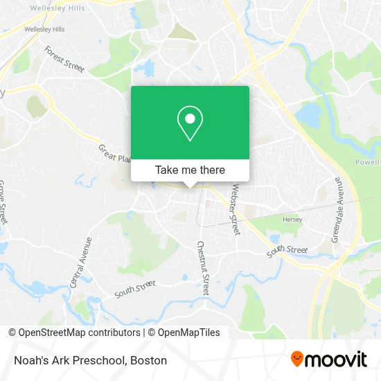
See Noah's Ark Preschool, Needham, on the map
Public Transit to Noah's Ark Preschool in Needham
Wondering how to get to Noah's Ark Preschool in Needham? Moovit helps you find the best way to get to Noah's Ark Preschool with step-by-step directions from the nearest public transit station.
Moovit provides free maps and live directions to help you navigate through your city. View schedules, routes, timetables, and find out how long does it take to get to Noah's Ark Preschool in real time.
Looking for the nearest stop or station to Noah's Ark Preschool? Check out this list of stops closest to your destination: Highland Ave Opp Oakland Ave; Needham Center.
Bus: 59, NEEDHAM LINE SHUTTLE, NEEDHAM LINE SHUTTLE.Train: NEEDHAM.
Want to see if there’s another route that gets you there at an earlier time? Moovit helps you find alternative routes or times. Get directions from and directions to Noah's Ark Preschool easily from the Moovit App or Website.
We make riding to Noah's Ark Preschool easy, which is why over 1.7 million users, including users in Needham, trust Moovit as the best app for public transit. You don’t need to download an individual bus app or train app, Moovit is your all-in-one transit app that helps you find the best bus time or train time available.
For information on prices of bus, train and subway, costs and ride fares to Noah's Ark Preschool, please check the Moovit app.
Use the app to navigate to popular places including to the airport, hospital, stadium, grocery store, mall, coffee shop, school, college, and university.
Noah's Ark Preschool Address: 1154 Great Plain Ave street in Needham
- Stormberg David L,
- Mason R William MD,
- Greymont Building,
- Beth Israel Deaconess Hospital-Needham-ER,
- Beth Israel Deaconess Hospital,
- Needham Town Offices,
- Rockland Trust,
- Pure Hockey,
- St Joseph Parish (Saint Joseph Parish),
- Pure Hockey,
- Kathy Lewis-Re/Max Home Team,
- Springwwell,
- Needham Housing Authority 5 Chambers St,
- VFW Post 2498,
- Ymca,
- Eliot Kotobukiya,
- Vesta Park,
- Aubrey Law,
- Stax *Miguel Beltran,
- Beth Israel
Places Near Noah's Ark Preschool (Needham)
- Boston Convention & Exhibition Center, Boston,
- Leader Bank Pavilion (Leader Bank Pavillion), Boston,
- Prudential Center, Boston,
- House Of Blues, Boston,
- Mgm Music Hall, Boston,
- Boston Children's Hospital, Boston,
- Boston Medical Center, Boston,
- Wang Theater, Boston,
- Faneuil Hall, Boston,
- Massachusetts General Hospital, Boston,
- Td Garden, Boston,
- Boston Common, Boston,
- Cheers, Boston,
- Museum Of Science, Boston,
- Quincy Market, Boston,
- North End, Boston,
- Isabella Stewart Gardner Museum, Boston,
- Wilbur Theatre, Boston,
- Castle Island, Boston,
- Seaport District, Boston
How to get to popular places in Boston with public transit
Get around Needham by public transit!
Traveling around Needham has never been so easy. See step by step directions as you travel to any attraction, street or major public transit station. View bus and train schedules, arrival times, service alerts and detailed routes on a map, so you know exactly how to get to anywhere in Needham.
When traveling to any destination around Needham use Moovit's Live Directions with Get Off Notifications to know exactly where and how far to walk, how long to wait for your line, and how many stops are left. Moovit will alert you when it's time to get off — no need to constantly re-check whether yours is the next stop.
Wondering how to use public transit in Needham or how to pay for public transit in Needham? Moovit public transit app can help you navigate your way with public transit easily, and at minimum cost. It includes public transit fees, ticket prices, and costs. Looking for a map of Needham public transit lines? Moovit public transit app shows all public transit maps in Needham with all Bus, Train, Subway and Ferry routes and stops on an interactive map.
Boston has 4 transit type(s), including: Bus, Train, Subway and Ferry, operated by several transit agencies, including MBTA, Southeastern Regional Transit Authority, MetroWest Regional Transit Authority, Rhode Island Public Transit Authority, WRTA, Lowell Regional Transit Authority, Merrimack Valley Transit, Montachusett Regional Transit Authority, Cape Cod Regional Transit Authority, Brockton Area Transit Authority, Martha's Vineyard Transit Authority, the WAVE - Nantucket Regional Transit Authority, GATRA, Cape Ann Transportation Authority and Massport