Directions to Nohri (Boston) with public transportation
The following transit lines have routes that pass near Nohri
 Bus: 504, 92, 93, SL3, SL4.
- Train: FRAMINGHAM/WORCESTER, LOWELL, NEEDHAM, COMMUTER RAIL SHUTTLE, FAIRMOUNT LINE SHUTTLE.
- Subway: GREEN LINE B, GREEN LINE D, ORANGE LINE, RED LINE, GREEN LINE C.
How to get to Nohri by bus?
Click on the bus route to see step by step directions with maps, line arrival times and updated time schedules.
From La Quinta Inn & Suites Boston Somerville, Somerville
62 minFrom The Mall At Chestnut Hill, Newton
65 minFrom Revere Beach, Revere
76 minFrom Regent Theatre, Arlington
75 minFrom Samuel Adams Brewery, Boston
42 minFrom Boston University Track and Tennis Center, Boston
57 minFrom FOUR POINTS BY SHERATON Boston Newton, Newton
24 minFrom Mspca, Boston
42 minFrom MBTA Alewife Station, Cambridge
79 minFrom Milton Academy, Milton
90 min
How to get to Nohri by train?
Click on the train route to see step by step directions with maps, line arrival times and updated time schedules.
How to get to Nohri by subway?
Click on the subway route to see step by step directions with maps, line arrival times and updated time schedules.
From La Quinta Inn & Suites Boston Somerville, Somerville
27 minFrom The Mall At Chestnut Hill, Newton
62 minFrom Revere Beach, Revere
47 minFrom Samuel Adams Brewery, Boston
24 minFrom Boston University Track and Tennis Center, Boston
39 minFrom Mspca, Boston
33 minFrom MBTA Alewife Station, Cambridge
30 minFrom Milton Academy, Milton
56 min
Bus stops near Nohri in Boston
- Washington St @ Essex St, 2 min walk,VIEW
- Tremont St @ Boylston Station, 3 min walk,VIEW
- Kneeland St @ Washington St, 4 min walk,VIEW
- South Station - Summer St @ Surface Rd, 4 min walk,VIEW
- Otis St @ Summer St, 6 min walk,VIEW
- South Station Boston, 7 min walk,VIEW
- South Station Bus Terminal, 9 min walk,VIEW
Train station near Nohri in Boston
- South Station, 13 min walk,VIEW
Bus lines to Nohri in Boston
- SL5, Nubian,VIEW
- 11, City Point,VIEW
- 15, Mattapan Via Nubian & Fields Corner,VIEW
- SL4, Nubian,VIEW
- 39, Haymarket Via Forest Hills,VIEW
- 43, Ruggles,VIEW
- 57, Haymarket Via Kenmore,VIEW
- GREEN LINE E SHUTTLE, Heath Street (Shuttle),VIEW
- GREEN LINE SHUTTLE, Blandford Street (Shuttle),VIEW
- 501, Downtown Via Cambridge St And Copley (Express),VIEW
- 504, Watertown Via Copley And Newton Corner (Express),VIEW
- RED LINE SHUTTLE, Jfk/Umass (Shuttle),VIEW
- 7, Otis & Summer - City Point,VIEW
- 505, Downtown (Express) - Waltham (Express),VIEW
- RED LINE SHUTTLE, Harvard - JFK/UMass via Congress Street,VIEW
- RED LINE SHUTTLE, Harvard - Broadway,VIEW
- RED LINE SHUTTLE, Kendall/MIT - JFK/UMass,VIEW
- RED LINE SHUTTLE, JFK/UMass - Kendall/MIT (Shuttle),VIEW
- PETER PAN, BOSTON - WORCESTER - SPRINGFIELD - NORTHAMPTON - AMHERST,VIEW
- PETER PAN, NEW YORK - BOSTON Express Service,VIEW
What are the closest stations to Nohri?
The closest stations to Nohri are:
- Washington St @ Essex St is 107 yards away, 2 min walk.
- Tremont St @ Boylston Station is 180 yards away, 3 min walk.
- Kneeland St @ Washington St is 317 yards away, 4 min walk.
- South Station - Summer St @ Surface Rd is 320 yards away, 4 min walk.
- Otis St @ Summer St is 448 yards away, 6 min walk.
- Downtown Crossing is 488 yards away, 6 min walk.
- South Station Boston is 500 yards away, 7 min walk.
- South Station Bus Terminal is 710 yards away, 9 min walk.
- South Station is 1120 yards away, 13 min walk.
- Boylston is 1238 yards away, 15 min walk.
Which bus lines stop near Nohri?
These bus lines stop near Nohri: 504, 92, 93, SL3, SL4, SL5.
Which train lines stop near Nohri?
These train lines stop near Nohri: FRAMINGHAM/WORCESTER, LOWELL, NEEDHAM.
Which subway lines stop near Nohri?
These subway lines stop near Nohri: GREEN LINE B, GREEN LINE D, ORANGE LINE, RED LINE.
What’s the nearest subway station to Nohri in Boston?
The nearest subway station to Nohri in Boston is Downtown Crossing. It’s a 6 min walk away.
What’s the nearest train station to Nohri in Boston?
The nearest train station to Nohri in Boston is South Station. It’s a 13 min walk away.
What’s the nearest bus station to Nohri in Boston?
The nearest bus station to Nohri in Boston is Washington St @ Essex St. It’s a 2 min walk away.
What time is the first subway to Nohri in Boston?
The GREEN LINE D is the first subway that goes to Nohri in Boston. It stops nearby at 5:09 AM.
What time is the last subway to Nohri in Boston?
The GREEN LINE E is the last subway that goes to Nohri in Boston. It stops nearby at 2:16 AM.
What time is the first train to Nohri in Boston?
The PROVIDENCE/STOUGHTON is the first train that goes to Nohri in Boston. It stops nearby at 4:20 AM.
What time is the last train to Nohri in Boston?
The LAKE SHORE LIMITED is the last train that goes to Nohri in Boston. It stops nearby at 8:32 PM.
What time is the first bus to Nohri in Boston?
The SLW is the first bus that goes to Nohri in Boston. It stops nearby at 4:19 AM.
What time is the last bus to Nohri in Boston?
The FLIXBUS N2605 is the last bus that goes to Nohri in Boston. It stops nearby at 9:25 AM.
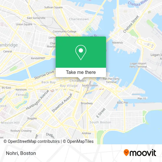
See Nohri, Boston, on the map
Public Transit to Nohri in Boston
Wondering how to get to Nohri in Boston? Moovit helps you find the best way to get to Nohri with step-by-step directions from the nearest public transit station.
Moovit provides free maps and live directions to help you navigate through your city. View schedules, routes, timetables, and find out how long does it take to get to Nohri in real time.
Looking for the nearest stop or station to Nohri? Check out this list of stops closest to your destination: Washington St @ Essex St; Tremont St @ Boylston Station; Kneeland St @ Washington St; South Station - Summer St @ Surface Rd; Otis St @ Summer St; Downtown Crossing; South Station Boston; South Station Bus Terminal; South Station; Boylston.
Bus: 504, 92, 93, SL3, SL4, SL5, 11, 15, 39, 43, 57, GREEN LINE E SHUTTLE, GREEN LINE SHUTTLE.Train: FRAMINGHAM/WORCESTER, LOWELL, NEEDHAM, COMMUTER RAIL SHUTTLE, FAIRMOUNT LINE SHUTTLE, FRANKLIN LINE SHUTTLE, KINGSTON LINE SHUTTLE, SL1.Subway: GREEN LINE B, GREEN LINE D, ORANGE LINE, RED LINE, GREEN LINE C, GREEN LINE E.
Want to see if there’s another route that gets you there at an earlier time? Moovit helps you find alternative routes or times. Get directions from and directions to Nohri easily from the Moovit App or Website.
We make riding to Nohri easy, which is why over 1.7 million users, including users in Boston, trust Moovit as the best app for public transit. You don’t need to download an individual bus app or train app, Moovit is your all-in-one transit app that helps you find the best bus time or train time available.
For information on prices of bus, subway and train, costs and ride fares to Nohri, please check the Moovit app.
Use the app to navigate to popular places including to the airport, hospital, stadium, grocery store, mall, coffee shop, school, college, and university.
Nohri Address: 5 Tyler St street in Boston
- Fong Massage Therapy,
- Kok Wa,
- Wakuwaku,
- 12 Tyler St,
- Wingwah (Wing Wah Mini Store in),
- Aqua World,
- Department of Neuroscience, Tufts University School of Medicine,
- Royal Entertainment,
- Shing Hong Trading,
- BLR by Shojo,
- Dewey Square Park on the Greenway,
- Wings Kitchen (Wing's Kitchen),
- Tufts University - Health Sciences Bookstore,
- Chinatown Gate (China Gate Plaza Park),
- Locks & Locksmith 24 Hrs (Locks and Locksmiths),
- Station KTV,
- Station KTV (Station Bistro),
- Tufts Dental,
- Phillips Square Tactical Plaza,
- Global Luxury Suites Downtown Boston
Places Near Nohri (Boston)
- House Of Blues, Boston,
- Boston Children's Hospital, Boston,
- Leader Bank Pavilion (Leader Bank Pavillion), Boston,
- Prudential Center, Boston,
- North End, Boston,
- Boston Common, Boston,
- Quincy Market, Boston,
- Faneuil Hall, Boston,
- Isabella Stewart Gardner Museum, Boston,
- Wang Theater, Boston,
- Mgm Music Hall, Boston,
- Wilbur Theatre, Boston,
- Cheers, Boston,
- Castle Island, Boston,
- Museum Of Science, Boston,
- Boston Medical Center, Boston,
- Seaport District, Boston,
- Boston Convention & Exhibition Center, Boston,
- Massachusetts General Hospital, Boston,
- Td Garden, Boston
How to get to popular places in Boston with public transit
Get around Boston by public transit!
Traveling around Boston has never been so easy. See step by step directions as you travel to any attraction, street or major public transit station. View bus and train schedules, arrival times, service alerts and detailed routes on a map, so you know exactly how to get to anywhere in Boston.
When traveling to any destination around Boston use Moovit's Live Directions with Get Off Notifications to know exactly where and how far to walk, how long to wait for your line, and how many stops are left. Moovit will alert you when it's time to get off — no need to constantly re-check whether yours is the next stop.
Wondering how to use public transit in Boston or how to pay for public transit in Boston? Moovit public transit app can help you navigate your way with public transit easily, and at minimum cost. It includes public transit fees, ticket prices, and costs. Looking for a map of Boston public transit lines? Moovit public transit app shows all public transit maps in Boston with all Bus, Train, Subway and Ferry routes and stops on an interactive map.
Boston has 4 transit type(s), including: Bus, Train, Subway and Ferry, operated by several transit agencies, including MBTA, Southeastern Regional Transit Authority, MetroWest Regional Transit Authority, Rhode Island Public Transit Authority, WRTA, Lowell Regional Transit Authority, Merrimack Valley Transit, Montachusett Regional Transit Authority, Cape Cod Regional Transit Authority, Brockton Area Transit Authority, Martha's Vineyard Transit Authority, the WAVE - Nantucket Regional Transit Authority, GATRA, Cape Ann Transportation Authority and Massport