Directions to Nordfyns Kommune (Søndersø) with public transportation
The following transit lines have routes that pass near Nordfyns Kommune
How to get to Nordfyns Kommune by bus?
Click on the bus route to see step by step directions with maps, line arrival times and updated time schedules.
Bus stations near Nordfyns Kommune in Søndersø
- Bolmerod / Bredgade (Nordfyn Kommune), 72 min walk,
Bus lines to Nordfyns Kommune in Søndersø
- 557, Otterup,
- 561, Rostrup,
What are the closest stations to Nordfyns Kommune?
The closest stations to Nordfyns Kommune are:
- Bolmerod / Bredgade (Nordfyn Kommune) is 5613 meters away, 72 min walk.
Which bus line stops near Nordfyns Kommune?
191
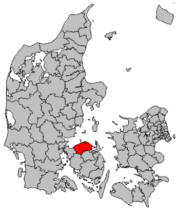
See Nordfyns Kommune, Søndersø, on the map
Public Transit to Nordfyns Kommune in Søndersø
Wondering how to get to Nordfyns Kommune in Søndersø, Denmark? Moovit helps you find the best way to get to Nordfyns Kommune with step-by-step directions from the nearest public transit station.
Moovit provides free maps and live directions to help you navigate through your city. View schedules, routes, timetables, and find out how long does it take to get to Nordfyns Kommune in real time.
Looking for the nearest stop or station to Nordfyns Kommune? Check out this list of stops closest to your destination: Bolmerod / Bredgade (Nordfyn Kommune).
Bus: 191, 557, 561.
Want to see if there’s another route that gets you there at an earlier time? Moovit helps you find alternative routes or times. Get directions from and directions to Nordfyns Kommune easily from the Moovit App or Website.
We make riding to Nordfyns Kommune easy, which is why over 1.5 million users, including users in Søndersø, trust Moovit as the best app for public transit. You don’t need to download an individual bus app or train app, Moovit is your all-in-one transit app that helps you find the best bus time or train time available.
For information on prices of bus, costs and ride fares to Nordfyns Kommune, please check the Moovit app.
Use the app to navigate to popular places including to the airport, hospital, stadium, grocery store, mall, coffee shop, school, college, and university.
Location: Søndersø, Denmark
Attractions near Nordfyns Kommune
Melby Ender,Lådne Brøndstrup,Askeby,Jullerup Enghave,Lille Jullerup,Melbyvej 95,Nordfyns,Ny Jullerup,Melby Kirke,Melby,Jullerup,Jullerup,Langager,Ullemose,Svenstrupvej,Rostrup,Augustinus Horses,Ørritslev,Svenstrup,EngeldrupHow to get to popular attractions in Søndersø with public transit
Siemens Gamesa Renewable Energy A / S, Ikast-Brande,Arriva Silkeborg-Skanderborg, Silkeborg,Moxy Copenhagen, København,Copenhagen Street Food - Reffen, København,Louis Nielsen, Helsingør,Rubjerg Knude Fyr, Løkken-Vrå,Nordea, København,Hellerup, København,Glostrup Hospital, Afd. M43, Glostrup,Tornby Strand, Hjørring,Copenhagen Airport, Tårnby,Karen Blixens Plads, København,Høje Gladsaxe, Gladsaxe,Hundested-Hillerød Grisen, Gribskov,Den Lille Havfrue, København,Busholdepladsen ved Musikhuset, Århus,Nyborg Strand Hotel & Konference Center, Nyborg,Tvillingernes Kvarters Store Festsal, Esbjerg,Learnmark Horsens, Stadionsvej, Horsens,Christiansborg Slot, KøbenhavnGet around Denmark by public transit!
Traveling around Denmark has never been so easy. See step by step directions as you travel to any attraction, street or major public transit station. View bus and train schedules, arrival times, service alerts and detailed routes on a map, so you know exactly how to get to anywhere in Denmark.
When traveling to any destination around Denmark use Moovit's Live Directions with Get Off Notifications to know exactly where and how far to walk, how long to wait for your line, and how many stops are left. Moovit will alert you when it's time to get off — no need to constantly re-check whether yours is the next stop.
Wondering how to use public transit in Denmark or how to pay for public transit in Denmark? Moovit public transit app can help you navigate your way with public transit easily, and at minimum cost. It includes public transit fees, ticket prices, and costs. Looking for a map of Denmark public transit lines? Moovit public transit app shows all public transit maps in Denmark with all Bus, Train, Metro, Light Rail and Ferry routes and stops on an interactive map.
Denmark has 5 transit type(s), including: Bus, Train, Metro, Light Rail and Ferry, operated by several transit agencies, including Metroselskabet, DSB S-tog, Lokaltog A/S, Midttrafik, Odense Letbane, DSB, NT, GoCollective, Skånetrafiken, Movia, FYNBUS, Sydtrafik, Bornholms Trafik, Citybus, Ærø Kommune