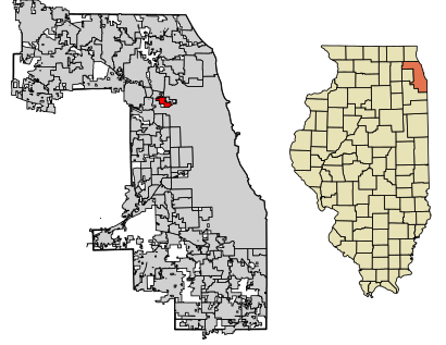
See Norridge on the map
Directions to Norridge with public transportation
The following transit lines have routes that pass near Norridge
 Bus:
Bus: - Train:
- Chicago 'L':
How to get to Norridge by bus?
Click on the bus route to see step by step directions with maps, line arrival times and updated time schedules.
How to get to Norridge by train?
Click on the train route to see step by step directions with maps, line arrival times and updated time schedules.
How to get to Norridge by Chicago 'L'?
Click on the Chicago 'L' route to see step by step directions with maps, line arrival times and updated time schedules.
Bus stations near Norridge
- Irving Park/Olcott,3 min walk,
- Forest Preserve Avenue & Harlem/Irving Park (Sw),8 min walk,
- Harlem & Irving Park (South),10 min walk,
Chicago 'l' stations near Norridge
- Harlem (Blue - O'Hare Branch),10 min walk,
Train stations near Norridge
- Mont Clare,20 min walk,
- River Grove,45 min walk,
Bus lines to Norridge
- 80,Irving Park & Cumberland Terminal (South),
- 78,Forest Preserve Avenue & Harlem/Irving Park (Sw),
- 90,Harlem/Lake Green Line Station (West),
What are the closest stations to Norridge?
The closest stations to Norridge are:
- Irving Park/Olcott is 152 yards away, 3 min walk.
- Forest Preserve Avenue & Harlem/Irving Park (Sw) is 652 yards away, 8 min walk.
- Harlem & Irving Park (South) is 780 yards away, 10 min walk.
- Harlem (Blue - O'Hare Branch) is 802 yards away, 10 min walk.
- Mont Clare is 1651 yards away, 20 min walk.
- River Grove is 3830 yards away, 45 min walk.
Which bus lines stop near Norridge?
These bus lines stop near Norridge: 78, 80, 90.
Which train lines stop near Norridge?
These train lines stop near Norridge: MD-W, NCS.
Which Chicago 'L' line stops near Norridge?
BLUE LINE
What’s the nearest Chicago 'L' station to Norridge?
The nearest Chicago 'L' station to Norridge is Harlem (Blue - O'Hare Branch). It’s a 10 min walk away.
What’s the nearest train station to Norridge?
The nearest train station to Norridge is Mont Clare. It’s a 20 min walk away.
What’s the nearest bus stop to Norridge?
The nearest bus stop to Norridge is Irving Park/Olcott. It’s a 3 min walk away.
What time is the first Chicago 'L' to Norridge?
The BLUE LINE is the first Chicago 'L' that goes to Norridge. It stops nearby at 3:10 AM.
What time is the last Chicago 'L' to Norridge?
The BLUE LINE is the last Chicago 'L' that goes to Norridge. It stops nearby at 3:55 AM.
What time is the first train to Norridge?
The MD-W is the first train that goes to Norridge. It stops nearby at 5:02 AM.
What time is the last train to Norridge?
The MD-W is the last train that goes to Norridge. It stops nearby at 11:37 PM.
What time is the first bus to Norridge?
The 80 is the first bus that goes to Norridge. It stops nearby at 4:21 AM.
What time is the last bus to Norridge?
The 80 is the last bus that goes to Norridge. It stops nearby at 12:00 AM.
How much is the Chicago 'L' fare to Norridge?
The Chicago 'L' fare to Norridge costs about $2.50 - $5.00.
How much is the bus fare to Norridge?
The bus fare to Norridge costs about $2.00 - $2.25.
How much is the train fare to Norridge?
The train fare to Norridge costs about $3.75 - $6.75.
See Norridge on the map
Public Transportation to Norridge
Wondering how to get to Norridge, United States? Moovit helps you find the best way to get to Norridge with step-by-step directions from the nearest public transit station.
Moovit provides free maps and live directions to help you navigate through your city. View schedules, routes, timetables, and find out how long does it take to get to Norridge in real time.
Looking for the nearest stop or station to Norridge? Check out this list of stops closest to your destination: Irving Park/Olcott; Forest Preserve Avenue & Harlem/Irving Park (Sw); Harlem & Irving Park (South); Harlem (Blue - O'Hare Branch); Mont Clare; River Grove.
Bus:Train:Chicago 'L':
Want to see if there’s another route that gets you there at an earlier time? Moovit helps you find alternative routes or times. Get directions from and directions to Norridge easily from the Moovit App or Website.
We make riding to Norridge easy, which is why over 1.5 million users, including users in Norridge, trust Moovit as the best app for public transit. You don’t need to download an individual bus app or train app, Moovit is your all-in-one transit app that helps you find the best bus time or train time available.
For information on prices of bus, train and Chicago 'L', costs and ride fares to Norridge, please check the Moovit app.
Use the app to navigate to popular places including to the airport, hospital, stadium, grocery store, mall, coffee shop, school, college, and university.
Norridge Address: Cook, Illinois street in Norridge
Attractions near Norridge
Norridge, Illinois,David's Flooring,Village of Norridge,Western Union,Orchid Medical Premier Comp Solutions,A & D Import Motors,Hesthaven Jack J,Farmers,Messina Market,World Healing Ministries,Street of Dreams Productions Recording Studio,Express Valet,Daniel L. Jaconetti DDS and Assoc. LTD,Air Conditioning Maintenance,Dorota Smialkowska: Allstate Insurance,Serenity's Sweet Shop,Mi-BRN Enterprises,Carpet Cleaning for You,Happy Bobas,Crime FightersHow to get to popular attractions in Norridge with public transit
Metra - 211th Street (Lincoln Highway), Olympia Fields,Manny's Cafeteria & Delicatessen, Chicago,Chicago Ridge Mall, Chicago Ridge,127th St, Cicero Ave & I-294, Alsip,Metra - Blue Island Vermont Street, Blue Island,Old Irving Park Neighborhood, Chicago,Woodfield Mall, Schaumburg,Brookdale, Naperville,River Grove, River Grove,Metra - Forest Glen, Chicago,Texas Roadhouse, Naperville,Garrett Popcorn Shops, Chicago,Sabri Nihari, Chicago,Metra - Wheaton, Wheaton,Intersection of Algonquin Road & Illinois Route 53, Rolling Meadows,Chipotle Mexican Grill, Chicago,Naperville Riverwalk, Naperville,Woodstock Square, Woodstock,Dark Matter Coffee, Chicago,Palos Heights, ILGet around Norridge by public transit!
Traveling around Norridge has never been so easy. See step by step directions as you travel to any attraction, street or major public transit station. View bus and train schedules, arrival times, service alerts and detailed routes on a map, so you know exactly how to get to anywhere in Norridge.
When traveling to any destination around Norridge use Moovit's Live Directions with Get Off Notifications to know exactly where and how far to walk, how long to wait for your line, and how many stops are left. Moovit will alert you when it's time to get off — no need to constantly re-check whether yours is the next stop.
Wondering how to use public transit in Norridge or how to pay for public transit in Norridge? Moovit public transit app can help you navigate your way with public transit easily, and at minimum cost. It includes public transit fees, ticket prices, and costs. Looking for a map of Norridge public transit lines? Moovit public transit app shows all public transit maps in Norridge with all bus, train or Chicago 'L' routes and stops on an interactive map.
Norridge has 3 transit type(s), including: bus, train or Chicago 'L', operated by several transit agencies, including CTA 'L', Metra, Northern Indiana Commuter Transportation District, CTA, PACE, O'Hare International Airport Shuttle Bus, Gary Public Transit, Amtrak, River Valley Metro, Valpo Transit, DeKalb Public Transit, FlixBus-us, Greyhound-us, Van Galder (Coach USA) and Wisconsin Coach Lines