Directions to North Bethesda, Maryland with public transportation
The following transit lines have routes that pass near North Bethesda, Maryland
How to get to North Bethesda, Maryland by bus?
Click on the bus route to see step by step directions with maps, line arrival times and updated time schedules.
How to get to North Bethesda, Maryland by train?
Click on the train route to see step by step directions with maps, line arrival times and updated time schedules.
How to get to North Bethesda, Maryland by metro?
Click on the metro route to see step by step directions with maps, line arrival times and updated time schedules.
Bus stations near North Bethesda, Maryland
- Grosvenor Pl & Grosvenor Ln, 4 min walk,
- Rockville Pike & Tuckerman Ln, 5 min walk,
Metro stations near North Bethesda, Maryland
- Grosvenor Metro Station, 42 min walk,
Train stations near North Bethesda, Maryland
- Garrett Park, 47 min walk,
Bus lines to North Bethesda, Maryland
- 6, Parkside Via Grosvenor,
- 46, Medical Center,
What are the closest stations to North Bethesda, Maryland?
The closest stations to North Bethesda, Maryland are:
- Grosvenor Pl & Grosvenor Ln is 292 yards away, 4 min walk.
- Rockville Pike & Tuckerman Ln is 324 yards away, 5 min walk.
- Grosvenor Metro Station is 3568 yards away, 42 min walk.
- Garrett Park is 3956 yards away, 47 min walk.
Which bus line stops near North Bethesda, Maryland?
46
Which train line stops near North Bethesda, Maryland?
MARC
Which metro line stops near North Bethesda, Maryland?
METRORAIL RED LINE
What’s the nearest bus stop to North Bethesda, Maryland?
The nearest bus stop to North Bethesda, Maryland is Grosvenor Pl & Grosvenor Ln. It’s a 4 min walk away.
What time is the first metro to North Bethesda, Maryland?
The METRORAIL RED LINE is the first metro that goes to North Bethesda, Maryland. It stops nearby at 5:09 AM.
What time is the last metro to North Bethesda, Maryland?
The METRORAIL RED LINE is the last metro that goes to North Bethesda, Maryland. It stops nearby at 12:58 AM.
What time is the first train to North Bethesda, Maryland?
The MARC is the first train that goes to North Bethesda, Maryland. It stops nearby at 5:45 AM.
What time is the last train to North Bethesda, Maryland?
The MARC is the last train that goes to North Bethesda, Maryland. It stops nearby at 7:45 PM.
What time is the first bus to North Bethesda, Maryland?
The 46 is the first bus that goes to North Bethesda, Maryland. It stops nearby at 5:34 AM.
What time is the last bus to North Bethesda, Maryland?
The 46 is the last bus that goes to North Bethesda, Maryland. It stops nearby at 1:30 AM.
How much is the metro fare to North Bethesda, Maryland?
The metro fare to North Bethesda, Maryland costs about $2.00 - $6.00.
How much is the bus fare to North Bethesda, Maryland?
The bus fare to North Bethesda, Maryland costs about $1.00.
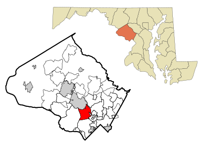
See North Bethesda, Maryland on the map
Public Transportation to North Bethesda, Maryland
Wondering how to get to North Bethesda, Maryland, United States? Moovit helps you find the best way to get to North Bethesda, Maryland with step-by-step directions from the nearest public transit station.
Moovit provides free maps and live directions to help you navigate through your city. View schedules, routes, timetables, and find out how long does it take to get to North Bethesda, Maryland in real time.
Looking for the nearest stop or station to North Bethesda, Maryland? Check out this list of stops closest to your destination: Grosvenor Pl & Grosvenor Ln; Rockville Pike & Tuckerman Ln; Grosvenor Metro Station; Garrett Park.
Bus: 46, 6.Train: MARC.Metro: METRORAIL RED LINE.
Want to see if there’s another route that gets you there at an earlier time? Moovit helps you find alternative routes or times. Get directions from and directions to North Bethesda, Maryland easily from the Moovit App or Website.
We make riding to North Bethesda, Maryland easy, which is why over 1.5 million users, including users in North Bethesda, trust Moovit as the best app for public transit. You don’t need to download an individual bus app or train app, Moovit is your all-in-one transit app that helps you find the best bus time or train time available.
For information on prices of bus, metro and train, costs and ride fares to North Bethesda, Maryland, please check the Moovit app.
Use the app to navigate to popular places including to the airport, hospital, stadium, grocery store, mall, coffee shop, school, college, and university.
North Bethesda, Maryland Address: Silver Spring, MD street in North Bethesda
Attractions near North Bethesda, Maryland
Mobile Notary Services of Maryland,Metro Grosvenor-Parking Garage,Tuckerman Lane & Rockville Pike,Meegama, Kavita,MLM Home Improvement,10101 Grosvenor Pl,Mary E Hall,Avalon Parking Garage,Grosvenor Ln,Wasserman Design,Mark Day Homes,Avalon at Grosvenor Station,Grosvenor Pl & @,Avolon,Bethesda Swimming Pool Contractors ,Grosvenor Pl MD-355,Entrance I-270 N,The Townes at Grosvenor Place,High Quality Handyman,Archstone Grosvenor TowersHow to get to popular attractions in North Bethesda with public transit
Rosa Mexicano, Washington,Green Lantern, Washington,Jack Rose Dining Saloon, Washington,Hard Rock Cafe Washington DC, Washington,Lyon Hall, Arlington County,Maryland Live! Casino, Anne Arundel County,Mother's Federal Hill Grille, Baltimore,Union Pub, Washington,The Big Hunt, Washington,Towson, MD, Baltimore County,Mount Vernon, Baltimore,Falls Church, VA, Falls Church,Penn Social, Washington,Murphy's Grand Irish Pub, Alexandria,Patterson Park, Baltimore,The Willard InterContinental Washington D.C. Hotel, Washington,Merritt Downtown Athletic Club, Baltimore,Pickles Pub, Baltimore,White Flint Metro Station, Montgomery County,Honey Pig Gooldaegee Korean Grill, Fairfax CountyGet around Washington, D.C. - Baltimore, MD by public transit!
Traveling around Washington, D.C. - Baltimore, MD has never been so easy. See step by step directions as you travel to any attraction, street or major public transit station. View bus and train schedules, arrival times, service alerts and detailed routes on a map, so you know exactly how to get to anywhere in Washington, D.C. - Baltimore, MD.
When traveling to any destination around Washington, D.C. - Baltimore, MD use Moovit's Live Directions with Get Off Notifications to know exactly where and how far to walk, how long to wait for your line, and how many stops are left. Moovit will alert you when it's time to get off — no need to constantly re-check whether yours is the next stop.
Wondering how to use public transit in Washington, D.C. - Baltimore, MD or how to pay for public transit in Washington, D.C. - Baltimore, MD? Moovit public transit app can help you navigate your way with public transit easily, and at minimum cost. It includes public transit fees, ticket prices, and costs. Looking for a map of Washington, D.C. - Baltimore, MD public transit lines? Moovit public transit app shows all public transit maps in Washington, D.C. - Baltimore, MD with all Bus, Train, Metro, Light Rail and Ferry routes and stops on an interactive map.
Washington, D.C. - Baltimore, MD has 5 transit type(s), including: Bus, Train, Metro, Light Rail and Ferry, operated by several transit agencies, including WMATA, Montgomery County Ride On, Fairfax Connector, TheBus, DC Circulator, MDOT MTA, Marc, Virginia Railway Express (VRE), PRTC, DASH - Alexandria, Arlington Transit (ART), DC Streetcar, RTA of Central Maryland, FRED, University of Maryland Shuttle-UM