Directions to North Choice Construction (Boston) with public transportation
The following transit lines have routes that pass near North Choice Construction
 Bus: 19, 426, 43, 450, EZRIDE.
- Train: FAIRMOUNT, FRAMINGHAM/WORCESTER, NEEDHAM, FITCHBURG, HAVERHILL.
- Subway: GREEN LINE D, GREEN LINE E, ORANGE LINE, RED LINE, HAVERHILL LINE SHUTTLE.
How to get to North Choice Construction by bus?
Click on the bus route to see step by step directions with maps, line arrival times and updated time schedules.
From Wollaston Beach, Quincy
142 minFrom Belle Isle Lobster & Seafood, Winthrop Town
54 minFrom Marina Bay, Quincy
174 minFrom Christian A Herter Park, Boston
58 minFrom Saugus, MA, Saugus
58 minFrom Lower Mills, Boston
108 minFrom Staybridge Suites Boston-Quincy, Quincy
118 minFrom Sam Adams Boston Brewery Tour, Boston
65 minFrom Uscis Biometrics Office, Revere
42 minFrom The Mall At Chestnut Hill, Newton
93 min
How to get to North Choice Construction by train?
Click on the train route to see step by step directions with maps, line arrival times and updated time schedules.
How to get to North Choice Construction by subway?
Click on the subway route to see step by step directions with maps, line arrival times and updated time schedules.
From Wollaston Beach, Quincy
59 minFrom Belle Isle Lobster & Seafood, Winthrop Town
46 minFrom Lower Mills, Boston
52 minFrom Staybridge Suites Boston-Quincy, Quincy
43 minFrom Sam Adams Boston Brewery Tour, Boston
34 minFrom Uscis Biometrics Office, Revere
48 minFrom The Mall At Chestnut Hill, Newton
72 min
Bus stops near North Choice Construction in Boston
Subway stations near North Choice Construction in Boston
Train station near North Choice Construction in Boston
- North Station, 5 min walk,VIEW
Bus lines to North Choice Construction in Boston
- GREEN LINE E SHUTTLE, Government Center - Medford/Tufts (Shuttle),VIEW
- GREEN LINE E SHUTTLE, North Station - Medford/Tufts (Shuttle),VIEW
- GREEN LINE E SHUTTLE, Medford/Tufts - North Station,VIEW
- GREEN LINE SHUTTLE, North Station - Sullivan Square via East Somerville,VIEW
- GREEN LINE SHUTTLE, Union Square - Government Center,VIEW
- GREEN LINE SHUTTLE, Lechmere - North Station,VIEW
- GREEN LINE SHUTTLE, Union Square - North Station,VIEW
- GREEN LINE SHUTTLE, Medford/Tufts - Government Center via Union Square,VIEW
- EZRIDE, Inbound To North Station From Erie St,VIEW
- EZRIDE, Outbound North Station To Erie St Via Lechmere And Kendall,VIEW
- EZRIDE, Outbound To Erie St From North Station,VIEW
- EZRIDE, Inbound To North Station Via Kendall And Lechmere,VIEW
- GREEN LINE SHUTTLE, North Station (Shuttle),VIEW
- ORANGE LINE SHUTTLE, North Station (Local Shuttle),VIEW
- ORANGE LINE SHUTTLE, Oak Grove (Express Shuttle),VIEW
- ORANGE LINE SHUTTLE, Oak Grove (Local Shuttle),VIEW
- ORANGE LINE SHUTTLE, Wellington (Express Shuttle),VIEW
- ORANGE LINE SHUTTLE, Sullivan (Shuttle),VIEW
- 4, Design Center,VIEW
- 92, Haymarket,VIEW
What are the closest stations to North Choice Construction?
The closest stations to North Choice Construction are:
- Science Park/West End - Nashua St @ Leverett Cir is 20 yards away, 1 min walk.
- Causeway St (East) is 145 yards away, 3 min walk.
- North Station is 276 yards away, 4 min walk.
- North Station - Haverhill St @ Causeway St is 306 yards away, 4 min walk.
- Portland St @ Causeway St is 328 yards away, 5 min walk.
- N Washington St @ Medford St is 347 yards away, 5 min walk.
- Charles/Mgh - Cambridge St @ Lindall Pl is 446 yards away, 6 min walk.
- Bowdoin is 553 yards away, 7 min walk.
Which bus lines stop near North Choice Construction?
These bus lines stop near North Choice Construction: 19, 426, 43, 450, EZRIDE, SL4.
Which train lines stop near North Choice Construction?
These train lines stop near North Choice Construction: FAIRMOUNT, FRAMINGHAM/WORCESTER, NEEDHAM.
Which subway lines stop near North Choice Construction?
These subway lines stop near North Choice Construction: GREEN LINE D, GREEN LINE E, ORANGE LINE, RED LINE.
What’s the nearest subway station to North Choice Construction in Boston?
The nearest subway station to North Choice Construction in Boston is Causeway St (East). It’s a 3 min walk away.
What’s the nearest train station to North Choice Construction in Boston?
The nearest train station to North Choice Construction in Boston is North Station. It’s a 5 min walk away.
What’s the nearest bus station to North Choice Construction in Boston?
The nearest bus station to North Choice Construction in Boston is Science Park/West End - Nashua St @ Leverett Cir. It’s a 1 min walk away.
What time is the first subway to North Choice Construction in Boston?
The GREEN LINE E is the first subway that goes to North Choice Construction in Boston. It stops nearby at 4:57 AM.
What time is the last subway to North Choice Construction in Boston?
The GREEN LINE E is the last subway that goes to North Choice Construction in Boston. It stops nearby at 2:28 AM.
What time is the first train to North Choice Construction in Boston?
The LOWELL is the first train that goes to North Choice Construction in Boston. It stops nearby at 5:20 AM.
What time is the last train to North Choice Construction in Boston?
The LOWELL is the last train that goes to North Choice Construction in Boston. It stops nearby at 12:34 AM.
What time is the first bus to North Choice Construction in Boston?
The 111 is the first bus that goes to North Choice Construction in Boston. It stops nearby at 4:49 AM.
What time is the last bus to North Choice Construction in Boston?
The 111 is the last bus that goes to North Choice Construction in Boston. It stops nearby at 2:15 AM.
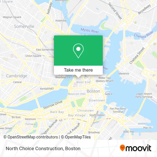
See North Choice Construction, Boston, on the map
Public Transit to North Choice Construction in Boston
Wondering how to get to North Choice Construction in Boston? Moovit helps you find the best way to get to North Choice Construction with step-by-step directions from the nearest public transit station.
Moovit provides free maps and live directions to help you navigate through your city. View schedules, routes, timetables, and find out how long does it take to get to North Choice Construction in real time.
Looking for the nearest stop or station to North Choice Construction? Check out this list of stops closest to your destination: Science Park/West End - Nashua St @ Leverett Cir; Causeway St (East); North Station; North Station - Haverhill St @ Causeway St; Portland St @ Causeway St; N Washington St @ Medford St; Charles/Mgh - Cambridge St @ Lindall Pl; Bowdoin.
Bus: 19, 426, 43, 450, EZRIDE, SL4, GREEN LINE E SHUTTLE, GREEN LINE E SHUTTLE, GREEN LINE E SHUTTLE, GREEN LINE SHUTTLE, GREEN LINE SHUTTLE, GREEN LINE SHUTTLE, ORANGE LINE SHUTTLE, ORANGE LINE SHUTTLE, ORANGE LINE SHUTTLE, ORANGE LINE SHUTTLE.Train: FAIRMOUNT, FRAMINGHAM/WORCESTER, NEEDHAM, FITCHBURG, HAVERHILL, LOWELL, NEWBURYPORT/ROCKPORT, DOWNEASTER.Subway: GREEN LINE D, GREEN LINE E, ORANGE LINE, RED LINE, HAVERHILL LINE SHUTTLE, HAVERHILL LINE SHUTTLE, LOWELL LINE SHUTTLE, LOWELL LINE SHUTTLE, NEWBURYPORT/ROCKPORT LINE SHUTTLE, BLUE LINE.
Want to see if there’s another route that gets you there at an earlier time? Moovit helps you find alternative routes or times. Get directions from and directions to North Choice Construction easily from the Moovit App or Website.
We make riding to North Choice Construction easy, which is why over 1.7 million users, including users in Boston, trust Moovit as the best app for public transit. You don’t need to download an individual bus app or train app, Moovit is your all-in-one transit app that helps you find the best bus time or train time available.
For information on prices of subway, bus, train and ferry, costs and ride fares to North Choice Construction, please check the Moovit app.
Use the app to navigate to popular places including to the airport, hospital, stadium, grocery store, mall, coffee shop, school, college, and university.
North Choice Construction Address: 7 Whittier Pl street in Boston
- J. Pace & Son,
- MBTA Science Park / West End Station,
- Leverett Circle,
- Nashua Street Jail (Suffolk County Jail),
- Charles River Esplanade,
- Suffolk County Jail,
- 10 Emerson Place,
- Hawthorne Place Lot (One Hawthorne Place),
- MGH Shuttle,
- Seimans CT Scanner - Blake Building (MGH),
- I-93 South,
- EZRide - North Station Stop,
- DanCyn Food Truck,
- Bulfinch Building (MGH),
- Shriners Hospitals for Children,
- MGH Bigelow 11 - General Medicine,
- Massachusetts General Hospital Cancer Center,
- Avalon,
- St Joseph's Rectory (St. Joseph Catholic Church (Roxbury, Massachusetts)),
- West End
Places Near North Choice Construction (Boston)
- North End, Boston,
- Td Garden, Boston,
- House Of Blues, Boston,
- Castle Island, Boston,
- Museum Of Science, Boston,
- Prudential Center, Boston,
- Wang Theater, Boston,
- Quincy Market, Boston,
- Faneuil Hall, Boston,
- Isabella Stewart Gardner Museum, Boston,
- Mgm Music Hall, Boston,
- Boston Common, Boston,
- Boston Medical Center, Boston,
- Cheers, Boston,
- Wilbur Theatre, Boston,
- Leader Bank Pavilion (Leader Bank Pavillion), Boston,
- Massachusetts General Hospital, Boston,
- Boston Convention & Exhibition Center, Boston,
- Seaport District, Boston,
- Boston Children's Hospital, Boston
How to get to popular places in Boston with public transit
Get around Boston by public transit!
Traveling around Boston has never been so easy. See step by step directions as you travel to any attraction, street or major public transit station. View bus and train schedules, arrival times, service alerts and detailed routes on a map, so you know exactly how to get to anywhere in Boston.
When traveling to any destination around Boston use Moovit's Live Directions with Get Off Notifications to know exactly where and how far to walk, how long to wait for your line, and how many stops are left. Moovit will alert you when it's time to get off — no need to constantly re-check whether yours is the next stop.
Wondering how to use public transit in Boston or how to pay for public transit in Boston? Moovit public transit app can help you navigate your way with public transit easily, and at minimum cost. It includes public transit fees, ticket prices, and costs. Looking for a map of Boston public transit lines? Moovit public transit app shows all public transit maps in Boston with all Bus, Train, Subway and Ferry routes and stops on an interactive map.
Boston has 4 transit type(s), including: Bus, Train, Subway and Ferry, operated by several transit agencies, including MBTA, Southeastern Regional Transit Authority, MetroWest Regional Transit Authority, Rhode Island Public Transit Authority, WRTA, Lowell Regional Transit Authority, Merrimack Valley Transit, Montachusett Regional Transit Authority, Cape Cod Regional Transit Authority, Brockton Area Transit Authority, Martha's Vineyard Transit Authority, the WAVE - Nantucket Regional Transit Authority, GATRA, Cape Ann Transportation Authority and Massport