Directions to Northbound Realty (Boston) with public transportation
The following transit lines have routes that pass near Northbound Realty
 Bus: 10, 9, SL4, SL5, 11.
- Train: FITCHBURG, NEEDHAM, NORTHEAST REGIONAL, FOXBORO EVENT SERVICE, FRAMINGHAM/WORCESTER.
- Subway: GREEN LINE D, ORANGE LINE, RED LINE, GREEN LINE B, GREEN LINE C.
How to get to Northbound Realty by bus?
Click on the bus route to see step by step directions with maps, line arrival times and updated time schedules.
From Milton Academy, Milton
81 minFrom Newton, MA, Newton
65 minFrom LEGOLAND Discovery Center Boston, Somerville
64 minFrom VFW Parkway, Boston
55 minFrom Newton, MA, Newton
45 minFrom West Roxbury, Boston
54 minFrom Lower Mills, Boston
66 minFrom Heartbreak Hill, Newton
45 minFrom Staybridge Suites Boston-Quincy, Quincy
86 minFrom Harvard Museum Of Natural History, Cambridge
45 min
How to get to Northbound Realty by train?
Click on the train route to see step by step directions with maps, line arrival times and updated time schedules.
How to get to Northbound Realty by subway?
Click on the subway route to see step by step directions with maps, line arrival times and updated time schedules.
From Milton Academy, Milton
62 minFrom Newton, MA, Newton
57 minFrom LEGOLAND Discovery Center Boston, Somerville
32 minFrom Newton, MA, Newton
62 minFrom Lower Mills, Boston
47 minFrom Heartbreak Hill, Newton
63 minFrom Staybridge Suites Boston-Quincy, Quincy
34 minFrom Harvard Museum Of Natural History, Cambridge
42 min
Subway stations near Northbound Realty in Boston
Bus stops near Northbound Realty in Boston
Train station near Northbound Realty in Boston
- Back Bay - South End, 15 min walk,VIEW
Bus lines to Northbound Realty in Boston
What are the closest stations to Northbound Realty?
The closest stations to Northbound Realty are:
- Tufts Medical Center is 177 yards away, 3 min walk.
- E Berkeley St @ Washington St is 213 yards away, 3 min walk.
- Washington St @ E Berkeley St is 247 yards away, 4 min walk.
- W Dedham St @ Washington St is 307 yards away, 4 min walk.
- Washington St @ Mystic St is 334 yards away, 5 min walk.
- Tremont St @ Upton St is 411 yards away, 5 min walk.
- Arlington is 991 yards away, 12 min walk.
- Broadway is 1111 yards away, 14 min walk.
- Back Bay - South End is 1204 yards away, 15 min walk.
Which bus lines stop near Northbound Realty?
These bus lines stop near Northbound Realty: 10, 9, SL4, SL5.
Which train lines stop near Northbound Realty?
These train lines stop near Northbound Realty: FITCHBURG, NEEDHAM, NORTHEAST REGIONAL.
Which subway lines stop near Northbound Realty?
These subway lines stop near Northbound Realty: GREEN LINE D, ORANGE LINE, RED LINE.
What’s the nearest subway station to Northbound Realty in Boston?
The nearest subway station to Northbound Realty in Boston is Tufts Medical Center. It’s a 3 min walk away.
What’s the nearest train station to Northbound Realty in Boston?
The nearest train station to Northbound Realty in Boston is Back Bay - South End. It’s a 15 min walk away.
What’s the nearest bus station to Northbound Realty in Boston?
The nearest bus station to Northbound Realty in Boston is E Berkeley St @ Washington St. It’s a 3 min walk away.
What time is the first subway to Northbound Realty in Boston?
The GREEN LINE D is the first subway that goes to Northbound Realty in Boston. It stops nearby at 5:07 AM.
What time is the last subway to Northbound Realty in Boston?
The GREEN LINE E is the last subway that goes to Northbound Realty in Boston. It stops nearby at 2:14 AM.
What time is the first train to Northbound Realty in Boston?
The PROVIDENCE/STOUGHTON is the first train that goes to Northbound Realty in Boston. It stops nearby at 4:25 AM.
What time is the last train to Northbound Realty in Boston?
The LAKE SHORE LIMITED is the last train that goes to Northbound Realty in Boston. It stops nearby at 8:26 PM.
What time is the first bus to Northbound Realty in Boston?
The 15 is the first bus that goes to Northbound Realty in Boston. It stops nearby at 5:04 AM.
What time is the last bus to Northbound Realty in Boston?
The 10 is the last bus that goes to Northbound Realty in Boston. It stops nearby at 1:22 AM.
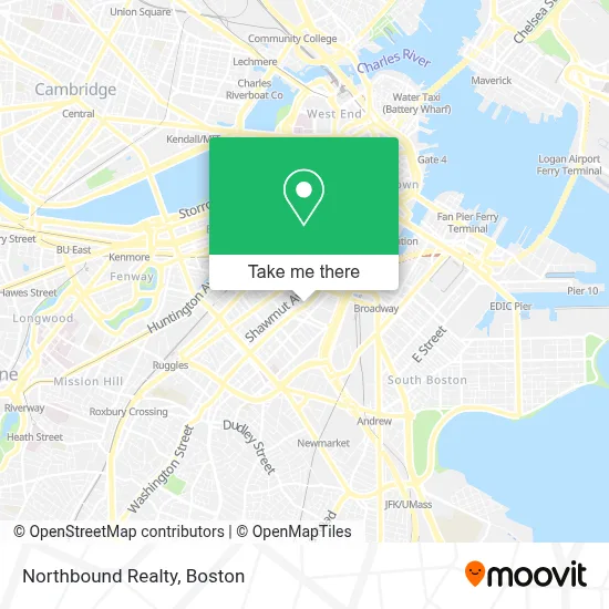
See Northbound Realty, Boston, on the map
Public Transit to Northbound Realty in Boston
Wondering how to get to Northbound Realty in Boston? Moovit helps you find the best way to get to Northbound Realty with step-by-step directions from the nearest public transit station.
Moovit provides free maps and live directions to help you navigate through your city. View schedules, routes, timetables, and find out how long does it take to get to Northbound Realty in real time.
Looking for the nearest stop or station to Northbound Realty? Check out this list of stops closest to your destination: Tufts Medical Center; E Berkeley St @ Washington St; Washington St @ E Berkeley St; W Dedham St @ Washington St; Washington St @ Mystic St; Tremont St @ Upton St; Arlington; Broadway; Back Bay - South End.
Bus: 10, 9, SL4, SL5, 11, 15.Train: FITCHBURG, NEEDHAM, NORTHEAST REGIONAL, FOXBORO EVENT SERVICE, FRAMINGHAM/WORCESTER, FRANKLIN/FOXBORO, PROVIDENCE/STOUGHTON.Subway: GREEN LINE D, ORANGE LINE, RED LINE, GREEN LINE B, GREEN LINE C, GREEN LINE E.
Want to see if there’s another route that gets you there at an earlier time? Moovit helps you find alternative routes or times. Get directions from and directions to Northbound Realty easily from the Moovit App or Website.
We make riding to Northbound Realty easy, which is why over 1.7 million users, including users in Boston, trust Moovit as the best app for public transit. You don’t need to download an individual bus app or train app, Moovit is your all-in-one transit app that helps you find the best bus time or train time available.
For information on prices of bus, subway and train, costs and ride fares to Northbound Realty, please check the Moovit app.
Use the app to navigate to popular places including to the airport, hospital, stadium, grocery store, mall, coffee shop, school, college, and university.
Northbound Realty Address: 1313 Washington St street in Boston
- Tweed Barbers of Boston,
- Cathedral High School,
- Panini Sante,
- Soma Optical,
- Gaslight,
- Coppa,
- South End,
- Boyd Technologies,
- Illuminate,
- South End Buttery,
- Cathedral Station,
- Saks Fifth Avenue,
- Cathedral Of the Holy Cross,
- Cathedral of the Holy Cross ,
- Abcd,
- The Elephant Walk,
- St-John the Baptist-Ma,
- St-John the Baptist-Ma (St John the Bapt Greek Orthodox Church),
- Girard Apartments,
- Laconia Gallery
Places Near Northbound Realty (Boston)
- North End, Boston,
- Td Garden, Boston,
- House Of Blues, Boston,
- Castle Island, Boston,
- Museum Of Science, Boston,
- Prudential Center, Boston,
- Wang Theater, Boston,
- Quincy Market, Boston,
- Faneuil Hall, Boston,
- Isabella Stewart Gardner Museum, Boston,
- Mgm Music Hall, Boston,
- Boston Common, Boston,
- Boston Medical Center, Boston,
- Cheers, Boston,
- Wilbur Theatre, Boston,
- Leader Bank Pavilion (Leader Bank Pavillion), Boston,
- Massachusetts General Hospital, Boston,
- Boston Convention & Exhibition Center, Boston,
- Seaport District, Boston,
- Boston Children's Hospital, Boston
How to get to popular places in Boston with public transit
Get around Boston by public transit!
Traveling around Boston has never been so easy. See step by step directions as you travel to any attraction, street or major public transit station. View bus and train schedules, arrival times, service alerts and detailed routes on a map, so you know exactly how to get to anywhere in Boston.
When traveling to any destination around Boston use Moovit's Live Directions with Get Off Notifications to know exactly where and how far to walk, how long to wait for your line, and how many stops are left. Moovit will alert you when it's time to get off — no need to constantly re-check whether yours is the next stop.
Wondering how to use public transit in Boston or how to pay for public transit in Boston? Moovit public transit app can help you navigate your way with public transit easily, and at minimum cost. It includes public transit fees, ticket prices, and costs. Looking for a map of Boston public transit lines? Moovit public transit app shows all public transit maps in Boston with all Bus, Train, Subway and Ferry routes and stops on an interactive map.
Boston has 4 transit type(s), including: Bus, Train, Subway and Ferry, operated by several transit agencies, including MBTA, Southeastern Regional Transit Authority, MetroWest Regional Transit Authority, Rhode Island Public Transit Authority, WRTA, Lowell Regional Transit Authority, Merrimack Valley Transit, Montachusett Regional Transit Authority, Cape Cod Regional Transit Authority, Brockton Area Transit Authority, Martha's Vineyard Transit Authority, the WAVE - Nantucket Regional Transit Authority, GATRA, Cape Ann Transportation Authority and Massport