How to get to Northeast Archeological Resources Program by bus?
Click on the bus route to see step by step directions with maps, line arrival times and updated time schedules.
How to get to Northeast Archeological Resources Program by train?
Click on the train route to see step by step directions with maps, line arrival times and updated time schedules.
Bus stops near Northeast Archeological Resources Program in Lowell
Bus lines to Northeast Archeological Resources Program in Lowell
- 1, Kennedy Center,VIEW
- 10, Kennedy Center,VIEW
- 8, Hannaford (Stop And Shop),VIEW
- 9, Loop,VIEW
- 18, Kennedy Center,VIEW
- 4, Lowell High School,VIEW
- 2, White Dove Plaza,VIEW
- 3, North Billerica Train Station,VIEW
- 5, Paige And Kirk Streets,VIEW
- 7, Kennedy Center,VIEW
- 13, Gorham Street,VIEW
- 16, Cross Point Tower,VIEW
- 17, Walmart,VIEW
What are the closest stations to Northeast Archeological Resources Program?
The closest stations to Northeast Archeological Resources Program are:
- Bridge & Vfw Parkway is 86 yards away, 2 min walk.
- Bridge St & W 4th St is 109 yards away, 2 min walk.
- Bridge St & Massmills Dr is 114 yards away, 2 min walk.
- Leo Roy Parking Garage (Market St) is 155 yards away, 3 min walk.
- Lowell High School is 504 yards away, 7 min walk.
- Paige St And Kirk St - Lowell High School is 573 yards away, 7 min walk.
Which bus lines stop near Northeast Archeological Resources Program?
These bus lines stop near Northeast Archeological Resources Program: 12, 24.
Which train line stops near Northeast Archeological Resources Program?
LOWELL (#331 | Lowell)
What’s the nearest bus station to Northeast Archeological Resources Program in Lowell?
The nearest bus stations to Northeast Archeological Resources Program in Lowell are Bridge & Vfw Parkway, Bridge St & W 4th St and Bridge St & Massmills Dr. The closest one is a 2 min walk away.
What time is the first bus to Northeast Archeological Resources Program in Lowell?
The 18 is the first bus that goes to Northeast Archeological Resources Program in Lowell. It stops nearby at 5:54 AM.
What time is the last bus to Northeast Archeological Resources Program in Lowell?
The 8 is the last bus that goes to Northeast Archeological Resources Program in Lowell. It stops nearby at 7:40 PM.
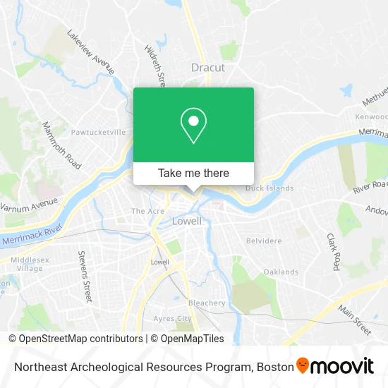
See Northeast Archeological Resources Program, Lowell, on the map
Public Transit to Northeast Archeological Resources Program in Lowell
Wondering how to get to Northeast Archeological Resources Program in Lowell? Moovit helps you find the best way to get to Northeast Archeological Resources Program with step-by-step directions from the nearest public transit station.
Moovit provides free maps and live directions to help you navigate through your city. View schedules, routes, timetables, and find out how long does it take to get to Northeast Archeological Resources Program in real time.
Looking for the nearest stop or station to Northeast Archeological Resources Program? Check out this list of stops closest to your destination: Bridge & Vfw Parkway; Bridge St & W 4th St; Bridge St & Massmills Dr; Leo Roy Parking Garage (Market St); Lowell High School; Paige St And Kirk St - Lowell High School.
Bus: 12, 24, 1, 8, 10, 9, 18, 4, 2, 3, 5, 7, 13.Train: LOWELL.
Want to see if there’s another route that gets you there at an earlier time? Moovit helps you find alternative routes or times. Get directions from and directions to Northeast Archeological Resources Program easily from the Moovit App or Website.
We make riding to Northeast Archeological Resources Program easy, which is why over 1.7 million users, including users in Lowell, trust Moovit as the best app for public transit. You don’t need to download an individual bus app or train app, Moovit is your all-in-one transit app that helps you find the best bus time or train time available.
For information on prices of bus and train, costs and ride fares to Northeast Archeological Resources Program, please check the Moovit app.
Use the app to navigate to popular places including to the airport, hospital, stadium, grocery store, mall, coffee shop, school, college, and university.
Northeast Archeological Resources Program Address: 115 John St street in Lowell
- American Constable Services,
- USPS Collection Box - Blue Box,
- Msc Masonry And Hardscaping,
- Luis Taxi,
- Latinglobal Multi,
- Globalregalos,
- Canto Driving School,
- Local Contractors Marketing,
- Full Deliverance Church,
- Lowell National Historical Park Library,
- Addiction Rehab Lowell,
- Laz PKG L05236-Flowbir,
- Joseph M. Downes, Sr. Facility,
- Diamond Team Garage Repair,
- Chess Engineering,
- Toxics Use Reduction Institute,
- Energy Performance Services,
- Boott Mills Lofts,
- Tabashir Health,
- Parking Garage
Places Near Northeast Archeological Resources Program (Lowell)
- Castle Island, Boston,
- Wang Theater, Boston,
- Museum Of Science, Boston,
- Massachusetts General Hospital, Boston,
- Leader Bank Pavilion (Leader Bank Pavillion), Boston,
- Boston Children's Hospital, Boston,
- Cheers, Boston,
- Boston Convention & Exhibition Center, Boston,
- Td Garden, Boston,
- Boston Medical Center, Boston,
- North End, Boston,
- Faneuil Hall, Boston,
- House Of Blues, Boston,
- Boston Common, Boston,
- Mgm Music Hall, Boston,
- Wilbur Theatre, Boston,
- Quincy Market, Boston,
- Seaport District, Boston,
- Isabella Stewart Gardner Museum, Boston,
- Prudential Center, Boston
How to get to popular places in Boston with public transit
Get around Lowell by public transit!
Traveling around Lowell has never been so easy. See step by step directions as you travel to any attraction, street or major public transit station. View bus and train schedules, arrival times, service alerts and detailed routes on a map, so you know exactly how to get to anywhere in Lowell.
When traveling to any destination around Lowell use Moovit's Live Directions with Get Off Notifications to know exactly where and how far to walk, how long to wait for your line, and how many stops are left. Moovit will alert you when it's time to get off — no need to constantly re-check whether yours is the next stop.
Wondering how to use public transit in Lowell or how to pay for public transit in Lowell? Moovit public transit app can help you navigate your way with public transit easily, and at minimum cost. It includes public transit fees, ticket prices, and costs. Looking for a map of Lowell public transit lines? Moovit public transit app shows all public transit maps in Lowell with all Bus, Train, Subway and Ferry routes and stops on an interactive map.
Boston has 4 transit type(s), including: Bus, Train, Subway and Ferry, operated by several transit agencies, including MBTA, Southeastern Regional Transit Authority, MetroWest Regional Transit Authority, Rhode Island Public Transit Authority, WRTA, Lowell Regional Transit Authority, Merrimack Valley Transit, Montachusett Regional Transit Authority, Cape Cod Regional Transit Authority, Brockton Area Transit Authority, Martha's Vineyard Transit Authority, the WAVE - Nantucket Regional Transit Authority, GATRA, Cape Ann Transportation Authority and Massport