Directions to Northeast Health Services (Cambridge) with public transportation
The following transit lines have routes that pass near Northeast Health Services
 Bus: 1, 109, 66, 71, 96.
- Train: FRAMINGHAM/WORCESTER, FITCHBURG.
- Subway: RED LINE, GREEN LINE B, GREEN LINE C, GREEN LINE E, GREEN LINE D.
How to get to Northeast Health Services by bus?
Click on the bus route to see step by step directions with maps, line arrival times and updated time schedules.
From Codman Square, Boston
82 minFrom VFW Parkway, Boston
59 minFrom Suffolk Downs, Boston
97 minFrom Stone Zoo, Stoneham
89 minFrom Rental Car Center - Logan Airport, Boston
67 minFrom Astrazeneca Hope Lodge, Boston
49 minFrom Belle Isle Lobster & Seafood, Winthrop Town
117 minFrom Maverick Station, Boston
71 minFrom 415 Summer Street, Boston
60 minFrom MBTA Suffolk Downs Station, Boston
101 min
How to get to Northeast Health Services by train?
Click on the train route to see step by step directions with maps, line arrival times and updated time schedules.
How to get to Northeast Health Services by subway?
Click on the subway route to see step by step directions with maps, line arrival times and updated time schedules.
From Codman Square, Boston
45 minFrom Suffolk Downs, Boston
50 minFrom Rental Car Center - Logan Airport, Boston
34 minFrom Astrazeneca Hope Lodge, Boston
46 minFrom Belle Isle Lobster & Seafood, Winthrop Town
52 minFrom Maverick Station, Boston
34 minFrom 415 Summer Street, Boston
32 minFrom MBTA Suffolk Downs Station, Boston
40 min
Bus stops near Northeast Health Services in Cambridge
Subway stations near Northeast Health Services in Cambridge
Train station near Northeast Health Services in Cambridge
- Porter, 11 min walk,VIEW
Bus lines to Northeast Health Services in Cambridge
- 66, Harvard Via Allston,VIEW
- 71, Watertown Square,VIEW
- 73, Waverley,VIEW
- 86, Reservoir,VIEW
- 74, Harvard - Belmont Center,VIEW
- 75, Harvard - Belmont Center,VIEW
- 77, Harvard - Arlington Heights,VIEW
- 78, Harvard - Arlmont Village,VIEW
- 96, Harvard - Medford Square,VIEW
- 109, Harvard via Sullivan - Linden Square via Sullivan,VIEW
- RED LINE SHUTTLE, Jfk/Umass (Shuttle),VIEW
- RED LINE SHUTTLE, Alewife (Shuttle),VIEW
- RED LINE SHUTTLE, Harvard (Shuttle),VIEW
- RED LINE SHUTTLE, Alewife (Local Shuttle),VIEW
- 68, Kendall/MIT,VIEW
- 69, Harvard,VIEW
- 1, Harvard,VIEW
- RED LINE SHUTTLE, Harvard - Kendall/MIT (Loop),VIEW
- RED LINE SHUTTLE, Harvard - South Station,VIEW
- RED LINE SHUTTLE, Alewife - Harvard via Holyoke Street,VIEW
What are the closest stations to Northeast Health Services?
The closest stations to Northeast Health Services are:
- Mt Auburn St @ University Rd is 110 yards away, 2 min walk.
- Eliot St @ Bennett St is 120 yards away, 2 min walk.
- Harvard Square is 271 yards away, 4 min walk.
- Harvard - Brattle St @ Palmer St is 315 yards away, 4 min walk.
- Quincy St @ Broadway Opp Fogg Museum is 406 yards away, 5 min walk.
- Massachusetts Ave @ Bow St is 482 yards away, 6 min walk.
- Massachusetts Ave Opp Holyoke St is 581 yards away, 8 min walk.
- Porter is 877 yards away, 11 min walk.
- Gilman Square is 1184 yards away, 14 min walk.
- Union Square is 2570 yards away, 31 min walk.
Which bus lines stop near Northeast Health Services?
These bus lines stop near Northeast Health Services: 1, 109, 66, 71, 96.
Which train line stops near Northeast Health Services?
FRAMINGHAM/WORCESTER (#525 | Worcester)
Which subway line stops near Northeast Health Services?
RED LINE (Alewife)
What’s the nearest subway station to Northeast Health Services in Cambridge?
The nearest subway station to Northeast Health Services in Cambridge is Harvard Square. It’s a 4 min walk away.
What’s the nearest train station to Northeast Health Services in Cambridge?
The nearest train station to Northeast Health Services in Cambridge is Porter. It’s a 11 min walk away.
What’s the nearest bus station to Northeast Health Services in Cambridge?
The nearest bus stations to Northeast Health Services in Cambridge are Mt Auburn St @ University Rd and Eliot St @ Bennett St. The closest one is a 2 min walk away.
What time is the first subway to Northeast Health Services in Cambridge?
The GREEN LINE E is the first subway that goes to Northeast Health Services in Cambridge. It stops nearby at 4:50 AM.
What time is the last subway to Northeast Health Services in Cambridge?
The GREEN LINE E is the last subway that goes to Northeast Health Services in Cambridge. It stops nearby at 2:36 AM.
What time is the first train to Northeast Health Services in Cambridge?
The FITCHBURG is the first train that goes to Northeast Health Services in Cambridge. It stops nearby at 5:47 AM.
What time is the last train to Northeast Health Services in Cambridge?
The FITCHBURG is the last train that goes to Northeast Health Services in Cambridge. It stops nearby at 12:17 AM.
What time is the first bus to Northeast Health Services in Cambridge?
The 73 is the first bus that goes to Northeast Health Services in Cambridge. It stops nearby at 4:45 AM.
What time is the last bus to Northeast Health Services in Cambridge?
The 66 is the last bus that goes to Northeast Health Services in Cambridge. It stops nearby at 2:36 AM.
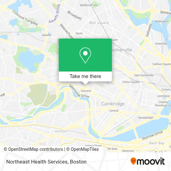
See Northeast Health Services, Cambridge, on the map
Public Transit to Northeast Health Services in Cambridge
Wondering how to get to Northeast Health Services in Cambridge? Moovit helps you find the best way to get to Northeast Health Services with step-by-step directions from the nearest public transit station.
Moovit provides free maps and live directions to help you navigate through your city. View schedules, routes, timetables, and find out how long does it take to get to Northeast Health Services in real time.
Looking for the nearest stop or station to Northeast Health Services? Check out this list of stops closest to your destination: Mt Auburn St @ University Rd; Eliot St @ Bennett St; Harvard Square; Harvard - Brattle St @ Palmer St; Quincy St @ Broadway Opp Fogg Museum; Massachusetts Ave @ Bow St; Massachusetts Ave Opp Holyoke St; Porter; Gilman Square; Union Square.
Bus: 1, 109, 66, 71, 96, 73, 86, 74, 75, 77, 78.Train: FRAMINGHAM/WORCESTER, FITCHBURG.Subway: RED LINE, GREEN LINE B, GREEN LINE C, GREEN LINE E, GREEN LINE D.
Want to see if there’s another route that gets you there at an earlier time? Moovit helps you find alternative routes or times. Get directions from and directions to Northeast Health Services easily from the Moovit App or Website.
We make riding to Northeast Health Services easy, which is why over 1.7 million users, including users in Cambridge, trust Moovit as the best app for public transit. You don’t need to download an individual bus app or train app, Moovit is your all-in-one transit app that helps you find the best bus time or train time available.
For information on prices of subway, bus and train, costs and ride fares to Northeast Health Services, please check the Moovit app.
Use the app to navigate to popular places including to the airport, hospital, stadium, grocery store, mall, coffee shop, school, college, and university.
Northeast Health Services Address: 1430 Massachusetts Ave street in Cambridge
- Harvard Square Hot Dogs,
- Mit Media Lab,
- Santander Bank,
- JFK St (jfk / Mass Ave),
- Harvard Square T Station - Red Line,
- Brattle St / Harvard Sq,
- Club Passim,
- Harvard Upper Busway,
- Starbucks,
- Harvard Johnston Gate,
- Mike's Pastry,
- Harvard University,
- Harvard Square MBTA Station - Red Line & Buses,
- La Flamme Barber Shop (Laflamme Barber Shop),
- 69 bus Route,
- Magica Italia,
- John Harvard Statue,
- Patagonia,
- harvard square lower busway,
- CarGurus
Places Near Northeast Health Services (Cambridge)
- Prudential Center, Boston,
- Cheers, Boston,
- Mgm Music Hall, Boston,
- Massachusetts General Hospital, Boston,
- Boston Medical Center, Boston,
- Isabella Stewart Gardner Museum, Boston,
- House Of Blues, Boston,
- Wang Theater, Boston,
- Seaport District, Boston,
- Boston Convention & Exhibition Center, Boston,
- North End, Boston,
- Leader Bank Pavilion (Leader Bank Pavillion), Boston,
- Boston Children's Hospital, Boston,
- Quincy Market, Boston,
- Boston Common, Boston,
- Td Garden, Boston,
- Wilbur Theatre, Boston,
- Castle Island, Boston,
- Museum Of Science, Boston,
- Faneuil Hall, Boston
How to get to popular places in Boston with public transit
Get around Cambridge by public transit!
Traveling around Cambridge has never been so easy. See step by step directions as you travel to any attraction, street or major public transit station. View bus and train schedules, arrival times, service alerts and detailed routes on a map, so you know exactly how to get to anywhere in Cambridge.
When traveling to any destination around Cambridge use Moovit's Live Directions with Get Off Notifications to know exactly where and how far to walk, how long to wait for your line, and how many stops are left. Moovit will alert you when it's time to get off — no need to constantly re-check whether yours is the next stop.
Wondering how to use public transit in Cambridge or how to pay for public transit in Cambridge? Moovit public transit app can help you navigate your way with public transit easily, and at minimum cost. It includes public transit fees, ticket prices, and costs. Looking for a map of Cambridge public transit lines? Moovit public transit app shows all public transit maps in Cambridge with all Bus, Train, Subway and Ferry routes and stops on an interactive map.
Boston has 4 transit type(s), including: Bus, Train, Subway and Ferry, operated by several transit agencies, including MBTA, Southeastern Regional Transit Authority, MetroWest Regional Transit Authority, Rhode Island Public Transit Authority, WRTA, Lowell Regional Transit Authority, Merrimack Valley Transit, Montachusett Regional Transit Authority, Cape Cod Regional Transit Authority, Brockton Area Transit Authority, Martha's Vineyard Transit Authority, the WAVE - Nantucket Regional Transit Authority, GATRA, Cape Ann Transportation Authority and Massport