See Northeast Metropolitan Regional Vocational High School, Wakefield, on the map
Directions to Northeast Metropolitan Regional Vocational High School (Wakefield) with public transportation
The following transit lines have routes that pass near Northeast Metropolitan Regional Vocational High School
 Bus:
Bus: - Train:
How to get to Northeast Metropolitan Regional Vocational High School by bus?
Click on the bus route to see step by step directions with maps, line arrival times and updated time schedules.
How to get to Northeast Metropolitan Regional Vocational High School by train?
Click on the train route to see step by step directions with maps, line arrival times and updated time schedules.
Which bus line stops near Northeast Metropolitan Regional Vocational High School?
137
Which train line stops near Northeast Metropolitan Regional Vocational High School?
HAVERHILL LINE
See Northeast Metropolitan Regional Vocational High School, Wakefield, on the map
Public Transit to Northeast Metropolitan Regional Vocational High School in Wakefield
Wondering how to get to Northeast Metropolitan Regional Vocational High School in Wakefield, United States? Moovit helps you find the best way to get to Northeast Metropolitan Regional Vocational High School with step-by-step directions from the nearest public transit station.
Moovit provides free maps and live directions to help you navigate through your city. View schedules, routes, timetables, and find out how long does it take to get to Northeast Metropolitan Regional Vocational High School in real time.
Bus:Train:
Want to see if there’s another route that gets you there at an earlier time? Moovit helps you find alternative routes or times. Get directions from and directions to Northeast Metropolitan Regional Vocational High School easily from the Moovit App or Website.
We make riding to Northeast Metropolitan Regional Vocational High School easy, which is why over 1.5 million users, including users in Wakefield, trust Moovit as the best app for public transit. You don’t need to download an individual bus app or train app, Moovit is your all-in-one transit app that helps you find the best bus time or train time available.
For information on prices of bus, train and subway, costs and ride fares to Northeast Metropolitan Regional Vocational High School, please check the Moovit app.
Use the app to navigate to popular places including to the airport, hospital, stadium, grocery store, mall, coffee shop, school, college, and university.
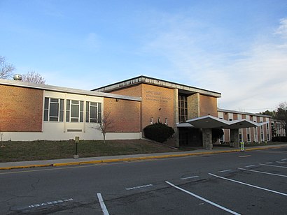
Northeast Metropolitan Regional Vocational High School Address: Elm Street street in Wakefield
Attractions near Northeast Metropolitan Regional Vocational High School
Northeast Metro Reg Voc School,100 Hemlock Road,Outer Loop Trail,Breakheart Reservation,Breakhart Reservation,Castle Hill,1 Water St,1 Water Street,Ne Met Reg Vocat School,Breakheart Reservation,550 Water St,Breakheart Reservation,Breakheart Reservation,John A W Pearce Lake Dam,Breakheart Reservation,Landrigan Field @ Wakefield High School,Children's Center of Wakefield,Landrigan Field,Beasly Track And Field,472 Water StHow to get to popular attractions in Wakefield with public transit
Douzo, Boston,Walmart Supercenter, Worcester,Harry's Bar and Grill, Boston,Star Market, Waltham,Stella, Boston,Tavern in the Square, Boston,Shabu Zen, Boston,Cityside Restaurant & Bar, Boston,Tasty Burger, Cambridge,Quincy Center, Quincy,Brown University,Cambridge Common, Cambridge,Neptune Oyster, Boston,Clerys, Boston,Newport, RI,Tia's, Boston,Ruggles Station, Boston,Five Horses Tavern, Somerville,Kings Dining & Entertainment - Boston Back Bay, Boston,Milford, MA, MilfordGet around Wakefield by public transit!
Traveling around Wakefield has never been so easy. See step by step directions as you travel to any attraction, street or major public transit station. View bus and train schedules, arrival times, service alerts and detailed routes on a map, so you know exactly how to get to anywhere in Wakefield.
When traveling to any destination around Wakefield use Moovit's Live Directions with Get Off Notifications to know exactly where and how far to walk, how long to wait for your line, and how many stops are left. Moovit will alert you when it's time to get off — no need to constantly re-check whether yours is the next stop.
Wondering how to use public transit in Wakefield or how to pay for public transit in Wakefield? Moovit public transit app can help you navigate your way with public transit easily, and at minimum cost. It includes public transit fees, ticket prices, and costs. Looking for a map of Wakefield public transit lines? Moovit public transit app shows all public transit maps in Wakefield with all bus, train or subway routes and stops on an interactive map.
Wakefield has 3 transit type(s), including: bus, train or subway, operated by several transit agencies, including MBTA, MBTA, MBTA, Southeastern Regional Transit Authority, MetroWest Regional Transit Authority, Rhode Island Public Transit Authority, WRTA, Lowell Regional Transit Authority, Merrimack Valley Transit, Montachusett Regional Transit Authority, Cape Cod Regional Transit Authority, Brockton Area Transit Authority, Cape Cod Regional Transit Authority, Martha's Vineyard Transit Authority and the WAVE - Nantucket Regional Transit Authority