Directions to Northeast Sports Card Expo (Quincy) with public transportation
The following transit lines have routes that pass near Northeast Sports Card Expo
 Bus: 215, 238.
- Train: FALL RIVER/NEW BEDFORD, GREENBUSH.
- Subway: RED LINE.
How to get to Northeast Sports Card Expo by bus?
Click on the bus route to see step by step directions with maps, line arrival times and updated time schedules.
From Franklin Park Zoo, Boston
101 minFrom Georgetown, Massachusetts, Boston
113 minFrom Milton, MA, Milton
73 minFrom Dorchester District Court, Boston
70 minFrom Uphams Corner, Boston
85 minFrom Staybridge Suites Boston-Quincy, Quincy
57 minFrom Doubletree-Boston Bayside, Boston
96 minFrom JFK Library, Boston
99 minFrom Children's Hospital, Boston
94 minFrom Curry College, Milton
110 min
How to get to Northeast Sports Card Expo by train?
Click on the train route to see step by step directions with maps, line arrival times and updated time schedules.
How to get to Northeast Sports Card Expo by subway?
Click on the subway route to see step by step directions with maps, line arrival times and updated time schedules.
From Franklin Park Zoo, Boston
89 minFrom Milton, MA, Milton
90 minFrom Dorchester District Court, Boston
57 minFrom Uphams Corner, Boston
48 minFrom Staybridge Suites Boston-Quincy, Quincy
35 minFrom Doubletree-Boston Bayside, Boston
44 minFrom JFK Library, Boston
60 minFrom Children's Hospital, Boston
43 min
Bus stop near Northeast Sports Card Expo in Quincy
- Centre St @ Intervale St, 1 min walk,VIEW
Bus lines to Northeast Sports Card Expo in Quincy
- 238, Quincy Center,VIEW
What are the closest stations to Northeast Sports Card Expo?
The closest stations to Northeast Sports Card Expo are:
- Centre St @ Intervale St is 16 yards away, 1 min walk.
Which bus lines stop near Northeast Sports Card Expo?
These bus lines stop near Northeast Sports Card Expo: 215, 238.
Which train lines stop near Northeast Sports Card Expo?
These train lines stop near Northeast Sports Card Expo: FALL RIVER/NEW BEDFORD, GREENBUSH.
Which subway line stops near Northeast Sports Card Expo?
RED LINE (Ashmont/Braintree)
What’s the nearest bus station to Northeast Sports Card Expo in Quincy?
The nearest bus station to Northeast Sports Card Expo in Quincy is Centre St @ Intervale St. It’s a 1 min walk away.
What time is the first bus to Northeast Sports Card Expo in Quincy?
The 238 is the first bus that goes to Northeast Sports Card Expo in Quincy. It stops nearby at 5:27 AM.
What time is the last bus to Northeast Sports Card Expo in Quincy?
The 238 is the last bus that goes to Northeast Sports Card Expo in Quincy. It stops nearby at 11:29 PM.
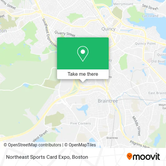
See Northeast Sports Card Expo, Quincy, on the map
Public Transit to Northeast Sports Card Expo in Quincy
Wondering how to get to Northeast Sports Card Expo in Quincy? Moovit helps you find the best way to get to Northeast Sports Card Expo with step-by-step directions from the nearest public transit station.
Moovit provides free maps and live directions to help you navigate through your city. View schedules, routes, timetables, and find out how long does it take to get to Northeast Sports Card Expo in real time.
Looking for the nearest stop or station to Northeast Sports Card Expo? Check out this list of stops closest to your destination: Centre St @ Intervale St.
Bus: 215, 238.Train: FALL RIVER/NEW BEDFORD, GREENBUSH.Subway: RED LINE.
Want to see if there’s another route that gets you there at an earlier time? Moovit helps you find alternative routes or times. Get directions from and directions to Northeast Sports Card Expo easily from the Moovit App or Website.
We make riding to Northeast Sports Card Expo easy, which is why over 1.7 million users, including users in Quincy, trust Moovit as the best app for public transit. You don’t need to download an individual bus app or train app, Moovit is your all-in-one transit app that helps you find the best bus time or train time available.
For information on prices of bus, subway and train, costs and ride fares to Northeast Sports Card Expo, please check the Moovit app.
Use the app to navigate to popular places including to the airport, hospital, stadium, grocery store, mall, coffee shop, school, college, and university.
Location: Quincy, Boston
- Goddard School of Quincy,
- Handcocks Steak and Seafood,
- Quincy Plumbing and Heating,
- Arbella Insurance,
- Braintree MA the split Jct 93- 3 -128,
- Glacon Contracting,
- crown Colony Shuttle,
- Dr Stephen Matarazzo (Quincy Best Dentist Steve Matarazzo, DDS),
- Career Builder. Com,
- Michel Associates,
- Gulf Computer,
- Jones Lang Lasalle,
- Xfinity,
- Studley Group,
- Greater Boston Smiles Pediatric Dentistry,
- Locksmith Professionals,
- Acls Academy,
- Compelling Legal Websites Home,
- Hite Hedge Asset Management,
- College Funding Solutions of Ma
Places Near Northeast Sports Card Expo (Quincy)
- Mgm Music Hall, Boston,
- Quincy Market, Boston,
- Cheers, Boston,
- Castle Island, Boston,
- North End, Boston,
- Massachusetts General Hospital, Boston,
- Td Garden, Boston,
- Wilbur Theatre, Boston,
- Faneuil Hall, Boston,
- Seaport District, Boston,
- Boston Medical Center, Boston,
- Museum Of Science, Boston,
- Leader Bank Pavilion (Leader Bank Pavillion), Boston,
- Isabella Stewart Gardner Museum, Boston,
- Boston Common, Boston,
- Prudential Center, Boston,
- House Of Blues, Boston,
- Boston Convention & Exhibition Center, Boston,
- Wang Theater, Boston,
- Boston Children's Hospital, Boston
How to get to popular places in Boston with public transit
Get around Quincy by public transit!
Traveling around Quincy has never been so easy. See step by step directions as you travel to any attraction, street or major public transit station. View bus and train schedules, arrival times, service alerts and detailed routes on a map, so you know exactly how to get to anywhere in Quincy.
When traveling to any destination around Quincy use Moovit's Live Directions with Get Off Notifications to know exactly where and how far to walk, how long to wait for your line, and how many stops are left. Moovit will alert you when it's time to get off — no need to constantly re-check whether yours is the next stop.
Wondering how to use public transit in Quincy or how to pay for public transit in Quincy? Moovit public transit app can help you navigate your way with public transit easily, and at minimum cost. It includes public transit fees, ticket prices, and costs. Looking for a map of Quincy public transit lines? Moovit public transit app shows all public transit maps in Quincy with all Bus, Train, Subway and Ferry routes and stops on an interactive map.
Boston has 4 transit type(s), including: Bus, Train, Subway and Ferry, operated by several transit agencies, including MBTA, Southeastern Regional Transit Authority, MetroWest Regional Transit Authority, Rhode Island Public Transit Authority, WRTA, Lowell Regional Transit Authority, Merrimack Valley Transit, Montachusett Regional Transit Authority, Cape Cod Regional Transit Authority, Brockton Area Transit Authority, Martha's Vineyard Transit Authority, the WAVE - Nantucket Regional Transit Authority, GATRA, Cape Ann Transportation Authority and Massport