Directions to Northern Strand Community Trail (Everett) with public transportation
The following transit lines have routes that pass near Northern Strand Community Trail
 Bus: 105, 106, 109, 112, 99.
- Train: NEWBURYPORT/ROCKPORT.
- Subway: ORANGE LINE.
How to get to Northern Strand Community Trail by bus?
Click on the bus route to see step by step directions with maps, line arrival times and updated time schedules.
From John F. Kennedy Presidential Library And Museum, Boston
116 minFrom Watertown, MA, Watertown Town
64 minFrom the mall at rockingham park mall, Boston
74 minFrom Emmanuel College, Boston
51 minFrom Market Basket, Revere
42 minFrom Harvard, Boston
46 minFrom Choi's Health Spa, Saugus
55 minFrom Mgm Music Hall, Boston
72 minFrom Massachusetts College of Art and Design, Boston
63 minFrom JFK Library, Boston
116 min
How to get to Northern Strand Community Trail by subway?
Click on the subway route to see step by step directions with maps, line arrival times and updated time schedules.
Bus stops near Northern Strand Community Trail in Everett
Train station near Northern Strand Community Trail in Everett
- Chelsea, 25 min walk,VIEW
Subway station near Northern Strand Community Trail in Everett
- Wellington, 31 min walk,VIEW
Bus lines to Northern Strand Community Trail in Everett
What are the closest stations to Northern Strand Community Trail?
The closest stations to Northern Strand Community Trail are:
- Main St @ Elmwood St is 374 yards away, 5 min walk.
- Broadway Opp Second St is 417 yards away, 6 min walk.
- Chelsea is 1853 yards away, 25 min walk.
- Wellington is 2568 yards away, 31 min walk.
Which bus lines stop near Northern Strand Community Trail?
These bus lines stop near Northern Strand Community Trail: 105, 106, 109, 112, 99.
Which subway line stops near Northern Strand Community Trail?
ORANGE LINE (Oak Grove)
What’s the nearest train station to Northern Strand Community Trail in Everett?
The nearest train station to Northern Strand Community Trail in Everett is Chelsea. It’s a 25 min walk away.
What’s the nearest bus station to Northern Strand Community Trail in Everett?
The nearest bus station to Northern Strand Community Trail in Everett is Main St @ Elmwood St. It’s a 5 min walk away.
What time is the first subway to Northern Strand Community Trail in Everett?
The ORANGE LINE is the first subway that goes to Northern Strand Community Trail in Everett. It stops nearby at 5:19 AM.
What time is the last subway to Northern Strand Community Trail in Everett?
The ORANGE LINE is the last subway that goes to Northern Strand Community Trail in Everett. It stops nearby at 1:53 AM.
What time is the first train to Northern Strand Community Trail in Everett?
The NEWBURYPORT/ROCKPORT is the first train that goes to Northern Strand Community Trail in Everett. It stops nearby at 5:40 AM.
What time is the last train to Northern Strand Community Trail in Everett?
The NEWBURYPORT/ROCKPORT is the last train that goes to Northern Strand Community Trail in Everett. It stops nearby at 12:06 AM.
What time is the first bus to Northern Strand Community Trail in Everett?
The 109 is the first bus that goes to Northern Strand Community Trail in Everett. It stops nearby at 4:40 AM.
What time is the last bus to Northern Strand Community Trail in Everett?
The 110 is the last bus that goes to Northern Strand Community Trail in Everett. It stops nearby at 2:06 AM.
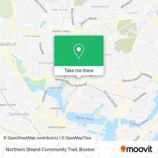
See Northern Strand Community Trail, Everett, on the map
Public Transit to Northern Strand Community Trail in Everett
Wondering how to get to Northern Strand Community Trail in Everett? Moovit helps you find the best way to get to Northern Strand Community Trail with step-by-step directions from the nearest public transit station.
Moovit provides free maps and live directions to help you navigate through your city. View schedules, routes, timetables, and find out how long does it take to get to Northern Strand Community Trail in real time.
Looking for the nearest stop or station to Northern Strand Community Trail? Check out this list of stops closest to your destination: Main St @ Elmwood St; Broadway Opp Second St; Chelsea; Wellington.
Bus: 105, 106, 109, 112, 99, 97, 110.Train: NEWBURYPORT/ROCKPORT.Subway: ORANGE LINE.
Want to see if there’s another route that gets you there at an earlier time? Moovit helps you find alternative routes or times. Get directions from and directions to Northern Strand Community Trail easily from the Moovit App or Website.
We make riding to Northern Strand Community Trail easy, which is why over 1.7 million users, including users in Everett, trust Moovit as the best app for public transit. You don’t need to download an individual bus app or train app, Moovit is your all-in-one transit app that helps you find the best bus time or train time available.
For information on prices of bus and subway, costs and ride fares to Northern Strand Community Trail, please check the Moovit app.
Use the app to navigate to popular places including to the airport, hospital, stadium, grocery store, mall, coffee shop, school, college, and university.
Northern Strand Community Trail Address: Northern Strand Community Trail street in Everett
- Papa's Ponytime Palace,
- Tileston St Plumbing,
- Premium Painting,
- Cooperative for Human Services,
- Norman Way,
- Junk Car,
- Gerson Auto Repair,
- Mass Bay Movers,
- Caciatore Art,
- Acrobots Led,
- Vitally Studio,
- Paradise Healing Center,
- Brazuka Store,
- Boston Orthopedic,
- Buteco do Tigrin,
- Berta's Restaurant,
- Turn-Key Petroleum,
- Night Shift Brewing (Night Shift -Espl),
- Rte 99 Rotary At Rte 16,
- Night Shift Brewing, Inc.
Places Near Northern Strand Community Trail (Everett)
- Museum Of Science, Boston,
- Castle Island, Boston,
- Massachusetts General Hospital, Boston,
- Wang Theater, Boston,
- Mgm Music Hall, Boston,
- Quincy Market, Boston,
- Boston Children's Hospital, Boston,
- Boston Convention & Exhibition Center, Boston,
- Prudential Center, Boston,
- Boston Common, Boston,
- Boston Medical Center, Boston,
- Isabella Stewart Gardner Museum, Boston,
- Seaport District, Boston,
- Faneuil Hall, Boston,
- Cheers, Boston,
- North End, Boston,
- Wilbur Theatre, Boston,
- Leader Bank Pavilion (Leader Bank Pavillion), Boston,
- House Of Blues, Boston,
- Td Garden, Boston
How to get to popular places in Boston with public transit
Get around Everett by public transit!
Traveling around Everett has never been so easy. See step by step directions as you travel to any attraction, street or major public transit station. View bus and train schedules, arrival times, service alerts and detailed routes on a map, so you know exactly how to get to anywhere in Everett.
When traveling to any destination around Everett use Moovit's Live Directions with Get Off Notifications to know exactly where and how far to walk, how long to wait for your line, and how many stops are left. Moovit will alert you when it's time to get off — no need to constantly re-check whether yours is the next stop.
Wondering how to use public transit in Everett or how to pay for public transit in Everett? Moovit public transit app can help you navigate your way with public transit easily, and at minimum cost. It includes public transit fees, ticket prices, and costs. Looking for a map of Everett public transit lines? Moovit public transit app shows all public transit maps in Everett with all Bus, Train, Subway and Ferry routes and stops on an interactive map.
Boston has 4 transit type(s), including: Bus, Train, Subway and Ferry, operated by several transit agencies, including MBTA, Southeastern Regional Transit Authority, MetroWest Regional Transit Authority, Rhode Island Public Transit Authority, WRTA, Lowell Regional Transit Authority, Merrimack Valley Transit, Montachusett Regional Transit Authority, Cape Cod Regional Transit Authority, Brockton Area Transit Authority, Martha's Vineyard Transit Authority, the WAVE - Nantucket Regional Transit Authority, GATRA, Cape Ann Transportation Authority and Massport