How to get to Northfield Commons Residents by bus?
Click on the bus route to see step by step directions with maps, line arrival times and updated time schedules.
Bus stop near Northfield Commons Residents in Boston
- Mount Vernon Street & Crestwood Circle, 10 min walk,VIEW
Train station near Northfield Commons Residents in Boston
- Lawrence, 15 min walk,VIEW
Bus lines to Northfield Commons Residents in Boston
- 7, Marriott Springhill,VIEW
What are the closest stations to Northfield Commons Residents?
The closest stations to Northfield Commons Residents are:
- Mount Vernon Street & Crestwood Circle is 803 yards away, 10 min walk.
- Lawrence is 1216 yards away, 15 min walk.
Which bus line stops near Northfield Commons Residents?
7 (Marriott Springhill)
What’s the nearest train station to Northfield Commons Residents in Boston?
The nearest train station to Northfield Commons Residents in Boston is Lawrence. It’s a 15 min walk away.
What’s the nearest bus station to Northfield Commons Residents in Boston?
The nearest bus station to Northfield Commons Residents in Boston is Mount Vernon Street & Crestwood Circle. It’s a 10 min walk away.
What time is the first train to Northfield Commons Residents in Boston?
The HAVERHILL is the first train that goes to Northfield Commons Residents in Boston. It stops nearby at 4:51 AM.
What time is the last train to Northfield Commons Residents in Boston?
The HAVERHILL is the last train that goes to Northfield Commons Residents in Boston. It stops nearby at 12:38 AM.
What time is the first bus to Northfield Commons Residents in Boston?
The 7 is the first bus that goes to Northfield Commons Residents in Boston. It stops nearby at 5:24 AM.
What time is the last bus to Northfield Commons Residents in Boston?
The 7 is the last bus that goes to Northfield Commons Residents in Boston. It stops nearby at 7:46 PM.
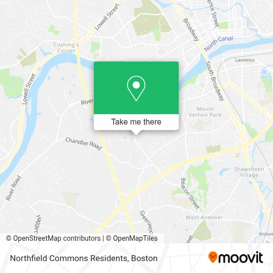
See Northfield Commons Residents, Boston, on the map
Public Transit to Northfield Commons Residents in Boston
Wondering how to get to Northfield Commons Residents in Boston? Moovit helps you find the best way to get to Northfield Commons Residents with step-by-step directions from the nearest public transit station.
Moovit provides free maps and live directions to help you navigate through your city. View schedules, routes, timetables, and find out how long does it take to get to Northfield Commons Residents in real time.
Looking for the nearest stop or station to Northfield Commons Residents? Check out this list of stops closest to your destination: Mount Vernon Street & Crestwood Circle; Lawrence.
Bus: 7.Train: HAVERHILL.
Want to see if there’s another route that gets you there at an earlier time? Moovit helps you find alternative routes or times. Get directions from and directions to Northfield Commons Residents easily from the Moovit App or Website.
We make riding to Northfield Commons Residents easy, which is why over 1.7 million users, including users in Boston, trust Moovit as the best app for public transit. You don’t need to download an individual bus app or train app, Moovit is your all-in-one transit app that helps you find the best bus time or train time available.
For information on prices of bus and train, costs and ride fares to Northfield Commons Residents, please check the Moovit app.
Use the app to navigate to popular places including to the airport, hospital, stadium, grocery store, mall, coffee shop, school, college, and university.
Northfield Commons Residents Address: 18 Atlantic Ave street in Boston
- B&D Scrubs,
- The Brookside at Andover,
- Schneider Electric,
- Wilson Wolfe Real Estate,
- Sarkisian Farms Driving Range & Ice Cream,
- Msl Blsa,
- The Shadow Fund NE,
- Alliance Healthcare Services,
- Northeast Document Conservation Center,
- Polycom, Inc.,
- Lawrence Pop Warner Football & Cheerleading,
- Massachusetts School Of Law Library,
- Prime Storage,
- Kneaded Massage Works,
- William J. Iannazzi, Inc.,
- JVJ Solutions,
- Chiropractic Wellness Centre,
- Aramark Uniform Services,
- ADT A D Security & Alarm,
- Koopman Lumber And Hardware Andover
Places Near Northfield Commons Residents (Boston)
- North End, Boston,
- Massachusetts General Hospital, Boston,
- Boston Medical Center, Boston,
- Wilbur Theatre, Boston,
- Quincy Market, Boston,
- Seaport District, Boston,
- Cheers, Boston,
- Boston Children's Hospital, Boston,
- Prudential Center, Boston,
- Td Garden, Boston,
- Castle Island, Boston,
- Mgm Music Hall, Boston,
- House Of Blues, Boston,
- Isabella Stewart Gardner Museum, Boston,
- Faneuil Hall, Boston,
- Leader Bank Pavilion (Leader Bank Pavillion), Boston,
- Boston Common, Boston,
- Boston Convention & Exhibition Center, Boston,
- Wang Theater, Boston,
- Museum Of Science, Boston
How to get to popular places in Boston with public transit
Get around Boston by public transit!
Traveling around Boston has never been so easy. See step by step directions as you travel to any attraction, street or major public transit station. View bus and train schedules, arrival times, service alerts and detailed routes on a map, so you know exactly how to get to anywhere in Boston.
When traveling to any destination around Boston use Moovit's Live Directions with Get Off Notifications to know exactly where and how far to walk, how long to wait for your line, and how many stops are left. Moovit will alert you when it's time to get off — no need to constantly re-check whether yours is the next stop.
Wondering how to use public transit in Boston or how to pay for public transit in Boston? Moovit public transit app can help you navigate your way with public transit easily, and at minimum cost. It includes public transit fees, ticket prices, and costs. Looking for a map of Boston public transit lines? Moovit public transit app shows all public transit maps in Boston with all Bus, Train, Subway and Ferry routes and stops on an interactive map.
Boston has 4 transit type(s), including: Bus, Train, Subway and Ferry, operated by several transit agencies, including MBTA, Southeastern Regional Transit Authority, MetroWest Regional Transit Authority, Rhode Island Public Transit Authority, WRTA, Lowell Regional Transit Authority, Merrimack Valley Transit, Montachusett Regional Transit Authority, Cape Cod Regional Transit Authority, Brockton Area Transit Authority, Martha's Vineyard Transit Authority, the WAVE - Nantucket Regional Transit Authority, GATRA, Cape Ann Transportation Authority and Massport