Directions to Northwest Refuse Service (Baltimore) with public transportation
The following transit lines have routes that pass near Northwest Refuse Service
 Bus: CITYLINK GOLD, CITYLINK LIME, CITYLINK NAVY, 85, 22.
- Train: MARC.
- Metro: METRO.
How to get to Northwest Refuse Service by bus?
Click on the bus route to see step by step directions with maps, line arrival times and updated time schedules.
From Bwi2 Employee Shuttles, Baltimore
40 minFrom Towson, MD, Baltimore County
50 minFrom Fells Point, Baltimore
33 minFrom I-70 at Security Blvd Baltimore City Lot Park & Ride, Baltimore
45 minFrom Towson Town Center, Baltimore County
57 minFrom Guinness Open Gate Brewery & Barrel House, Baltimore County
74 minFrom I-695 @ Exit 27 (Dulaney Valley Road/MD 146), Baltimore County
66 minFrom I-695 @ Exit 26 (York Rd/MD 45), Baltimore County
61 minFrom Medstar Harbor Hospital, Baltimore
41 minFrom Walmart, Baltimore County
50 min
How to get to Northwest Refuse Service by train?
Click on the train route to see step by step directions with maps, line arrival times and updated time schedules.
How to get to Northwest Refuse Service by metro?
Click on the metro route to see step by step directions with maps, line arrival times and updated time schedules.
Bus stops near Northwest Refuse Service in Baltimore
Metro station near Northwest Refuse Service in Baltimore
- Mondawmin Metro, 5 min walk,VIEW
Light Rail stations near Northwest Refuse Service in Baltimore
- North Avenue, 10 min walk,VIEW
Bus lines to Northwest Refuse Service in Baltimore
What are the closest stations to Northwest Refuse Service?
The closest stations to Northwest Refuse Service are:
- Pennsylvania Ave & Fulton Ave Nb is 281 yards away, 4 min walk.
- North Ave & Pennsylvania Ave Wb is 337 yards away, 5 min walk.
- Fulton Ave & Clifton Ave is 346 yards away, 5 min walk.
- Mondawmin Metro is 413 yards away, 5 min walk.
- Cloverdale Rd & Mcculloh St is 430 yards away, 6 min walk.
- North Avenue is 831 yards away, 10 min walk.
Which bus lines stop near Northwest Refuse Service?
These bus lines stop near Northwest Refuse Service: CITYLINK GOLD, CITYLINK LIME, CITYLINK NAVY.
Which train line stops near Northwest Refuse Service?
MARC (Inbound - Penn)
Which metro line stops near Northwest Refuse Service?
METRO (Towards Owing Mills)
What’s the nearest light rail station to Northwest Refuse Service in Baltimore?
The nearest light rail station to Northwest Refuse Service in Baltimore is North Avenue. It’s a 10 min walk away.
What’s the nearest metro station to Northwest Refuse Service in Baltimore?
The nearest metro station to Northwest Refuse Service in Baltimore is Mondawmin Metro. It’s a 5 min walk away.
What’s the nearest bus station to Northwest Refuse Service in Baltimore?
The nearest bus station to Northwest Refuse Service in Baltimore is Pennsylvania Ave & Fulton Ave Nb. It’s a 4 min walk away.
What time is the first light rail to Northwest Refuse Service in Baltimore?
The LIGHT RAILLINK is the first light rail that goes to Northwest Refuse Service in Baltimore. It stops nearby at 3:42 AM.
What time is the last light rail to Northwest Refuse Service in Baltimore?
The LIGHT RAILLINK is the last light rail that goes to Northwest Refuse Service in Baltimore. It stops nearby at 1:30 AM.
What time is the first metro to Northwest Refuse Service in Baltimore?
The METRO is the first metro that goes to Northwest Refuse Service in Baltimore. It stops nearby at 5:01 AM.
What time is the last metro to Northwest Refuse Service in Baltimore?
The METRO is the last metro that goes to Northwest Refuse Service in Baltimore. It stops nearby at 12:20 AM.
What time is the first bus to Northwest Refuse Service in Baltimore?
The CITYLINK GOLD is the first bus that goes to Northwest Refuse Service in Baltimore. It stops nearby at 3:21 AM.
What time is the last bus to Northwest Refuse Service in Baltimore?
The CITYLINK NAVY is the last bus that goes to Northwest Refuse Service in Baltimore. It stops nearby at 3:31 AM.
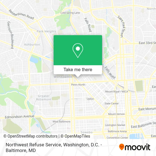
See Northwest Refuse Service, Baltimore, on the map
Public Transit to Northwest Refuse Service in Baltimore
Wondering how to get to Northwest Refuse Service in Baltimore? Moovit helps you find the best way to get to Northwest Refuse Service with step-by-step directions from the nearest public transit station.
Moovit provides free maps and live directions to help you navigate through your city. View schedules, routes, timetables, and find out how long does it take to get to Northwest Refuse Service in real time.
Looking for the nearest stop or station to Northwest Refuse Service? Check out this list of stops closest to your destination: Pennsylvania Ave & Fulton Ave Nb; North Ave & Pennsylvania Ave Wb; Fulton Ave & Clifton Ave; Mondawmin Metro; Cloverdale Rd & Mcculloh St; North Avenue.
Bus: CITYLINK GOLD, CITYLINK LIME, CITYLINK NAVY, 85, 22, 91.Train: MARC.Metro: METRO.
Want to see if there’s another route that gets you there at an earlier time? Moovit helps you find alternative routes or times. Get directions from and directions to Northwest Refuse Service easily from the Moovit App or Website.
We make riding to Northwest Refuse Service easy, which is why over 1.7 million users, including users in Baltimore, trust Moovit as the best app for public transit. You don’t need to download an individual bus app or train app, Moovit is your all-in-one transit app that helps you find the best bus time or train time available.
For information on prices of bus, metro and train, costs and ride fares to Northwest Refuse Service, please check the Moovit app.
Use the app to navigate to popular places including to the airport, hospital, stadium, grocery store, mall, coffee shop, school, college, and university.
Northwest Refuse Service Address: 2001 Windsor Ave street in Baltimore
- Pennsylvania Avenue & North Avenue Northbound,
- Penn North,
- Dru Hill Dru Park Lake Dr,
- Joseph Brown Funeral Home,
- Joseph H Brown Funeral Home ,
- North Ave and N Fulton Ave,
- W North Ave (north avenue & Druid Hill Ave),
- McCulloh St and North Ave,
- North Avenue & Pulaski,
- Vsu Training,
- Druid Hill Park,
- North Avenue & Eutaw Place Westbound,
- Reservoir Hill,
- Mt. Hebron Memorial Cogic (Mount Hebron Church of God in Christ),
- AT&T,
- Sashae Selections,
- Frederick Douglass High School,
- Fulton, Maryland,
- Post Office,
- Mondawmin, Maryland
Places Near Northwest Refuse Service (Baltimore)
- Rock Creek Tennis Center, Washington,
- National Zoo, Washington,
- PG Mall, Prince George's County,
- Amazon Hq2, Arlington County,
- Museum Of The Bible, Washington,
- The Anthem, Washington,
- Sibley Memorial Hospital, Washington,
- M&T Bank Stadium, Baltimore,
- National Museum of African American History and Culture, Washington,
- Capital One Arena, Washington,
- Georgetown, Washington,
- National Theatre, Washington,
- Warner Theatre, Washington,
- Westfield Montgomery Mall, Montgomery County,
- Washington National Cathedral, Washington,
- Basilica of the National Shrine, Washington,
- Marriott Marquis Washington, DC, Washington,
- Washington DC VA Medical Center, Washington,
- Pennsylvania Ave NW (3rd st and pennsylvania), Washington,
- Camden Yards, Baltimore
How to get to popular places in Washington, D.C. - Baltimore, MD with public transit
Get around Baltimore by public transit!
Traveling around Baltimore has never been so easy. See step by step directions as you travel to any attraction, street or major public transit station. View bus and train schedules, arrival times, service alerts and detailed routes on a map, so you know exactly how to get to anywhere in Baltimore.
When traveling to any destination around Baltimore use Moovit's Live Directions with Get Off Notifications to know exactly where and how far to walk, how long to wait for your line, and how many stops are left. Moovit will alert you when it's time to get off — no need to constantly re-check whether yours is the next stop.
Wondering how to use public transit in Baltimore or how to pay for public transit in Baltimore? Moovit public transit app can help you navigate your way with public transit easily, and at minimum cost. It includes public transit fees, ticket prices, and costs. Looking for a map of Baltimore public transit lines? Moovit public transit app shows all public transit maps in Baltimore with all Bus, Train, Metro, Light Rail and Ferry routes and stops on an interactive map.
Washington, D.C. - Baltimore, MD has 5 transit type(s), including: Bus, Train, Metro, Light Rail and Ferry, operated by several transit agencies, including WMATA, Montgomery County Ride On, Fairfax Connector, TheBus, PRTC, DASH - Alexandria, Arlington Transit (ART), RTA of Central Maryland, MDOT MTA, MDOT MTA Light RailLink, MDOT MTA Commuter Bus, MDOT MTA Local Bus, FXBGO!, Virginia Railway Express (VRE) and MARC