Directions to Pause For Prayer (Baltimore) with public transportation
The following transit lines have routes that pass near Pause For Prayer
 Bus: CITYLINK GOLD, CITYLINK LIME, CITYLINK NAVY, 22, 85.
- Train: MARC.
- Metro: METRO.
How to get to Pause For Prayer by bus?
Click on the bus route to see step by step directions with maps, line arrival times and updated time schedules.
From Walmart, Baltimore County
52 minFrom Towson, MD, Baltimore County
49 minFrom Social Security Administration (Robert M. Ball Building), Baltimore County
54 minFrom I-695 @ Exit 18 (Liberty Rd/MD 26), Baltimore County
36 minFrom Patterson Park, Baltimore
43 minFrom Good Samaritan Hospital, Baltimore
45 minFrom I-70 at Security Blvd Baltimore City Lot Park & Ride, Baltimore
47 minFrom Bwi2 Employee Shuttles, Baltimore
42 minFrom Towson Town Center, Baltimore County
61 minFrom Guinness Open Gate Brewery & Barrel House, Baltimore County
76 min
How to get to Pause For Prayer by train?
Click on the train route to see step by step directions with maps, line arrival times and updated time schedules.
Bus stops near Pause For Prayer in Baltimore
Metro station near Pause For Prayer in Baltimore
- Mondawmin Metro, 11 min walk,VIEW
Light Rail stations near Pause For Prayer in Baltimore
- North Avenue, 16 min walk,VIEW
Bus lines to Pause For Prayer in Baltimore
What are the closest stations to Pause For Prayer?
The closest stations to Pause For Prayer are:
- North Ave & Pennsylvania Ave Wb is 167 yards away, 3 min walk.
- Fulton Ave & Reisterstown Rd FS Nb is 177 yards away, 3 min walk.
- Whitelock St & Madison Ave FS Eb is 687 yards away, 9 min walk.
- Mondawmin Metro is 841 yards away, 11 min walk.
- North Avenue is 1289 yards away, 16 min walk.
Which bus lines stop near Pause For Prayer?
These bus lines stop near Pause For Prayer: CITYLINK GOLD, CITYLINK LIME, CITYLINK NAVY.
Which train line stops near Pause For Prayer?
MARC (Inbound - Penn)
Which metro line stops near Pause For Prayer?
METRO (Towards Owing Mills)
What’s the nearest light rail station to Pause For Prayer in Baltimore?
The nearest light rail station to Pause For Prayer in Baltimore is North Avenue. It’s a 16 min walk away.
What’s the nearest metro station to Pause For Prayer in Baltimore?
The nearest metro station to Pause For Prayer in Baltimore is Mondawmin Metro. It’s a 11 min walk away.
What’s the nearest bus station to Pause For Prayer in Baltimore?
The nearest bus stations to Pause For Prayer in Baltimore are North Ave & Pennsylvania Ave Wb and Fulton Ave & Reisterstown Rd FS Nb. The closest one is a 3 min walk away.
What time is the first light rail to Pause For Prayer in Baltimore?
The LIGHT RAILLINK is the first light rail that goes to Pause For Prayer in Baltimore. It stops nearby at 3:42 AM.
What time is the last light rail to Pause For Prayer in Baltimore?
The LIGHT RAILLINK is the last light rail that goes to Pause For Prayer in Baltimore. It stops nearby at 1:30 AM.
What time is the first metro to Pause For Prayer in Baltimore?
The METRO is the first metro that goes to Pause For Prayer in Baltimore. It stops nearby at 5:01 AM.
What time is the last metro to Pause For Prayer in Baltimore?
The METRO is the last metro that goes to Pause For Prayer in Baltimore. It stops nearby at 12:20 AM.
What time is the first bus to Pause For Prayer in Baltimore?
The CITYLINK GOLD is the first bus that goes to Pause For Prayer in Baltimore. It stops nearby at 3:21 AM.
What time is the last bus to Pause For Prayer in Baltimore?
The CITYLINK GOLD is the last bus that goes to Pause For Prayer in Baltimore. It stops nearby at 2:59 AM.
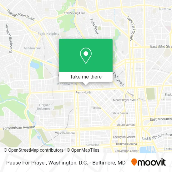
See Pause For Prayer, Baltimore, on the map
Public Transit to Pause For Prayer in Baltimore
Wondering how to get to Pause For Prayer in Baltimore? Moovit helps you find the best way to get to Pause For Prayer with step-by-step directions from the nearest public transit station.
Moovit provides free maps and live directions to help you navigate through your city. View schedules, routes, timetables, and find out how long does it take to get to Pause For Prayer in real time.
Looking for the nearest stop or station to Pause For Prayer? Check out this list of stops closest to your destination: North Ave & Pennsylvania Ave Wb; Fulton Ave & Reisterstown Rd FS Nb; Whitelock St & Madison Ave FS Eb; Mondawmin Metro; North Avenue.
Bus: CITYLINK GOLD, CITYLINK LIME, CITYLINK NAVY, 22, 85, 91.Train: MARC.Metro: METRO.
Want to see if there’s another route that gets you there at an earlier time? Moovit helps you find alternative routes or times. Get directions from and directions to Pause For Prayer easily from the Moovit App or Website.
We make riding to Pause For Prayer easy, which is why over 1.7 million users, including users in Baltimore, trust Moovit as the best app for public transit. You don’t need to download an individual bus app or train app, Moovit is your all-in-one transit app that helps you find the best bus time or train time available.
For information on prices of bus, metro and train, costs and ride fares to Pause For Prayer, please check the Moovit app.
Use the app to navigate to popular places including to the airport, hospital, stadium, grocery store, mall, coffee shop, school, college, and university.
Pause For Prayer Address: 2459 Etting St street in Baltimore
- Million Dollar Dreams,
- Northwest Refuse Service,
- Mount Gilead Outreach Mission,
- Mo's Seafood And Bar,
- Kiss International Conglomerate,
- Icarr Solutions,
- Grace City-Baltimore,
- Btg Sports Group,
- Groover, Tiffany Md,
- The Church Spot,
- Department Of Social Services Penn-North,
- Ups Access Point Location,
- Women at the Well Foundation,
- Penn North,
- National Auto Repair,
- Pennsylvania Avenue & North Avenue Northbound,
- Kims: Penn-North,
- Chillin Fish & Chicken,
- Big O’S Hand Car Wash,
- Western Union
Places Near Pause For Prayer (Baltimore)
- Westfield Montgomery Mall, Montgomery County,
- Capital One Arena, Washington,
- Basilica of the National Shrine, Washington,
- M&T Bank Stadium, Baltimore,
- Pennsylvania Ave NW (3rd st and pennsylvania), Washington,
- National Theatre, Washington,
- Washington National Cathedral, Washington,
- PG Mall, Prince George's County,
- Sibley Memorial Hospital, Washington,
- Rock Creek Tennis Center, Washington,
- Warner Theatre, Washington,
- Amazon Hq2, Arlington County,
- Marriott Marquis Washington, DC, Washington,
- National Museum of African American History and Culture, Washington,
- Georgetown, Washington,
- Washington DC VA Medical Center, Washington,
- Museum Of The Bible, Washington,
- The Anthem, Washington,
- Camden Yards, Baltimore,
- National Zoo, Washington
How to get to popular places in Washington, D.C. - Baltimore, MD with public transit
Get around Baltimore by public transit!
Traveling around Baltimore has never been so easy. See step by step directions as you travel to any attraction, street or major public transit station. View bus and train schedules, arrival times, service alerts and detailed routes on a map, so you know exactly how to get to anywhere in Baltimore.
When traveling to any destination around Baltimore use Moovit's Live Directions with Get Off Notifications to know exactly where and how far to walk, how long to wait for your line, and how many stops are left. Moovit will alert you when it's time to get off — no need to constantly re-check whether yours is the next stop.
Wondering how to use public transit in Baltimore or how to pay for public transit in Baltimore? Moovit public transit app can help you navigate your way with public transit easily, and at minimum cost. It includes public transit fees, ticket prices, and costs. Looking for a map of Baltimore public transit lines? Moovit public transit app shows all public transit maps in Baltimore with all Bus, Train, Metro, Light Rail and Ferry routes and stops on an interactive map.
Washington, D.C. - Baltimore, MD has 5 transit type(s), including: Bus, Train, Metro, Light Rail and Ferry, operated by several transit agencies, including WMATA, Montgomery County Ride On, Fairfax Connector, TheBus, PRTC, DASH - Alexandria, Arlington Transit (ART), RTA of Central Maryland, MDOT MTA, MDOT MTA Light RailLink, MDOT MTA Commuter Bus, MDOT MTA Local Bus, FXBGO!, Virginia Railway Express (VRE) and MARC