See Norwood Station on the map
Directions to Norwood Station with public transportation
The following transit lines have routes that pass near Norwood Station
 Bus:
Bus: - Train:
How to get to Norwood Station by bus?
Click on the bus route to see step by step directions with maps, line arrival times and updated time schedules.
How to get to Norwood Station by train?
Click on the train route to see step by step directions with maps, line arrival times and updated time schedules.
Bus stations near Norwood Station
- Chester Pk & Garfield Av - FS,3 min walk,
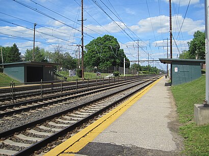
Train stations near Norwood Station
- Norwood,7 min walk,
Bus lines to Norwood Station
- 114,Wawa Station,
What are the closest stations to Norwood Station?
The closest stations to Norwood Station are:
- Chester Pk & Garfield Av - FS is 202 yards away, 3 min walk.
- Norwood is 536 yards away, 7 min walk.
Which bus line stops near Norwood Station?
114
Which train line stops near Norwood Station?
WILMINGTON/NEWARK LINE
What’s the nearest train station to Norwood Station?
The nearest train station to Norwood Station is Norwood. It’s a 7 min walk away.
What’s the nearest bus stop to Norwood Station?
The nearest bus stop to Norwood Station is Chester Pk & Garfield Av - FS. It’s a 3 min walk away.
See Norwood Station on the map
Public Transportation to Norwood Station
Wondering how to get to Norwood Station, United States? Moovit helps you find the best way to get to Norwood Station with step-by-step directions from the nearest public transit station.
Moovit provides free maps and live directions to help you navigate through your city. View schedules, routes, timetables, and find out how long does it take to get to Norwood Station in real time.
Looking for the nearest stop or station to Norwood Station? Check out this list of stops closest to your destination: Chester Pk & Garfield Av - FS; Norwood.
Bus:Train:
Want to see if there’s another route that gets you there at an earlier time? Moovit helps you find alternative routes or times. Get directions from and directions to Norwood Station easily from the Moovit App or Website.
We make riding to Norwood Station easy, which is why over 1.5 million users, including users in Norwood, trust Moovit as the best app for public transit. You don’t need to download an individual bus app or train app, Moovit is your all-in-one transit app that helps you find the best bus time or train time available.
For information on prices of bus and train, costs and ride fares to Norwood Station, please check the Moovit app.
Use the app to navigate to popular places including to the airport, hospital, stadium, grocery store, mall, coffee shop, school, college, and university.
Location: Norwood, Philadelphia
Attractions near Norwood Station
1,19074,Norwood Park,AS Built Construction,Garfield Ave,United methodist church,Matthew's Bar,The Park,Cavanagh Funeral Home,Cremation Specialists,PBF Dock Paulsboro,Shady Park,147 Garfield Ave,American Legion,227 Chester Pike,Matthews Tavern,Halliday Construction Company LLC,In Perfect Harmony Yoga Studio & Boutique,59 Leon Ave,190 Harrison AveHow to get to popular attractions in Norwood with public transit
Mercer County Community College,Havertown, PA, Haverford,McCarter Theatre, Princeton,Target,Tony Luke's, Philadelphia,Hatfield, PA, Hatfield,444 N 3rd Street, Philadelphia,Philadelphia Premium Outlets, Limerick,SEPTA Torresdale Station, Philadelphia,Malvern, PA, Malvern,Moriarty's Restaurant & Irish Pub, Philadelphia,SEPTA Elm Street Station (Norristown), Norristown,Princeton Theological Seminary, Princeton,Independence Blue Cross, Philadelphia,New Jersey State House, Trenton,Hyatt Regency Princeton,NJT - Princeton Junction Station (NEC), Princeton Junction,Lockheed Martin Rotary and Mission Systems,Croydon, PA, Croydon,Three Monkeys Café, PhiladelphiaGet around Norwood by public transit!
Traveling around Norwood has never been so easy. See step by step directions as you travel to any attraction, street or major public transit station. View bus and train schedules, arrival times, service alerts and detailed routes on a map, so you know exactly how to get to anywhere in Norwood.
When traveling to any destination around Norwood use Moovit's Live Directions with Get Off Notifications to know exactly where and how far to walk, how long to wait for your line, and how many stops are left. Moovit will alert you when it's time to get off — no need to constantly re-check whether yours is the next stop.
Wondering how to use public transit in Norwood or how to pay for public transit in Norwood? Moovit public transit app can help you navigate your way with public transit easily, and at minimum cost. It includes public transit fees, ticket prices, and costs. Looking for a map of Norwood public transit lines? Moovit public transit app shows all public transit maps in Norwood with all bus or train routes and stops on an interactive map.
Norwood has 2 transit type(s), including: bus or train, operated by several transit agencies, including SEPTA Subway, SEPTA Trolley, SEPTA Rail, SEPTA, SEPTA, NJ TRANSIT RAIL-Rail, NJ TRANSIT RAIL-Tram, NJ TRANSIT BUS, Port Authority Transit Corporation, Navy Yard, Penn Transit, Drexel University, Pottstown Area Rapid Transit (PART), Fullington Tours and Chescobus