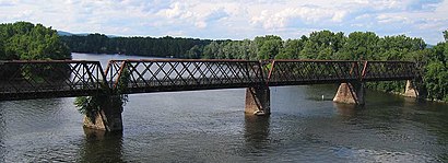
Directions to Norwottuck Rail Trail Bridge (Boston) with public transportation
The following transit lines have routes that pass near Norwottuck Rail Trail Bridge
How to get to Norwottuck Rail Trail Bridge by bus?
Click on the bus route to see step by step directions with maps, line arrival times and updated time schedules.
How to get to Norwottuck Rail Trail Bridge by train?
Click on the train route to see step by step directions with maps, line arrival times and updated time schedules.
Bus stations near Norwottuck Rail Trail Bridge in Boston
- Russell/Bay (Barn Shops),4 min walk,
Bus lines to Norwottuck Rail Trail Bridge in Boston
- B43,Northampton,
What are the closest stations to Norwottuck Rail Trail Bridge?
The closest stations to Norwottuck Rail Trail Bridge are:
- Russell/Bay (Barn Shops) is 233 yards away, 4 min walk.
Which bus lines stop near Norwottuck Rail Trail Bridge?
These bus lines stop near Norwottuck Rail Trail Bridge: B43, G73E.
Which train line stops near Norwottuck Rail Trail Bridge?
VERMONTER
What’s the nearest bus stop to Norwottuck Rail Trail Bridge in Boston?
The nearest bus stop to Norwottuck Rail Trail Bridge in Boston is Russell/Bay (Barn Shops). It’s a 4 min walk away.
What time is the first bus to Norwottuck Rail Trail Bridge in Boston?
The B43 is the first bus that goes to Norwottuck Rail Trail Bridge in Boston. It stops nearby at 6:37 AM.
What time is the last bus to Norwottuck Rail Trail Bridge in Boston?
The B43 is the last bus that goes to Norwottuck Rail Trail Bridge in Boston. It stops nearby at 11:41 PM.
See Norwottuck Rail Trail Bridge, Boston, on the map
Public Transit to Norwottuck Rail Trail Bridge in Boston
How to get to Norwottuck Rail Trail Bridge in Boston, United States?
It’s easy with Moovit. Type in your street address and Moovit’s route finder will locate the fastest way to get you there! Not sure where to get off on the street? Download the Moovit App to find live directions (including where to get off on Norwottuck Rail Trail Bridge), see timetables and get the estimated arrival times for your favorite bus or train lines.
Looking for the nearest stop or station to Norwottuck Rail Trail Bridge? Check out this list of closest stops available to your destination: Russell/Bay (Barn Shops).
Bus:B43G73ETrain:VERMONTER
Download the Moovit App to see the current schedule and routes available for Boston. No need to install a special bus app to check the bus time or a train app to get train time. Moovit is the only all-in-one transit app that helps you get where you need to go.
We make riding on public transit to Norwottuck Rail Trail Bridge easy, which is why over 1.5 million users, including users in Boston trust Moovit as the best app for public transit.
Use the app to navigate to popular places including to the airport, hospital, stadium, grocery store, mall, coffee shop, school, college, and university.
Location: Boston
Streets near Norwottuck Rail Trail Bridge, Boston
Old Damon Road, Unknown,South Branch Road, Unknown,Norwottuck Rail Trail, Unknown,Riverbank Road, Unknown,Cross Path, Unknown,Aqua Vitae Road, Unknown,Industrial Drive Rotary, Unknown,Cross Path Road, Unknown,Hampton Manor Drive, Unknown,Lane Plant Road, Unknown,Strongs Road, Unknown,North Branch Road, Unknown,Denise Court, Unknown,Carlon Drive, Unknown,Hampshire Heights, Unknown,Hooker Avenue, Unknown,Hampton Garden Drive, Unknown,Pine Brook Curve, Unknown,Terrace Trails (Hill Trail), Unknown,Edwards Square, UnknownHow to get to popular attractions in Boston with public transit
Somerville, MA, Somerville,Samuel Adams Brewery, Boston,Everett, MA, Everett,Harvard University, Cambridge,Omni Hotel Seaport (2021), Boston,Franklin Park Zoo, Boston,Harvard Stadium, Boston,Boston Medical Center, Boston,Copley Square, Boston,Massachusetts General Hospital, Boston,Massport Bus 77 Chelsea Employee Parking, Chelsea,South Shore Plaza, Braintree Town,Massachusetts State House, Boston,Wilbur Theatre, Boston,Waltham, MA, Waltham,Mgm Music Hall, Boston,Faneuil Hall, Boston,Cambridge, MA, Cambridge,New England Aquarium, Boston,Park Plaza Castle, BostonGet around Boston by public transit!
Traveling around Boston has never been so easy. See step by step directions as you travel to any attraction, street or major public transit station. View bus and train schedules, arrival times, service alerts and detailed routes on a map, so you know exactly how to get to anywhere in Boston.
When traveling to any destination around Boston use Moovit's Live Directions with Get Off Notifications to know exactly where and how far to walk, how long to wait for your line, and how many stops are left. Moovit will alert you when it's time to get off — no need to constantly re-check whether yours is the next stop.
Wondering how to use public transit in Boston or how to pay for public transit in Boston? Moovit public transit app can help you navigate your way with public transit easily, and at minimum cost. It includes public transit fees, ticket prices, and costs. Looking for a map of Boston public transit lines? Moovit public transit app shows all public transit maps in Boston with all bus or train routes and stops on an interactive map.
Boston has 2 transit type(s), including: bus or train, operated by several transit agencies, including MBTA, MBTA, MBTA, Southeastern Regional Transit Authority, MetroWest Regional Transit Authority, Rhode Island Public Transit Authority, WRTA, Lowell Regional Transit Authority, Merrimack Valley Transit, Montachusett Regional Transit Authority, Cape Cod Regional Transit Authority, Brockton Area Transit Authority, Cape Cod Regional Transit Authority, Martha's Vineyard Transit Authority and the WAVE - Nantucket Regional Transit Authority