Directions to Nostos Boutique (Ipswich) with public transportation
The following transit lines have routes that pass near Nostos Boutique
How to get to Nostos Boutique by train?
Click on the train route to see step by step directions with maps, line arrival times and updated time schedules.
Bus stop near Nostos Boutique in Ipswich
- Ipswich, 3 min walk,VIEW
Train station near Nostos Boutique in Ipswich
- Ipswich, 3 min walk,VIEW
Bus lines to Nostos Boutique in Ipswich
What are the closest stations to Nostos Boutique?
The closest stations to Nostos Boutique are:
- Ipswich is 199 yards away, 3 min walk.
Which train line stops near Nostos Boutique?
NEWBURYPORT/ROCKPORT (#125 | Newburyport)
What’s the nearest train station to Nostos Boutique in Ipswich?
The nearest train station to Nostos Boutique in Ipswich is Ipswich. It’s a 3 min walk away.
What’s the nearest bus station to Nostos Boutique in Ipswich?
The nearest bus station to Nostos Boutique in Ipswich is Ipswich. It’s a 3 min walk away.
What time is the first train to Nostos Boutique in Ipswich?
The NEWBURYPORT/ROCKPORT is the first train that goes to Nostos Boutique in Ipswich. It stops nearby at 5:01 AM.
What time is the last train to Nostos Boutique in Ipswich?
The NEWBURYPORT/ROCKPORT is the last train that goes to Nostos Boutique in Ipswich. It stops nearby at 12:46 AM.
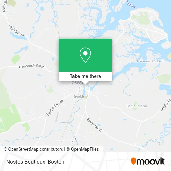
See Nostos Boutique, Ipswich, on the map
Public Transit to Nostos Boutique in Ipswich
Wondering how to get to Nostos Boutique in Ipswich? Moovit helps you find the best way to get to Nostos Boutique with step-by-step directions from the nearest public transit station.
Moovit provides free maps and live directions to help you navigate through your city. View schedules, routes, timetables, and find out how long does it take to get to Nostos Boutique in real time.
Looking for the nearest stop or station to Nostos Boutique? Check out this list of stops closest to your destination: Ipswich.
Bus: NEWBURYPORT LINE SHUTTLE, NEWBURYPORT LINE SHUTTLE, NEWBURYPORT LINE SHUTTLE.Train: NEWBURYPORT/ROCKPORT.
Want to see if there’s another route that gets you there at an earlier time? Moovit helps you find alternative routes or times. Get directions from and directions to Nostos Boutique easily from the Moovit App or Website.
We make riding to Nostos Boutique easy, which is why over 1.7 million users, including users in Ipswich, trust Moovit as the best app for public transit. You don’t need to download an individual bus app or train app, Moovit is your all-in-one transit app that helps you find the best bus time or train time available.
For information on prices of train and bus, costs and ride fares to Nostos Boutique, please check the Moovit app.
Use the app to navigate to popular places including to the airport, hospital, stadium, grocery store, mall, coffee shop, school, college, and university.
Nostos Boutique Address: 21 S Main St street in Ipswich
- Ipswich, Massachusetts,
- Ebsco Industries,
- John T. Ambrose Renovations and Remodeling,
- MBTA-Ipswich,
- Ithaki Modern Mediterranean (Ithaki Mediterranean Cuisine),
- Ipswich, MA,
- Dip 'n Clip,
- Rev. Levi Frisbie House (Est. 1788),
- The Nathaniel Hovey House (1718),
- Central Masonry,
- The Joseph Willcomb House (1669),
- Tougas Geo J,
- Mobil,
- Countryscapes Art by Johanne Cassia,
- Moritz B. Philipp And Jane Peterson Estate (1885),
- Shatswell-Tuttle House (Right Side by 1690 / Left,1806),
- Car Windshield Chip Repair Glass Auto,
- Idg Ipswich Dental PC,
- Hellenic Community Center,
- Ipswich Greek Festival
Places Near Nostos Boutique (Ipswich)
- Boston Convention & Exhibition Center, Boston,
- Castle Island, Boston,
- Museum Of Science, Boston,
- Wilbur Theatre, Boston,
- Seaport District, Boston,
- Quincy Market, Boston,
- House Of Blues, Boston,
- Cheers, Boston,
- Prudential Center, Boston,
- Massachusetts General Hospital, Boston,
- Isabella Stewart Gardner Museum, Boston,
- Boston Common, Boston,
- Boston Children's Hospital, Boston,
- North End, Boston,
- Td Garden, Boston,
- Wang Theater, Boston,
- Faneuil Hall, Boston,
- Mgm Music Hall, Boston,
- Boston Medical Center, Boston,
- Leader Bank Pavilion (Leader Bank Pavillion), Boston
How to get to popular places in Boston with public transit
Get around Ipswich by public transit!
Traveling around Ipswich has never been so easy. See step by step directions as you travel to any attraction, street or major public transit station. View bus and train schedules, arrival times, service alerts and detailed routes on a map, so you know exactly how to get to anywhere in Ipswich.
When traveling to any destination around Ipswich use Moovit's Live Directions with Get Off Notifications to know exactly where and how far to walk, how long to wait for your line, and how many stops are left. Moovit will alert you when it's time to get off — no need to constantly re-check whether yours is the next stop.
Wondering how to use public transit in Ipswich or how to pay for public transit in Ipswich? Moovit public transit app can help you navigate your way with public transit easily, and at minimum cost. It includes public transit fees, ticket prices, and costs. Looking for a map of Ipswich public transit lines? Moovit public transit app shows all public transit maps in Ipswich with all Bus, Train, Subway and Ferry routes and stops on an interactive map.
Boston has 4 transit type(s), including: Bus, Train, Subway and Ferry, operated by several transit agencies, including MBTA, Southeastern Regional Transit Authority, MetroWest Regional Transit Authority, Rhode Island Public Transit Authority, WRTA, Lowell Regional Transit Authority, Merrimack Valley Transit, Montachusett Regional Transit Authority, Cape Cod Regional Transit Authority, Brockton Area Transit Authority, Martha's Vineyard Transit Authority, the WAVE - Nantucket Regional Transit Authority, GATRA, Cape Ann Transportation Authority and Massport