Directions to Not Active Page (Newton) with public transportation
The following transit lines have routes that pass near Not Active Page
 Bus: 504, 57, 52, 553, 554.
- Train: FRAMINGHAM/WORCESTER.
- Subway: GREEN LINE D, GREEN LINE B.
How to get to Not Active Page by bus?
Click on the bus route to see step by step directions with maps, line arrival times and updated time schedules.
From Lolita Cocina & Tequila Bar, Boston
16 minFrom Wilbur Theatre, Boston
21 minFrom Moxy Hotel, Boston
21 minFrom Dana-Farber Cancer Institute, Boston
38 minFrom Boston Children's Hospital, Boston
48 minFrom Courtyard by Marriott Brookline, Brookline
38 minFrom Endicott College Boston, Boston
22 minFrom Courtyard Marriott Lobby, Boston
22 minFrom John Hancock Tower, Boston
17 minFrom Childrens Museum, Boston
47 min
How to get to Not Active Page by train?
Click on the train route to see step by step directions with maps, line arrival times and updated time schedules.
From Lolita Cocina & Tequila Bar, Boston
47 minFrom Wilbur Theatre, Boston
54 minFrom Moxy Hotel, Boston
54 minFrom Dana-Farber Cancer Institute, Boston
54 minFrom Boston Children's Hospital, Boston
55 minFrom Endicott College Boston, Boston
55 minFrom Courtyard Marriott Lobby, Boston
55 minFrom John Hancock Tower, Boston
47 minFrom Childrens Museum, Boston
150 min
How to get to Not Active Page by subway?
Click on the subway route to see step by step directions with maps, line arrival times and updated time schedules.
From Lolita Cocina & Tequila Bar, Boston
71 minFrom Wilbur Theatre, Boston
79 minFrom Moxy Hotel, Boston
79 minFrom Dana-Farber Cancer Institute, Boston
69 minFrom Boston Children's Hospital, Boston
70 minFrom Courtyard by Marriott Brookline, Brookline
72 minFrom Endicott College Boston, Boston
77 minFrom Courtyard Marriott Lobby, Boston
80 minFrom John Hancock Tower, Boston
75 minFrom Childrens Museum, Boston
113 min
Bus stops near Not Active Page in Newton
Train station near Not Active Page in Newton
- Newtonville, 20 min walk,VIEW
Subway stations near Not Active Page in Newton
Bus lines to Not Active Page in Newton
What are the closest stations to Not Active Page?
The closest stations to Not Active Page are:
- 400 Centre St - West is 133 yards away, 2 min walk.
- 400 Centre St - East is 233 yards away, 3 min walk.
- Newtonville is 1616 yards away, 20 min walk.
- Boston College is 2199 yards away, 26 min walk.
- Newton Centre is 3372 yards away, 40 min walk.
Which bus lines stop near Not Active Page?
These bus lines stop near Not Active Page: 504, 57.
Which train line stops near Not Active Page?
FRAMINGHAM/WORCESTER (#521 | Worcester)
Which subway line stops near Not Active Page?
GREEN LINE D (Riverside)
What’s the nearest subway station to Not Active Page in Newton?
The nearest subway station to Not Active Page in Newton is Boston College. It’s a 26 min walk away.
What’s the nearest train station to Not Active Page in Newton?
The nearest train station to Not Active Page in Newton is Newtonville. It’s a 20 min walk away.
What’s the nearest bus station to Not Active Page in Newton?
The nearest bus station to Not Active Page in Newton is 400 Centre St - West. It’s a 2 min walk away.
What time is the first subway to Not Active Page in Newton?
The GREEN LINE D is the first subway that goes to Not Active Page in Newton. It stops nearby at 4:54 AM.
What time is the last subway to Not Active Page in Newton?
The GREEN LINE B is the last subway that goes to Not Active Page in Newton. It stops nearby at 2:39 AM.
What time is the first train to Not Active Page in Newton?
The FRAMINGHAM/WORCESTER is the first train that goes to Not Active Page in Newton. It stops nearby at 5:25 AM.
What time is the last train to Not Active Page in Newton?
The FRAMINGHAM/WORCESTER is the last train that goes to Not Active Page in Newton. It stops nearby at 12:17 AM.
What time is the first bus to Not Active Page in Newton?
The 57 is the first bus that goes to Not Active Page in Newton. It stops nearby at 4:31 AM.
What time is the last bus to Not Active Page in Newton?
The 57 is the last bus that goes to Not Active Page in Newton. It stops nearby at 2:32 AM.
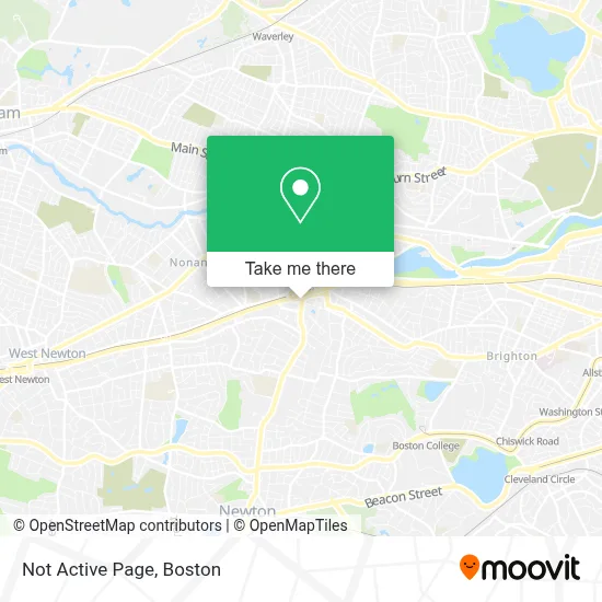
See Not Active Page, Newton, on the map
Public Transit to Not Active Page in Newton
Wondering how to get to Not Active Page in Newton? Moovit helps you find the best way to get to Not Active Page with step-by-step directions from the nearest public transit station.
Moovit provides free maps and live directions to help you navigate through your city. View schedules, routes, timetables, and find out how long does it take to get to Not Active Page in real time.
Looking for the nearest stop or station to Not Active Page? Check out this list of stops closest to your destination: 400 Centre St - West; 400 Centre St - East; Newtonville; Boston College; Newton Centre.
Bus: 504, 57, 52, 553, 554, 556, 501.Train: FRAMINGHAM/WORCESTER.Subway: GREEN LINE D, GREEN LINE B.
Want to see if there’s another route that gets you there at an earlier time? Moovit helps you find alternative routes or times. Get directions from and directions to Not Active Page easily from the Moovit App or Website.
We make riding to Not Active Page easy, which is why over 1.7 million users, including users in Newton, trust Moovit as the best app for public transit. You don’t need to download an individual bus app or train app, Moovit is your all-in-one transit app that helps you find the best bus time or train time available.
For information on prices of bus, subway and train, costs and ride fares to Not Active Page, please check the Moovit app.
Use the app to navigate to popular places including to the airport, hospital, stadium, grocery store, mall, coffee shop, school, college, and university.
Not Active Page Address: 429 Centre St street in Newton
- Atm,
- FOUR POINTS BY SHERATON Boston Newton,
- Arabic Baptist Church,
- Beth Yeshua Messianic Congregation,
- Buff's Pub,
- MBTA Bus Route 502,
- I-90 Mass Pike, Exit 17,
- Newton Corner,
- Castle Slate Roofing Company,
- Brigham and Women's at Newton Corner (Brigham & Womens-Newton Corner - Harley A Simeone MD),
- Mir 09,
- 501 Express Bus,
- House at 115-117 Jewett Street,
- Genova Construction,
- Vows Bridal Outlet,
- Sacred Threads Center,
- Vows Bridal Outlet & Bridepower,
- St. Joseph Spiritual Ministries,
- Tortissima,
- Historical Slate Roofing Co.
Places Near Not Active Page (Newton)
- Leader Bank Pavilion (Leader Bank Pavillion), Boston,
- House Of Blues, Boston,
- Quincy Market, Boston,
- Wang Theater, Boston,
- Boston Medical Center, Boston,
- Massachusetts General Hospital, Boston,
- Museum Of Science, Boston,
- Td Garden, Boston,
- Cheers, Boston,
- Boston Convention & Exhibition Center, Boston,
- Boston Common, Boston,
- Wilbur Theatre, Boston,
- Castle Island, Boston,
- Boston Children's Hospital, Boston,
- North End, Boston,
- Isabella Stewart Gardner Museum, Boston,
- Faneuil Hall, Boston,
- Seaport District, Boston,
- Prudential Center, Boston,
- Mgm Music Hall, Boston
How to get to popular places in Boston with public transit
Get around Newton by public transit!
Traveling around Newton has never been so easy. See step by step directions as you travel to any attraction, street or major public transit station. View bus and train schedules, arrival times, service alerts and detailed routes on a map, so you know exactly how to get to anywhere in Newton.
When traveling to any destination around Newton use Moovit's Live Directions with Get Off Notifications to know exactly where and how far to walk, how long to wait for your line, and how many stops are left. Moovit will alert you when it's time to get off — no need to constantly re-check whether yours is the next stop.
Wondering how to use public transit in Newton or how to pay for public transit in Newton? Moovit public transit app can help you navigate your way with public transit easily, and at minimum cost. It includes public transit fees, ticket prices, and costs. Looking for a map of Newton public transit lines? Moovit public transit app shows all public transit maps in Newton with all Bus, Train, Subway and Ferry routes and stops on an interactive map.
Boston has 4 transit type(s), including: Bus, Train, Subway and Ferry, operated by several transit agencies, including MBTA, Southeastern Regional Transit Authority, MetroWest Regional Transit Authority, Rhode Island Public Transit Authority, WRTA, Lowell Regional Transit Authority, Merrimack Valley Transit, Montachusett Regional Transit Authority, Cape Cod Regional Transit Authority, Brockton Area Transit Authority, Martha's Vineyard Transit Authority, the WAVE - Nantucket Regional Transit Authority, GATRA, Cape Ann Transportation Authority and Massport