How to get to Not Available by bus?
Click on the bus route to see step by step directions with maps, line arrival times and updated time schedules.
From Washington DC VA Medical Center, Washington
74 minFrom Filomena Ristorante, Washington
59 minFrom Black Cat, Washington
64 minFrom VA Medical Center-Washington, Washington
74 minFrom Georgetown Cupcake, Washington
60 minFrom British Embassy, Washington
64 minFrom Healy Lawn, Georgetown University, Washington
59 minFrom Ted's Bulletin, Washington
63 minFrom Franklin Hall, Washington
64 minFrom The Mansion on O Street, Washington
64 min
How to get to Not Available by metro?
Click on the metro route to see step by step directions with maps, line arrival times and updated time schedules.
From Washington DC VA Medical Center, Washington
66 minFrom Filomena Ristorante, Washington
57 minFrom Black Cat, Washington
47 minFrom VA Medical Center-Washington, Washington
66 minFrom Georgetown Cupcake, Washington
57 minFrom British Embassy, Washington
43 minFrom Healy Lawn, Georgetown University, Washington
62 minFrom Ted's Bulletin, Washington
48 minFrom Franklin Hall, Washington
49 minFrom The Mansion on O Street, Washington
33 min
Bus stops near Not Available in Montgomery County
Metro station near Not Available in Montgomery County
- Tenleytown Metro Station, 56 min walk,VIEW
Bus lines to Not Available in Montgomery County
What are the closest stations to Not Available?
The closest stations to Not Available are:
- Woodmont Av+Cheltenham Dr is 46 yards away, 1 min walk.
- Battery La & #4890 is 177 yards away, 3 min walk.
- Battery La & #4887 is 199 yards away, 3 min walk.
- Old Georgetown Rd & Fairmont Ave is 324 yards away, 5 min walk.
- Old Georgetown Rd & Woodmont Ave is 336 yards away, 5 min walk.
- Tenleytown Metro Station is 4769 yards away, 56 min walk.
Which bus lines stop near Not Available?
These bus lines stop near Not Available: D96, M70.
Which metro line stops near Not Available?
RED (Shady Grove)
What’s the nearest bus station to Not Available in Montgomery County?
The nearest bus station to Not Available in Montgomery County is Woodmont Av+Cheltenham Dr. It’s a 1 min walk away.
What time is the first metro to Not Available in Montgomery County?
The RED is the first metro that goes to Not Available in Montgomery County. It stops nearby at 5:21 AM.
What time is the last metro to Not Available in Montgomery County?
The RED is the last metro that goes to Not Available in Montgomery County. It stops nearby at 12:19 AM.
What time is the first bus to Not Available in Montgomery County?
The M70 is the first bus that goes to Not Available in Montgomery County. It stops nearby at 4:56 AM.
What time is the last bus to Not Available in Montgomery County?
The M70 is the last bus that goes to Not Available in Montgomery County. It stops nearby at 2:16 AM.
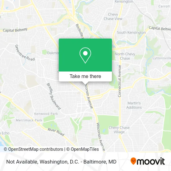
See Not Available, Montgomery County, on the map
Public Transit to Not Available in Montgomery County
Wondering how to get to Not Available in Montgomery County? Moovit helps you find the best way to get to Not Available with step-by-step directions from the nearest public transit station.
Moovit provides free maps and live directions to help you navigate through your city. View schedules, routes, timetables, and find out how long does it take to get to Not Available in real time.
Looking for the nearest stop or station to Not Available? Check out this list of stops closest to your destination: Woodmont Av+Cheltenham Dr; Battery La & #4890; Battery La & #4887; Old Georgetown Rd & Fairmont Ave; Old Georgetown Rd & Woodmont Ave; Tenleytown Metro Station.
Bus: D96, M70, 34, 70, 30, 32, 47, 29.Metro: RED.
Want to see if there’s another route that gets you there at an earlier time? Moovit helps you find alternative routes or times. Get directions from and directions to Not Available easily from the Moovit App or Website.
We make riding to Not Available easy, which is why over 1.5 million users, including users in Montgomery County, trust Moovit as the best app for public transit. You don’t need to download an individual bus app or train app, Moovit is your all-in-one transit app that helps you find the best bus time or train time available.
For information on prices of bus and metro, costs and ride fares to Not Available, please check the Moovit app.
Use the app to navigate to popular places including to the airport, hospital, stadium, grocery store, mall, coffee shop, school, college, and university.
Not Available Address: Woodmont Ave Bethesda, MD 20814 street in Montgomery County
- Blink Charging,
- Shevaesthetics,
- Salon Hours,
- Wirkus Mietek & Associates PA,
- Beyond Measure Custom,
- Alison Huang, LCPC, Mindfulness Counseling,
- Walk4hearing,
- American Assoc-Geriatric Psych,
- Premier Companies,
- Bruce Meyers - Mutual of Omaha Reverse Mortgage,
- Bethesda Maryland Divorce Criminal Defense Personal Injury Attorney,
- Viamericas Corporation,
- TGB Nextexec,
- Grow Confident LLC,
- The Caring Daughters,
- Geldon Counseling,
- Landow,
- Probate & Trust Administration,
- EC America/Govbuys,
- Trader Joe's
Places Near Not Available (Montgomery County)
- Washington DC VA Medical Center, Washington,
- M&T Bank Stadium, Baltimore,
- Camden Yards, Baltimore,
- National Mall, Washington,
- National Museum of African American History and Culture, Washington,
- Westfield Montgomery Mall, Montgomery County,
- Rock Creek Tennis Center, Washington,
- Georgetown, Washington,
- Pennsylvania Ave NW (3rd st and pennsylvania), Washington,
- National Zoo, Washington,
- Sibley Memorial Hospital, Washington,
- Amazon Hq2, Arlington County,
- Washington National Cathedral, Washington,
- Capital One Arena, Washington,
- Marriott Marquis Washington, DC, Washington,
- Basilica of the National Shrine, Washington,
- PG Mall, Prince George's County,
- Museum Of The Bible, Washington,
- Warner Theatre, Washington,
- The Anthem, Washington
How to get to popular places in Washington, D.C. - Baltimore, MD with public transit
Get around Montgomery County by public transit!
Traveling around Montgomery County has never been so easy. See step by step directions as you travel to any attraction, street or major public transit station. View bus and train schedules, arrival times, service alerts and detailed routes on a map, so you know exactly how to get to anywhere in Montgomery County.
When traveling to any destination around Montgomery County use Moovit's Live Directions with Get Off Notifications to know exactly where and how far to walk, how long to wait for your line, and how many stops are left. Moovit will alert you when it's time to get off — no need to constantly re-check whether yours is the next stop.
Wondering how to use public transit in Montgomery County or how to pay for public transit in Montgomery County? Moovit public transit app can help you navigate your way with public transit easily, and at minimum cost. It includes public transit fees, ticket prices, and costs. Looking for a map of Montgomery County public transit lines? Moovit public transit app shows all public transit maps in Montgomery County with all Bus, Train, Metro, Light Rail and Ferry routes and stops on an interactive map.
Washington, D.C. - Baltimore, MD has 5 transit type(s), including: Bus, Train, Metro, Light Rail and Ferry, operated by several transit agencies, including WMATA, Montgomery County Ride On, Fairfax Connector, TheBus, PRTC, DASH - Alexandria, Arlington Transit (ART), RTA of Central Maryland, MDOT MTA, MDOT MTA Light RailLink, MDOT MTA Commuter Bus, MDOT MTA Local Bus, FXBGO!, Virginia Railway Express (VRE) and MARC