How to get to Beyond Measure Custom by bus?
Click on the bus route to see step by step directions with maps, line arrival times and updated time schedules.
From VA Medical Center-Washington, Washington
75 minFrom Georgetown, Washington
59 minFrom Massachusetts Ave NW, Washington
34 minFrom Ted's Bulletin, Washington
64 minFrom Citi Open, Washington
47 minFrom Washington DC VA Medical Center, Washington
75 minFrom Holy Cross Hospital, Montgomery County
37 minFrom Omni Shoreham Hotel, Washington
65 minFrom U Street Metro Station, Washington
66 minFrom The Mansion on O Street, Washington
65 min
How to get to Beyond Measure Custom by metro?
Click on the metro route to see step by step directions with maps, line arrival times and updated time schedules.
From VA Medical Center-Washington, Washington
67 minFrom Georgetown, Washington
57 minFrom Massachusetts Ave NW, Washington
38 minFrom Ted's Bulletin, Washington
48 minFrom Washington DC VA Medical Center, Washington
67 minFrom Holy Cross Hospital, Montgomery County
61 minFrom Omni Shoreham Hotel, Washington
29 minFrom U Street Metro Station, Washington
41 minFrom The Mansion on O Street, Washington
33 min
Bus stops near Beyond Measure Custom in Montgomery County
Metro station near Beyond Measure Custom in Montgomery County
- Tenleytown Metro Station, 51 min walk,VIEW
Bus lines to Beyond Measure Custom in Montgomery County
What are the closest stations to Beyond Measure Custom?
The closest stations to Beyond Measure Custom are:
- Wisconsin Av+Cheltenham Dr is 218 yards away, 3 min walk.
- Woodmont Av & Battery La is 379 yards away, 5 min walk.
- Old Georgetown Rd & Fairmont Ave is 462 yards away, 6 min walk.
- Wilson Ln & Old Georgetown Rd is 465 yards away, 6 min walk.
- Tenleytown Metro Station is 4301 yards away, 51 min walk.
Which bus lines stop near Beyond Measure Custom?
These bus lines stop near Beyond Measure Custom: D96, M70.
Which metro line stops near Beyond Measure Custom?
RED (Shady Grove)
What’s the nearest bus station to Beyond Measure Custom in Montgomery County?
The nearest bus station to Beyond Measure Custom in Montgomery County is Wisconsin Av+Cheltenham Dr. It’s a 3 min walk away.
What time is the first metro to Beyond Measure Custom in Montgomery County?
The RED is the first metro that goes to Beyond Measure Custom in Montgomery County. It stops nearby at 5:21 AM.
What time is the last metro to Beyond Measure Custom in Montgomery County?
The RED is the last metro that goes to Beyond Measure Custom in Montgomery County. It stops nearby at 12:19 AM.
What time is the first bus to Beyond Measure Custom in Montgomery County?
The M70 is the first bus that goes to Beyond Measure Custom in Montgomery County. It stops nearby at 4:56 AM.
What time is the last bus to Beyond Measure Custom in Montgomery County?
The M70 is the last bus that goes to Beyond Measure Custom in Montgomery County. It stops nearby at 2:16 AM.
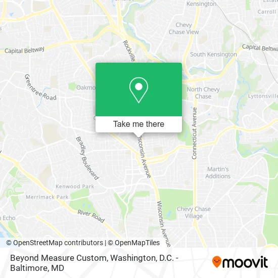
See Beyond Measure Custom, Montgomery County, on the map
Public Transit to Beyond Measure Custom in Montgomery County
Wondering how to get to Beyond Measure Custom in Montgomery County? Moovit helps you find the best way to get to Beyond Measure Custom with step-by-step directions from the nearest public transit station.
Moovit provides free maps and live directions to help you navigate through your city. View schedules, routes, timetables, and find out how long does it take to get to Beyond Measure Custom in real time.
Looking for the nearest stop or station to Beyond Measure Custom? Check out this list of stops closest to your destination: Wisconsin Av+Cheltenham Dr; Woodmont Av & Battery La; Old Georgetown Rd & Fairmont Ave; Wilson Ln & Old Georgetown Rd; Tenleytown Metro Station.
Bus: D96, M70, 34, 70, 29, 30, 32, 47.Metro: RED.
Want to see if there’s another route that gets you there at an earlier time? Moovit helps you find alternative routes or times. Get directions from and directions to Beyond Measure Custom easily from the Moovit App or Website.
We make riding to Beyond Measure Custom easy, which is why over 1.5 million users, including users in Montgomery County, trust Moovit as the best app for public transit. You don’t need to download an individual bus app or train app, Moovit is your all-in-one transit app that helps you find the best bus time or train time available.
For information on prices of bus and metro, costs and ride fares to Beyond Measure Custom, please check the Moovit app.
Use the app to navigate to popular places including to the airport, hospital, stadium, grocery store, mall, coffee shop, school, college, and university.
Beyond Measure Custom Address: 8001 Woodmont Ave Bethesda, MD 20814 street in Montgomery County
- Blink Charging,
- Paint Nail Bar,
- Not Available,
- Shevaesthetics,
- Wirkus Mietek & Associates PA,
- Salon Hours,
- Wisconsin Ave West Ave,
- Ranger Surplus,
- Harmony,
- EC America/Govbuys,
- Trader Joe's,
- Clean and Bright Carpet Cleaning Carpet Cleaning,
- Palisades Eye Surgery Center ,
- Best for DMV,
- Cordell Ave & MD-355,
- Lot 8,
- Walk4hearing,
- TGB Nextexec,
- Viamericas Corporation,
- Geldon Counseling
Places Near Beyond Measure Custom (Montgomery County)
- Pennsylvania Ave NW (3rd st and pennsylvania), Washington,
- National Mall, Washington,
- Georgetown, Washington,
- PG Mall, Prince George's County,
- Museum Of The Bible, Washington,
- Westfield Montgomery Mall, Montgomery County,
- Washington National Cathedral, Washington,
- Rock Creek Tennis Center, Washington,
- Capital One Arena, Washington,
- Marriott Marquis Washington, DC, Washington,
- Washington DC VA Medical Center, Washington,
- Warner Theatre, Washington,
- Camden Yards, Baltimore,
- Basilica of the National Shrine, Washington,
- Amazon Hq2, Arlington County,
- Sibley Memorial Hospital, Washington,
- National Museum of African American History and Culture, Washington,
- The Anthem, Washington,
- National Zoo, Washington,
- M&T Bank Stadium, Baltimore
How to get to popular places in Washington, D.C. - Baltimore, MD with public transit
Get around Montgomery County by public transit!
Traveling around Montgomery County has never been so easy. See step by step directions as you travel to any attraction, street or major public transit station. View bus and train schedules, arrival times, service alerts and detailed routes on a map, so you know exactly how to get to anywhere in Montgomery County.
When traveling to any destination around Montgomery County use Moovit's Live Directions with Get Off Notifications to know exactly where and how far to walk, how long to wait for your line, and how many stops are left. Moovit will alert you when it's time to get off — no need to constantly re-check whether yours is the next stop.
Wondering how to use public transit in Montgomery County or how to pay for public transit in Montgomery County? Moovit public transit app can help you navigate your way with public transit easily, and at minimum cost. It includes public transit fees, ticket prices, and costs. Looking for a map of Montgomery County public transit lines? Moovit public transit app shows all public transit maps in Montgomery County with all Bus, Train, Metro, Light Rail and Ferry routes and stops on an interactive map.
Washington, D.C. - Baltimore, MD has 5 transit type(s), including: Bus, Train, Metro, Light Rail and Ferry, operated by several transit agencies, including WMATA, Montgomery County Ride On, Fairfax Connector, TheBus, PRTC, DASH - Alexandria, Arlington Transit (ART), RTA of Central Maryland, MDOT MTA, MDOT MTA Light RailLink, MDOT MTA Commuter Bus, MDOT MTA Local Bus, FXBGO!, Virginia Railway Express (VRE) and MARC