How to get to Novabuild by bus?
Click on the bus route to see step by step directions with maps, line arrival times and updated time schedules.
From Optimhome Brochard Sophie Mandataire Indépendant, Mulsanne
53 minFrom Auchan Drive Le Mans, Saint-Saturnin
39 minFrom La Pataterie, Trangé
72 minFrom Auchan, La Chapelle-Saint-Aubin
45 minFrom Teloché, Mulsanne
45 minFrom Carrefour Market, Mulsanne
40 minFrom Les Sablons, Allonnes
40 minFrom Pouic Cochon, Mulsanne
49 minFrom Champagné, Champagné
36 min
Bus stops near Novabuild in Le Mans
Bus lines to Novabuild in Le Mans
- 5, Gazonfier - Oasis-Centre des Expositions,VIEW
- 6, République - St-Martin,VIEW
- 12, Domaine de Beauregard - Zamenhof,VIEW
- 14, Parc Manceau - St-Martin,VIEW
- 23, République - Yvré-l'Évêque,VIEW
- 25, République - Champagné,VIEW
- 31, Malpalu - EHPAD,VIEW
- 25EX, République - La Baronnière,VIEW
- M, La Mancelle,VIEW
- T2, Espal-Arche de la Nature - Bellevue-Hauts de C.,VIEW
- T1, Ant-Circuit 24h,VIEW
- 35, Sécurité Sociale,VIEW
- 110, Sainte Hélène,VIEW
- 4, St-Georges / St-Joseph – Bellevue-Hauts de C.,VIEW
- 7, Éperon par Auchan,VIEW
- 11, Le Cadran / St-Aubin - Closerie,VIEW
- 16, Lafayette - Californie,VIEW
- 17, Gallière - Eperon,VIEW
- 20, Éperon - Aigné,VIEW
What are the closest stations to Novabuild?
The closest stations to Novabuild are:
- Comtes Du Maine is 188 meters away, 3 min walk.
- République is 604 meters away, 8 min walk.
- Paixhans is 720 meters away, 10 min walk.
- St-Exupéry is 730 meters away, 10 min walk.
- Lafayette is 3588 meters away, 47 min walk.
Which bus lines stop near Novabuild?
These bus lines stop near Novabuild: 12, 14, 25EX, 5, T3.
Which light rail line stops near Novabuild?
T1 (Antares Stade)
What’s the nearest bus station to Novabuild in Le Mans?
The nearest bus station to Novabuild in Le Mans is Comtes Du Maine. It’s a 3 min walk away.
What time is the first light rail to Novabuild in Le Mans?
The T2 is the first light rail that goes to Novabuild in Le Mans. It stops nearby at 5:10 AM.
What time is the last light rail to Novabuild in Le Mans?
The T1 is the last light rail that goes to Novabuild in Le Mans. It stops nearby at 1:12 AM.
What time is the first bus to Novabuild in Le Mans?
The 25 is the first bus that goes to Novabuild in Le Mans. It stops nearby at 5:22 AM.
What time is the last bus to Novabuild in Le Mans?
The 5 is the last bus that goes to Novabuild in Le Mans. It stops nearby at 11:50 PM.
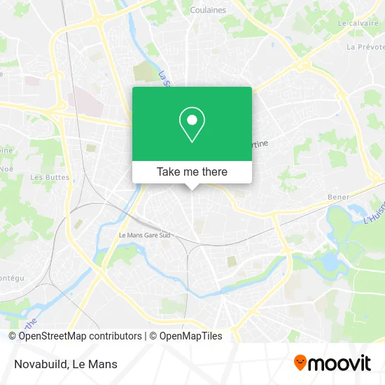
See Novabuild, Le Mans, on the map
Public Transit to Novabuild in Le Mans
Wondering how to get to Novabuild in Le Mans? Moovit helps you find the best way to get to Novabuild with step-by-step directions from the nearest public transit station.
Moovit provides free maps and live directions to help you navigate through your city. View schedules, routes, timetables, and find out how long does it take to get to Novabuild in real time.
Looking for the nearest stop or station to Novabuild? Check out this list of stops closest to your destination: Comtes Du Maine; République; Paixhans; St-Exupéry; Lafayette.
Bus: 12, 14, 25EX, 5, T3, 6, 23, T1, 35, 110, 4, 7, 11, 16, 17.Light Rail: T1.
Want to see if there’s another route that gets you there at an earlier time? Moovit helps you find alternative routes or times. Get directions from and directions to Novabuild easily from the Moovit App or Website.
We make riding to Novabuild easy, which is why over 1.5 million users, including users in Le Mans, trust Moovit as the best app for public transit. You don’t need to download an individual bus app or train app, Moovit is your all-in-one transit app that helps you find the best bus time or train time available.
For information on prices of bus and light rail, costs and ride fares to Novabuild, please check the Moovit app.
Use the app to navigate to popular places including to the airport, hospital, stadium, grocery store, mall, coffee shop, school, college, and university.
Novabuild Address: 1 Rue de la Mariette 72000 Le Mans street in Le Mans
- Rue de la Mariette 7,
- Groupe Dorise,
- Rue Erpell 15,
- Rue Chanzy,
- Parc Victor Hugo,
- Centre de Soins Pour Adolescents,
- Csa E.P.S.M. Chanzy,
- U.N.A.F.A.M,
- Herve N Sellier,
- Parc Victor Hugo — Jardin de la Préfecture,
- Hôtel Mercure Le Mans Centre,
- Amazon Locker-Davis,
- Le Chanzy Bar Tabac,
- Collège Berthelot,
- Centre Auto Sport le Mans,
- Carrefour Express,
- Apef,
- Le Beau Verger,
- Centre Jean Bernard,
- Vega
Places Near Novabuild (Le Mans)
- Place des Jacobins (le Mans), Le Mans,
- Coulaines, Coulaines,
- Saint-Saturnin, Saint-Saturnin,
- Clinique Du Pré, Le Mans,
- Maison D'Arrêt Le Mans - Les Croisettes, Coulaines,
- E.Leclerc, Le Mans,
- Pôle Santé Sud-Elsan, Le Mans,
- Changé, Changé,
- La Chapelle-Saint-Aubin, La Chapelle-Saint-Aubin,
- Auchan le Mans, La Chapelle-Saint-Aubin,
- Centre Hospitalier Du Mans, Le Mans,
- Hôpital, Le Mans,
- Circuit des 24 Heures du Mans, Le Mans,
- Family Village, Ruaudin,
- Gare SNCF du Mans, Le Mans,
- Avenue Bollée, Le Mans,
- Camp du 2e RIMa, Champagné,
- Université, Le Mans,
- Clinique Pôle Santé Sud, Le Mans,
- Parc Des Expositions, Le Mans
How to get to popular places in Le Mans with public transit
Get around Le Mans by public transit!
Traveling around Le Mans has never been so easy. See step by step directions as you travel to any attraction, street or major public transit station. View bus and train schedules, arrival times, service alerts and detailed routes on a map, so you know exactly how to get to anywhere in Le Mans.
When traveling to any destination around Le Mans use Moovit's Live Directions with Get Off Notifications to know exactly where and how far to walk, how long to wait for your line, and how many stops are left. Moovit will alert you when it's time to get off — no need to constantly re-check whether yours is the next stop.
Wondering how to use public transit in Le Mans or how to pay for public transit in Le Mans? Moovit public transit app can help you navigate your way with public transit easily, and at minimum cost. It includes public transit fees, ticket prices, and costs. Looking for a map of Le Mans public transit lines? Moovit public transit app shows all public transit maps in Le Mans with all Bus and Light Rail routes and stops on an interactive map.
Le Mans has 2 transit type(s), including: Bus and Light Rail, operated by several transit agencies, including SETRAM