Directions to Nsod (Waltham) with public transportation
The following transit lines have routes that pass near Nsod
 Bus: 70, 558, 554.
- Train: FRAMINGHAM/WORCESTER, FITCHBURG.
How to get to Nsod by bus?
Click on the bus route to see step by step directions with maps, line arrival times and updated time schedules.
From Hotel Commonwealth, Boston
46 minFrom Fenway Park-Gate C Entrance, Boston
53 minFrom MSPCA Angell Animal Medical Center, Boston
75 minFrom Isabella Stewart Gardner Museum, Boston
72 minFrom Mspca, Boston
74 minFrom Moderna Therapeutics - Corporate Headquarters, Cambridge
58 minFrom Harvard Business School, Boston
32 minFrom Wellesley, MA, Wellesley
77 minFrom Christian A Herter Park, Boston
31 minFrom Angell Animal Medical Center (Mspca Angell), Boston
74 min
How to get to Nsod by train?
Click on the train route to see step by step directions with maps, line arrival times and updated time schedules.
Bus stops near Nsod in Waltham
What are the closest stations to Nsod?
The closest stations to Nsod are:
- Main St @ Warren St - Waltham Line is 313 yards away, 4 min walk.
- Pleasant St @ Repton Pl is 382 yards away, 5 min walk.
- Beaver St @ Warren St is 974 yards away, 12 min walk.
- West Newton is 1395 yards away, 17 min walk.
- Waverley is 3110 yards away, 37 min walk.
Which bus line stops near Nsod?
70 (Waltham Center)
Which train line stops near Nsod?
FRAMINGHAM/WORCESTER (#521 | Worcester)
What’s the nearest train station to Nsod in Waltham?
The nearest train station to Nsod in Waltham is West Newton. It’s a 17 min walk away.
What’s the nearest bus station to Nsod in Waltham?
The nearest bus station to Nsod in Waltham is Main St @ Warren St - Waltham Line. It’s a 4 min walk away.
What time is the first train to Nsod in Waltham?
The FRAMINGHAM/WORCESTER is the first train that goes to Nsod in Waltham. It stops nearby at 5:22 AM.
What time is the last train to Nsod in Waltham?
The FRAMINGHAM/WORCESTER is the last train that goes to Nsod in Waltham. It stops nearby at 12:20 AM.
What time is the first bus to Nsod in Waltham?
The 70 is the first bus that goes to Nsod in Waltham. It stops nearby at 4:43 AM.
What time is the last bus to Nsod in Waltham?
The 70 is the last bus that goes to Nsod in Waltham. It stops nearby at 12:46 AM.
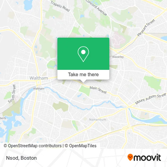
See Nsod, Waltham, on the map
Public Transit to Nsod in Waltham
Wondering how to get to Nsod in Waltham? Moovit helps you find the best way to get to Nsod with step-by-step directions from the nearest public transit station.
Moovit provides free maps and live directions to help you navigate through your city. View schedules, routes, timetables, and find out how long does it take to get to Nsod in real time.
Looking for the nearest stop or station to Nsod? Check out this list of stops closest to your destination: Main St @ Warren St - Waltham Line; Pleasant St @ Repton Pl; Beaver St @ Warren St; West Newton; Waverley.
Bus: 70, 558, 554.Train: FRAMINGHAM/WORCESTER, FITCHBURG.
Want to see if there’s another route that gets you there at an earlier time? Moovit helps you find alternative routes or times. Get directions from and directions to Nsod easily from the Moovit App or Website.
We make riding to Nsod easy, which is why over 1.7 million users, including users in Waltham, trust Moovit as the best app for public transit. You don’t need to download an individual bus app or train app, Moovit is your all-in-one transit app that helps you find the best bus time or train time available.
For information on prices of bus and train, costs and ride fares to Nsod, please check the Moovit app.
Use the app to navigate to popular places including to the airport, hospital, stadium, grocery store, mall, coffee shop, school, college, and university.
Nsod Address: 14 Warren St street in Waltham
- Veggie Crust,
- Lord Jesus Christ,
- Entering Watertown,
- Early Childhood Professional Development,
- Overhead Door,
- Lifebloom Candles,
- Waltham Fire Department Engine 3 Station,
- The New York Mta,
- Charchaflian PI,
- AT&T,
- Bj's Wholesale Club,
- Montesin Enterprises,
- GMT Home Design,
- Bemis Park,
- EV Connect,
- Pegas Appliance Repair,
- Middlesex Human Services,
- American Legion (Waltham Post Number 156 the American),
- Watertown Public Schools,
- Locksmith
Places Near Nsod (Waltham)
- Faneuil Hall, Boston,
- North End, Boston,
- Cheers, Boston,
- Boston Children's Hospital, Boston,
- Castle Island, Boston,
- Isabella Stewart Gardner Museum, Boston,
- House Of Blues, Boston,
- Boston Convention & Exhibition Center, Boston,
- Td Garden, Boston,
- Massachusetts General Hospital, Boston,
- Wang Theater, Boston,
- Wilbur Theatre, Boston,
- Prudential Center, Boston,
- Mgm Music Hall, Boston,
- Quincy Market, Boston,
- Leader Bank Pavilion (Leader Bank Pavillion), Boston,
- Boston Medical Center, Boston,
- Boston Common, Boston,
- Museum Of Science, Boston,
- Seaport District, Boston
How to get to popular places in Boston with public transit
Get around Waltham by public transit!
Traveling around Waltham has never been so easy. See step by step directions as you travel to any attraction, street or major public transit station. View bus and train schedules, arrival times, service alerts and detailed routes on a map, so you know exactly how to get to anywhere in Waltham.
When traveling to any destination around Waltham use Moovit's Live Directions with Get Off Notifications to know exactly where and how far to walk, how long to wait for your line, and how many stops are left. Moovit will alert you when it's time to get off — no need to constantly re-check whether yours is the next stop.
Wondering how to use public transit in Waltham or how to pay for public transit in Waltham? Moovit public transit app can help you navigate your way with public transit easily, and at minimum cost. It includes public transit fees, ticket prices, and costs. Looking for a map of Waltham public transit lines? Moovit public transit app shows all public transit maps in Waltham with all Bus, Train, Subway and Ferry routes and stops on an interactive map.
Boston has 4 transit type(s), including: Bus, Train, Subway and Ferry, operated by several transit agencies, including MBTA, Southeastern Regional Transit Authority, MetroWest Regional Transit Authority, Rhode Island Public Transit Authority, WRTA, Lowell Regional Transit Authority, Merrimack Valley Transit, Montachusett Regional Transit Authority, Cape Cod Regional Transit Authority, Brockton Area Transit Authority, Martha's Vineyard Transit Authority, the WAVE - Nantucket Regional Transit Authority, GATRA, Cape Ann Transportation Authority and Massport