Directions to Nuroo (Boston) with public transportation
The following transit lines have routes that pass near Nuroo
 Bus: 4, 501, 504, 7, SL4.
- Train: FITCHBURG, FRAMINGHAM/WORCESTER, LOWELL, NEEDHAM, COMMUTER RAIL SHUTTLE.
- Subway: RED LINE.
- Ferry: QUINCY FERRY, WINTHROP FERRY, WINTHROP/QUINCY FERRY, EAST, LOVEJOY - FAN PIER - PIER 10.
How to get to Nuroo by bus?
Click on the bus route to see step by step directions with maps, line arrival times and updated time schedules.
From The Mall At Chestnut Hill, Newton
78 minFrom Goodwill Store, Boston
66 minFrom 1 Brookline Place, Brookline
47 minFrom Milton Academy, Milton
103 minFrom Jamaica Pond, Boston
58 minFrom Brookline, MA, Brookline
63 minFrom Brattle St / Harvard Sq, Cambridge
59 minFrom Alumni Stadium, Newton
72 minFrom Regent Theatre, Arlington
75 minFrom Watertown, MA, Watertown Town
52 min
How to get to Nuroo by train?
Click on the train route to see step by step directions with maps, line arrival times and updated time schedules.
How to get to Nuroo by subway?
Click on the subway route to see step by step directions with maps, line arrival times and updated time schedules.
Bus stops near Nuroo in Boston
Train station near Nuroo in Boston
- South Station, 6 min walk,VIEW
Ferry stations near Nuroo in Boston
Bus lines to Nuroo in Boston
- 4, North Station Via South Station,VIEW
- SL1, South Station - Logan Airport,VIEW
- SL2, South Station - Design Center,VIEW
- SL3, South Station - Chelsea,VIEW
- SLW, South Station - Silver Line Way,VIEW
- FLIXBUS 2610, NYC - Boston,VIEW
- FLIXBUS 2611, NYC Chinatown - Boston,VIEW
- FLIXBUS 2612, NYC Queens - Boston,VIEW
- FLIXBUS 2614, Newark - Boston,VIEW
- FLIXBUS 2619, Boston - NYC - Philadelphia,VIEW
- FLIXBUS 2691, Boston - Albany - Ithaca,VIEW
- FLIXBUS 2693, Boston - Albany,VIEW
- FLIXBUS N2605, Boston - NYC - Richmond,VIEW
- FLIXBUS N2610, NYC - Boston,VIEW
- FLIXBUS N2615, NYC - Boston - Portland - Bangor,VIEW
- GREYHOUND US0171, Cleveland - Buffalo - Boston,VIEW
- GREYHOUND US0230, Boston - New York (Express Service),VIEW
- GREYHOUND US0231, Boston - New York (Weekend Service),VIEW
- GREYHOUND US0235, Boston - Philadelphia - Washington,VIEW
- GREYHOUND US0240, New York - Hartford - Boston,VIEW
What are the closest stations to Nuroo?
The closest stations to Nuroo are:
- Seaport Blvd @ Sleeper St is 230 yards away, 3 min walk.
- Courthouse is 241 yards away, 3 min walk.
- South Station Bus Terminal is 424 yards away, 6 min walk.
- South Station is 460 yards away, 6 min walk.
- Summer St @ Atlantic Ave is 504 yards away, 7 min walk.
- Rowes Wharf is 504 yards away, 7 min walk.
- Seaport (Fan Pier) is 541 yards away, 7 min walk.
- Summer St @ South Station - Red Line Entrance is 569 yards away, 8 min walk.
- Boston-South Station is 656 yards away, 8 min walk.
- World Trade Center Pier, Boston, MA is 786 yards away, 10 min walk.
Which bus lines stop near Nuroo?
These bus lines stop near Nuroo: 4, 501, 504, 7, SL4.
Which train lines stop near Nuroo?
These train lines stop near Nuroo: FITCHBURG, FRAMINGHAM/WORCESTER, LOWELL, NEEDHAM.
Which subway line stops near Nuroo?
RED LINE (Ashmont/Braintree)
What’s the nearest train station to Nuroo in Boston?
The nearest train station to Nuroo in Boston is South Station. It’s a 6 min walk away.
What’s the nearest bus station to Nuroo in Boston?
The nearest bus stations to Nuroo in Boston are Seaport Blvd @ Sleeper St and Courthouse. The closest one is a 3 min walk away.
What’s the nearest ferry station to Nuroo in Boston?
The nearest ferry stations to Nuroo in Boston are Rowes Wharf and Seaport (Fan Pier). The closest one is a 7 min walk away.
What time is the first subway to Nuroo in Boston?
The RED LINE is the first subway that goes to Nuroo in Boston. It stops nearby at 5:30 AM.
What time is the last subway to Nuroo in Boston?
The RED LINE is the last subway that goes to Nuroo in Boston. It stops nearby at 1:49 AM.
What time is the first train to Nuroo in Boston?
The PROVIDENCE/STOUGHTON is the first train that goes to Nuroo in Boston. It stops nearby at 4:20 AM.
What time is the last train to Nuroo in Boston?
The LAKE SHORE LIMITED is the last train that goes to Nuroo in Boston. It stops nearby at 8:32 PM.
What time is the first bus to Nuroo in Boston?
The SLW is the first bus that goes to Nuroo in Boston. It stops nearby at 4:15 AM.
What time is the last bus to Nuroo in Boston?
The FLIXBUS N2605 is the last bus that goes to Nuroo in Boston. It stops nearby at 9:25 AM.
What time is the first ferry to Nuroo in Boston?
The EAST is the first ferry that goes to Nuroo in Boston. It stops nearby at 6:01 AM.
What time is the last ferry to Nuroo in Boston?
The FAST FERRY is the last ferry that goes to Nuroo in Boston. It stops nearby at 9:05 PM.
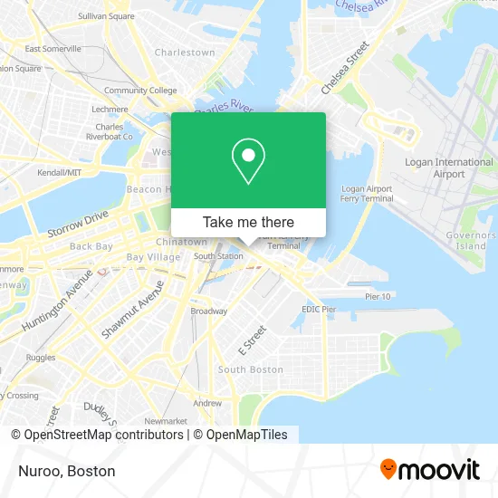
See Nuroo, Boston, on the map
Public Transit to Nuroo in Boston
Wondering how to get to Nuroo in Boston? Moovit helps you find the best way to get to Nuroo with step-by-step directions from the nearest public transit station.
Moovit provides free maps and live directions to help you navigate through your city. View schedules, routes, timetables, and find out how long does it take to get to Nuroo in real time.
Looking for the nearest stop or station to Nuroo? Check out this list of stops closest to your destination: Seaport Blvd @ Sleeper St; Courthouse; South Station Bus Terminal; South Station; Summer St @ Atlantic Ave; Rowes Wharf; Seaport (Fan Pier); Summer St @ South Station - Red Line Entrance; Boston-South Station; World Trade Center Pier.
Bus: 4, 501, 504, 7, SL4, SL1, SL2, SL3, SLW, FLIXBUS 2610, FLIXBUS 2611, FLIXBUS 2612, FLIXBUS 2614, FLIXBUS 2619, RED LINE SHUTTLE, RED LINE SHUTTLE, RED LINE SHUTTLE, RED LINE SHUTTLE.Train: FITCHBURG, FRAMINGHAM/WORCESTER, LOWELL, NEEDHAM, COMMUTER RAIL SHUTTLE, FAIRMOUNT LINE SHUTTLE, FRANKLIN LINE SHUTTLE, KINGSTON LINE SHUTTLE, WORCESTER LINE SHUTTLE.Subway: RED LINE.Ferry: QUINCY FERRY, WINTHROP FERRY, WINTHROP/QUINCY FERRY, EAST, LOVEJOY - FAN PIER - PIER 10.
Want to see if there’s another route that gets you there at an earlier time? Moovit helps you find alternative routes or times. Get directions from and directions to Nuroo easily from the Moovit App or Website.
We make riding to Nuroo easy, which is why over 1.7 million users, including users in Boston, trust Moovit as the best app for public transit. You don’t need to download an individual bus app or train app, Moovit is your all-in-one transit app that helps you find the best bus time or train time available.
For information on prices of subway, bus and train, costs and ride fares to Nuroo, please check the Moovit app.
Use the app to navigate to popular places including to the airport, hospital, stadium, grocery store, mall, coffee shop, school, college, and university.
Nuroo Address: 280 Summer St street in Boston
- Smoke Shop BBQ,
- The Artist Building at 300 Summer Street,
- Grand Circle Gallery,
- New Balance Hubway,
- Boston Wharf Co. Sign,
- Robert S Kutner Lawyer (Gregg S Blackburn Lawyer),
- Sze Chia-Ming Architects,
- Morrison Mahoney Llp,
- Sportello,
- Bos17 - Amazon,
- Columbia Construction on Company at Amazon,
- Lucky's Lounge,
- Lolita,
- Karen Kelly Photography,
- Flour Bakery,
- Trillium Brewing,
- Trillium Brewing Company,
- Sonja Haviland Design (Lewis Lighting Design),
- Hood Milk Bottle,
- Caffe Nero
Places Near Nuroo (Boston)
- Castle Island, Boston,
- North End, Boston,
- Td Garden, Boston,
- House Of Blues, Boston,
- Leader Bank Pavilion (Leader Bank Pavillion), Boston,
- Boston Common, Boston,
- Mgm Music Hall, Boston,
- Wang Theater, Boston,
- Boston Children's Hospital, Boston,
- Museum Of Science, Boston,
- Massachusetts General Hospital, Boston,
- Boston Medical Center, Boston,
- Seaport District, Boston,
- Prudential Center, Boston,
- Faneuil Hall, Boston,
- Quincy Market, Boston,
- Isabella Stewart Gardner Museum, Boston,
- Boston Convention & Exhibition Center, Boston,
- Cheers, Boston,
- Wilbur Theatre, Boston
How to get to popular places in Boston with public transit
Get around Boston by public transit!
Traveling around Boston has never been so easy. See step by step directions as you travel to any attraction, street or major public transit station. View bus and train schedules, arrival times, service alerts and detailed routes on a map, so you know exactly how to get to anywhere in Boston.
When traveling to any destination around Boston use Moovit's Live Directions with Get Off Notifications to know exactly where and how far to walk, how long to wait for your line, and how many stops are left. Moovit will alert you when it's time to get off — no need to constantly re-check whether yours is the next stop.
Wondering how to use public transit in Boston or how to pay for public transit in Boston? Moovit public transit app can help you navigate your way with public transit easily, and at minimum cost. It includes public transit fees, ticket prices, and costs. Looking for a map of Boston public transit lines? Moovit public transit app shows all public transit maps in Boston with all Bus, Train, Subway and Ferry routes and stops on an interactive map.
Boston has 4 transit type(s), including: Bus, Train, Subway and Ferry, operated by several transit agencies, including MBTA, Southeastern Regional Transit Authority, MetroWest Regional Transit Authority, Rhode Island Public Transit Authority, WRTA, Lowell Regional Transit Authority, Merrimack Valley Transit, Montachusett Regional Transit Authority, Cape Cod Regional Transit Authority, Brockton Area Transit Authority, Martha's Vineyard Transit Authority, the WAVE - Nantucket Regional Transit Authority, GATRA, Cape Ann Transportation Authority and Massport