Directions to Nurtury Horadan Way (Boston) with public transportation
The following transit lines have routes that pass near Nurtury Horadan Way
 Bus: 39, 47, 66, 85, 28.
- Train: PROVIDENCE/STOUGHTON, FRANKLIN/FOXBORO, NEEDHAM.
- Subway: GREEN LINE E, ORANGE LINE.
How to get to Nurtury Horadan Way by bus?
Click on the bus route to see step by step directions with maps, line arrival times and updated time schedules.
From Assembly Row, Somerville
65 minFrom Fort Independence, Boston
68 minFrom Washington St, Boston
55 minFrom Regent Theatre, Arlington
89 minFrom Conte Forum, Boston
59 minFrom Georgetown, Massachusetts, Boston
65 minFrom AC Hotel Boston Cambridge, Cambridge
91 minFrom McLean Hospital, Belmont
92 minFrom Academy Of the Pacific Rim Charter Public School, Boston
64 minFrom Belle Isle Lobster & Seafood, Winthrop Town
102 min
How to get to Nurtury Horadan Way by train?
Click on the train route to see step by step directions with maps, line arrival times and updated time schedules.
How to get to Nurtury Horadan Way by subway?
Click on the subway route to see step by step directions with maps, line arrival times and updated time schedules.
Bus stops near Nurtury Horadan Way in Boston
Subway stations near Nurtury Horadan Way in Boston
Train station near Nurtury Horadan Way in Boston
- Ruggles, 10 min walk,VIEW
Bus lines to Nurtury Horadan Way in Boston
- 28, Avenue Louis Pasteur Via Ruggles,VIEW
- 35, Dedham Mall,VIEW
- 39, Haymarket Via Forest Hills,VIEW
- 85, Ruggles,VIEW
- GREEN LINE E SHUTTLE, Park Street (Shuttle),VIEW
- GREEN LINE E SHUTTLE, Prudential (Shuttle),VIEW
- 66, Harvard Via Allston,VIEW
- 19, Gallivan Blvd,VIEW
- 22, Ruggles - Ashmont,VIEW
- ORANGE LINE SHUTTLE, Forest Hills - Back Bay (Shuttle),VIEW
- ORANGE LINE SHUTTLE, Forest Hills - Ruggles,VIEW
- ORANGE LINE SHUTTLE, Forest Hills - Copley,VIEW
- ORANGE LINE SHUTTLE, Forest Hills - Back Bay via Ruggles Busway (Shuttle),VIEW
- ORANGE LINE SHUTTLE, Jackson Square - Copley,VIEW
- ORANGE LINE SHUTTLE, Jackson Square - Back Bay,VIEW
- ORANGE LINE SHUTTLE, Forest Hills - Back Bay via Copley (Shuttle),VIEW
- 15, Ruggles - Fields Corner,VIEW
- 23, Ruggles - Ashmont,VIEW
- 44, Ruggles - Jackson Square,VIEW
- 45, Ruggles - Franklin Park,VIEW
What are the closest stations to Nurtury Horadan Way?
The closest stations to Nurtury Horadan Way are:
- Huntington Ave @ Longwood Ave is 47 yards away, 1 min walk.
- Roxbury Crossing is 61 yards away, 1 min walk.
- Tremont St @ Columbus Ave is 74 yards away, 1 min walk.
- Tremont St Opp Roxbury Crossing Sta is 81 yards away, 2 min walk.
- Tremont St @ Roxbury Crossing Station is 132 yards away, 2 min walk.
- Malcolm X Blvd @ Tremont St is 257 yards away, 4 min walk.
- Ruggles St @ Huntington Ave is 498 yards away, 7 min walk.
- Brigham Circle is 783 yards away, 10 min walk.
- Ruggles is 837 yards away, 10 min walk.
Which bus lines stop near Nurtury Horadan Way?
These bus lines stop near Nurtury Horadan Way: 39, 47, 66, 85.
Which train line stops near Nurtury Horadan Way?
PROVIDENCE/STOUGHTON (#828 | South Station)
Which subway lines stop near Nurtury Horadan Way?
These subway lines stop near Nurtury Horadan Way: GREEN LINE E, ORANGE LINE.
What’s the nearest subway station to Nurtury Horadan Way in Boston?
The nearest subway station to Nurtury Horadan Way in Boston is Roxbury Crossing. It’s a 1 min walk away.
What’s the nearest train station to Nurtury Horadan Way in Boston?
The nearest train station to Nurtury Horadan Way in Boston is Ruggles. It’s a 10 min walk away.
What’s the nearest bus station to Nurtury Horadan Way in Boston?
The nearest bus stations to Nurtury Horadan Way in Boston are Huntington Ave @ Longwood Ave and Tremont St @ Columbus Ave. The closest one is a 1 min walk away.
What time is the first subway to Nurtury Horadan Way in Boston?
The ORANGE LINE is the first subway that goes to Nurtury Horadan Way in Boston. It stops nearby at 5:22 AM.
What time is the last subway to Nurtury Horadan Way in Boston?
The GREEN LINE E is the last subway that goes to Nurtury Horadan Way in Boston. It stops nearby at 2:04 AM.
What time is the first train to Nurtury Horadan Way in Boston?
The PROVIDENCE/STOUGHTON is the first train that goes to Nurtury Horadan Way in Boston. It stops nearby at 4:28 AM.
What time is the last train to Nurtury Horadan Way in Boston?
The PROVIDENCE/STOUGHTON is the last train that goes to Nurtury Horadan Way in Boston. It stops nearby at 12:34 AM.
What time is the first bus to Nurtury Horadan Way in Boston?
The 66 is the first bus that goes to Nurtury Horadan Way in Boston. It stops nearby at 4:49 AM.
What time is the last bus to Nurtury Horadan Way in Boston?
The 28 is the last bus that goes to Nurtury Horadan Way in Boston. It stops nearby at 2:32 AM.
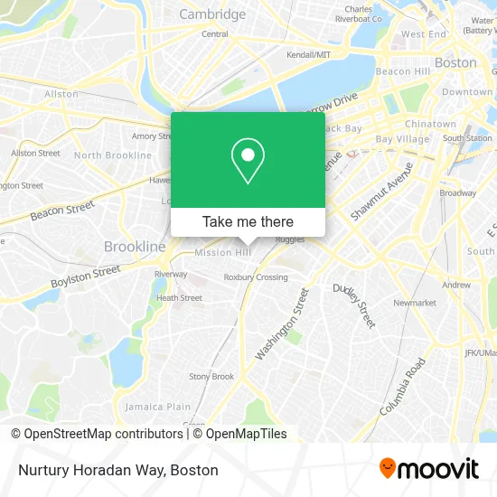
See Nurtury Horadan Way, Boston, on the map
Public Transit to Nurtury Horadan Way in Boston
Wondering how to get to Nurtury Horadan Way in Boston? Moovit helps you find the best way to get to Nurtury Horadan Way with step-by-step directions from the nearest public transit station.
Moovit provides free maps and live directions to help you navigate through your city. View schedules, routes, timetables, and find out how long does it take to get to Nurtury Horadan Way in real time.
Looking for the nearest stop or station to Nurtury Horadan Way? Check out this list of stops closest to your destination: Huntington Ave @ Longwood Ave; Roxbury Crossing; Tremont St @ Columbus Ave; Tremont St Opp Roxbury Crossing Sta; Tremont St @ Roxbury Crossing Station; Malcolm X Blvd @ Tremont St; Ruggles St @ Huntington Ave; Brigham Circle; Ruggles.
Bus: 39, 47, 66, 85, 28, 35, GREEN LINE E SHUTTLE, 19.Train: PROVIDENCE/STOUGHTON, FRANKLIN/FOXBORO, NEEDHAM.Subway: GREEN LINE E, ORANGE LINE.
Want to see if there’s another route that gets you there at an earlier time? Moovit helps you find alternative routes or times. Get directions from and directions to Nurtury Horadan Way easily from the Moovit App or Website.
We make riding to Nurtury Horadan Way easy, which is why over 1.7 million users, including users in Boston, trust Moovit as the best app for public transit. You don’t need to download an individual bus app or train app, Moovit is your all-in-one transit app that helps you find the best bus time or train time available.
For information on prices of bus, subway and train, costs and ride fares to Nurtury Horadan Way, please check the Moovit app.
Use the app to navigate to popular places including to the airport, hospital, stadium, grocery store, mall, coffee shop, school, college, and university.
Nurtury Horadan Way Address: 38 Horadan Way street in Boston
- Horadan Way Building 42 ,
- Parker St & Station St,
- Maurice J Tobin,
- Tobin Community Center,
- Boston City Hall,
- Valor,
- Tavern of Tales,
- Boston's Basilica (Basilica of Our Lady of Perpetual Help),
- Milkweed,
- Crispy Dough Pizzeria (Crispy Dough Pizza Menu),
- Mission Church,
- C-Store (MassART/Wentworth),
- Kush Groove,
- Canna Nation,
- Local Locksmith Company,
- Wentworth Institute of Technology - Annex Buildings,
- Global Luxury Suites at Longwood,
- Jvue at the Lma,
- Massachusetts College of Art and Design,
- MBTA Roxbury Crossing Station
Places Near Nurtury Horadan Way (Boston)
- Castle Island, Boston,
- Wang Theater, Boston,
- House Of Blues, Boston,
- Boston Children's Hospital, Boston,
- Seaport District, Boston,
- Wilbur Theatre, Boston,
- Leader Bank Pavilion (Leader Bank Pavillion), Boston,
- Boston Common, Boston,
- North End, Boston,
- Td Garden, Boston,
- Prudential Center, Boston,
- Quincy Market, Boston,
- Museum Of Science, Boston,
- Massachusetts General Hospital, Boston,
- Mgm Music Hall, Boston,
- Boston Medical Center, Boston,
- Isabella Stewart Gardner Museum, Boston,
- Boston Convention & Exhibition Center, Boston,
- Faneuil Hall, Boston,
- Cheers, Boston
How to get to popular places in Boston with public transit
Get around Boston by public transit!
Traveling around Boston has never been so easy. See step by step directions as you travel to any attraction, street or major public transit station. View bus and train schedules, arrival times, service alerts and detailed routes on a map, so you know exactly how to get to anywhere in Boston.
When traveling to any destination around Boston use Moovit's Live Directions with Get Off Notifications to know exactly where and how far to walk, how long to wait for your line, and how many stops are left. Moovit will alert you when it's time to get off — no need to constantly re-check whether yours is the next stop.
Wondering how to use public transit in Boston or how to pay for public transit in Boston? Moovit public transit app can help you navigate your way with public transit easily, and at minimum cost. It includes public transit fees, ticket prices, and costs. Looking for a map of Boston public transit lines? Moovit public transit app shows all public transit maps in Boston with all Bus, Train, Subway and Ferry routes and stops on an interactive map.
Boston has 4 transit type(s), including: Bus, Train, Subway and Ferry, operated by several transit agencies, including MBTA, Southeastern Regional Transit Authority, MetroWest Regional Transit Authority, Rhode Island Public Transit Authority, WRTA, Lowell Regional Transit Authority, Merrimack Valley Transit, Montachusett Regional Transit Authority, Cape Cod Regional Transit Authority, Brockton Area Transit Authority, Martha's Vineyard Transit Authority, the WAVE - Nantucket Regional Transit Authority, GATRA, Cape Ann Transportation Authority and Massport