Directions to Nutley High School (Nutley, Nj) with public transportation
The following transit lines have routes that pass near Nutley High School
How to get to Nutley High School by bus?
Click on the bus route to see step by step directions with maps, line arrival times and updated time schedules.
How to get to Nutley High School by train?
Click on the train route to see step by step directions with maps, line arrival times and updated time schedules.
Bus stations near Nutley High School in Nutley, Nj
- Park Ave At Tontine Ave, 37 min walk,
- Delawanna Ave At Delawanna Station, 40 min walk,
Train stations near Nutley High School in Nutley, Nj
- Delawanna , 40 min walk,
Bus lines to Nutley High School in Nutley, Nj
- 192, Allwood Circle Via Nutley,
- 199, Clifton Via Nutley,
- 74, 74u Branch Brook Park Station Via Union Ave Via Delawanna-Ex,
- 190, 190d Paterson Local Via Delawanna & Passaic Ave,
What are the closest stations to Nutley High School?
The closest stations to Nutley High School are:
- Park Ave At Tontine Ave is 3098 yards away, 37 min walk.
- Delawanna Ave At Delawanna Station is 3309 yards away, 40 min walk.
- Delawanna is 3317 yards away, 40 min walk.
Which bus lines stop near Nutley High School?
These bus lines stop near Nutley High School: 13, 192, 74.
Which train line stops near Nutley High School?
MCL
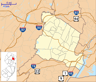
See Nutley High School, Nutley, Nj, on the map
Public Transit to Nutley High School in Nutley, Nj
Wondering how to get to Nutley High School in Nutley, Nj, United States? Moovit helps you find the best way to get to Nutley High School with step-by-step directions from the nearest public transit station.
Moovit provides free maps and live directions to help you navigate through your city. View schedules, routes, timetables, and find out how long does it take to get to Nutley High School in real time.
Looking for the nearest stop or station to Nutley High School? Check out this list of stops closest to your destination: Park Ave At Tontine Ave; Delawanna Ave At Delawanna Station; Delawanna .
Bus: 13, 192, 74, 199, 190.Train: MCL, PJL.
Want to see if there’s another route that gets you there at an earlier time? Moovit helps you find alternative routes or times. Get directions from and directions to Nutley High School easily from the Moovit App or Website.
We make riding to Nutley High School easy, which is why over 1.5 million users, including users in Nutley, Nj, trust Moovit as the best app for public transit. You don’t need to download an individual bus app or train app, Moovit is your all-in-one transit app that helps you find the best bus time or train time available.
For information on prices of bus, train, light rail and subway, costs and ride fares to Nutley High School, please check the Moovit app.
Use the app to navigate to popular places including to the airport, hospital, stadium, grocery store, mall, coffee shop, school, college, and university.
Location: Nutley, Nj, New York - New Jersey
Attractions near Nutley High School
Nutley Station,Whitford Ave (whitford ave nutley),286 Nutley Ave,130 Whitford Avenue,Nutley Dogwood,Positive Impact Partners LLC,Ceramic Tile,Richard Clark,Franklin Floors Inc,All City Contracting,K R M Electric Inc,Snap-On Tools,Chestnut St Whitford,201 Whitford Avenue,St George,Passaic Ave (vreeland ave passaic),Passaic Vreeland,Vreeland Ave Passaic,Sydney Shuttle Corp,Brittashan Enterprise CorpHow to get to popular attractions in Nutley, Nj with public transit
Uptown NY, Manhattan,Chinatown, Manhattan,210 East 64th Street, Manhattan,E 34th St (34th street and 1st ave), Manhattan,1 Police Plaza (Nypd Headquarters), Manhattan,Jamaican Consulate, Manhattan,Citi Field, Queens,333 East 38th Street, Manhattan,Community Coach Bus 77, West Orange, Nj,24 bus stop orange nj, West Orange, Nj,Rutgers, New Brunswick, Nj,Little Italy, Manhattan,1000 5th Avenue, Manhattan,2541-2549 Bainbridge Avenue, Bronx,51, Jersey City, Nj,The Mills At Jersey Gardens, Elizabeth, Nj,Charging Bull, Manhattan,633 3rd Avenue, Manhattan,Metropolitan Hospital, Manhattan,Museum of Modern Art (MoMA), ManhattanGet around New York - New Jersey by public transit!
Traveling around New York - New Jersey has never been so easy. See step by step directions as you travel to any attraction, street or major public transit station. View bus and train schedules, arrival times, service alerts and detailed routes on a map, so you know exactly how to get to anywhere in New York - New Jersey.
When traveling to any destination around New York - New Jersey use Moovit's Live Directions with Get Off Notifications to know exactly where and how far to walk, how long to wait for your line, and how many stops are left. Moovit will alert you when it's time to get off — no need to constantly re-check whether yours is the next stop.
Wondering how to use public transit in New York - New Jersey or how to pay for public transit in New York - New Jersey? Moovit public transit app can help you navigate your way with public transit easily, and at minimum cost. It includes public transit fees, ticket prices, and costs. Looking for a map of New York - New Jersey public transit lines? Moovit public transit app shows all public transit maps in New York - New Jersey with all Bus, Train, Subway, Light Rail, Ferry and Cable Car routes and stops on an interactive map.
New York - New Jersey has 6 transit type(s), including: Bus, Train, Subway, Light Rail, Ferry and Cable Car, operated by several transit agencies, including MTA Subway, Metro-North Railroad, LIRR, PATH, Shore Line East, MTA Bus Company, MTA New York City Transit - Express routes, MTA Bus, NJ Transit, NYC Ferry, NICE bus, Bee-Line Bus, NJ Transit Rail, Norwalk Transit District, CTTransit - Waterbury-Meriden