How to get to Nutrition Services - Weight Management Programs by bus?
Click on the bus route to see step by step directions with maps, line arrival times and updated time schedules.
Bus stop near Nutrition Services - Weight Management Programs in Boston
- Rosebrook, 25 min walk,VIEW
Train station near Nutrition Services - Weight Management Programs in Boston
- Wareham Village, 46 min walk,VIEW
Bus lines to Nutrition Services - Weight Management Programs in Boston
- L4, Cranberry Plaza,VIEW
What are the closest stations to Nutrition Services - Weight Management Programs?
The closest stations to Nutrition Services - Weight Management Programs are:
- Rosebrook is 2049 yards away, 25 min walk.
- Wareham Village is 3958 yards away, 46 min walk.
Which bus lines stop near Nutrition Services - Weight Management Programs?
These bus lines stop near Nutrition Services - Weight Management Programs: L4, WARE.
What time is the first bus to Nutrition Services - Weight Management Programs in Boston?
The L4 is the first bus that goes to Nutrition Services - Weight Management Programs in Boston. It stops nearby at 8:42 AM.
What time is the last bus to Nutrition Services - Weight Management Programs in Boston?
The L4 is the last bus that goes to Nutrition Services - Weight Management Programs in Boston. It stops nearby at 3:57 PM.
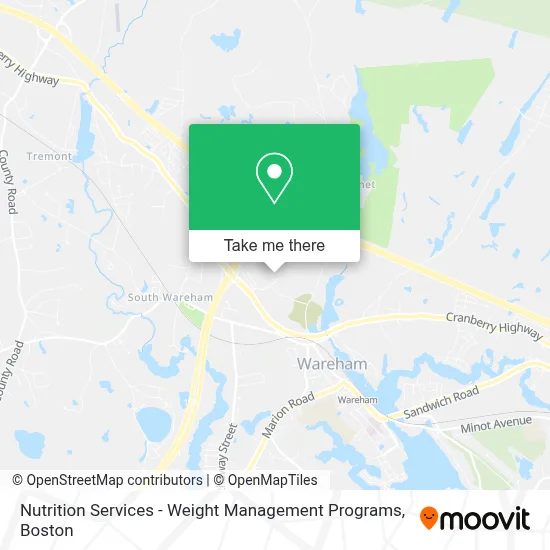
See Nutrition Services - Weight Management Programs, Boston, on the map
Public Transit to Nutrition Services - Weight Management Programs in Boston
Wondering how to get to Nutrition Services - Weight Management Programs in Boston? Moovit helps you find the best way to get to Nutrition Services - Weight Management Programs with step-by-step directions from the nearest public transit station.
Moovit provides free maps and live directions to help you navigate through your city. View schedules, routes, timetables, and find out how long does it take to get to Nutrition Services - Weight Management Programs in real time.
Looking for the nearest stop or station to Nutrition Services - Weight Management Programs? Check out this list of stops closest to your destination: Rosebrook; Wareham Village.
Bus: L4, WARE.Train: CAPEFLYER.
Want to see if there’s another route that gets you there at an earlier time? Moovit helps you find alternative routes or times. Get directions from and directions to Nutrition Services - Weight Management Programs easily from the Moovit App or Website.
We make riding to Nutrition Services - Weight Management Programs easy, which is why over 1.7 million users, including users in Boston, trust Moovit as the best app for public transit. You don’t need to download an individual bus app or train app, Moovit is your all-in-one transit app that helps you find the best bus time or train time available.
For information on prices of bus and train, costs and ride fares to Nutrition Services - Weight Management Programs, please check the Moovit app.
Use the app to navigate to popular places including to the airport, hospital, stadium, grocery store, mall, coffee shop, school, college, and university.
Nutrition Services - Weight Management Programs Address: 100 Rosebrook Way street in Boston
- Southcoast Health Center,
- Thomas Streeter MD,
- Local Auto Glass Glass Auto,
- ADT 24 7 Alarm & Security,
- D'Oliveira & Associates,
- Towneplace Suites by Marriott-Wareham Buzzards Bay,Towneplace Suites by Marriott-Wareham,
- Technical Solutions,
- Ninety Nine Restaurant,
- Rosebrook Event Center,
- Brown Bag Express,
- DUNKIN',
- Scottish Rite, Valley of Southeastern Massachusetts,
- Exit 39/RT-28/W,
- Salvation Army Thrift Store,
- Police Administration,
- Whitney Marc,
- Interstate Batteries,
- Cape Cod Choppers,
- Southcoast Health Orthopedic Surgery,
- Auto Glass Near Me Glass Auto
Places Near Nutrition Services - Weight Management Programs (Boston)
- Faneuil Hall, Boston,
- Castle Island, Boston,
- Museum Of Science, Boston,
- Wilbur Theatre, Boston,
- Isabella Stewart Gardner Museum, Boston,
- Massachusetts General Hospital, Boston,
- North End, Boston,
- Seaport District, Boston,
- Leader Bank Pavilion (Leader Bank Pavillion), Boston,
- Boston Convention & Exhibition Center, Boston,
- Boston Common, Boston,
- Quincy Market, Boston,
- Prudential Center, Boston,
- Boston Medical Center, Boston,
- Mgm Music Hall, Boston,
- Cheers, Boston,
- Wang Theater, Boston,
- Td Garden, Boston,
- Boston Children's Hospital, Boston,
- House Of Blues, Boston
How to get to popular places in Boston with public transit
Get around Boston by public transit!
Traveling around Boston has never been so easy. See step by step directions as you travel to any attraction, street or major public transit station. View bus and train schedules, arrival times, service alerts and detailed routes on a map, so you know exactly how to get to anywhere in Boston.
When traveling to any destination around Boston use Moovit's Live Directions with Get Off Notifications to know exactly where and how far to walk, how long to wait for your line, and how many stops are left. Moovit will alert you when it's time to get off — no need to constantly re-check whether yours is the next stop.
Wondering how to use public transit in Boston or how to pay for public transit in Boston? Moovit public transit app can help you navigate your way with public transit easily, and at minimum cost. It includes public transit fees, ticket prices, and costs. Looking for a map of Boston public transit lines? Moovit public transit app shows all public transit maps in Boston with all Bus, Train, Subway and Ferry routes and stops on an interactive map.
Boston has 4 transit type(s), including: Bus, Train, Subway and Ferry, operated by several transit agencies, including MBTA, Southeastern Regional Transit Authority, MetroWest Regional Transit Authority, Rhode Island Public Transit Authority, WRTA, Lowell Regional Transit Authority, Merrimack Valley Transit, Montachusett Regional Transit Authority, Cape Cod Regional Transit Authority, Brockton Area Transit Authority, Martha's Vineyard Transit Authority, the WAVE - Nantucket Regional Transit Authority, GATRA, Cape Ann Transportation Authority and Massport