How to get to ONP by bus?
Click on the bus route to see step by step directions with maps, line arrival times and updated time schedules.
From AV EL MURO CUADRA 5 MARISCAL CACERES, San Juan D
76 minFrom Av. Las Flores - San Juan de Lurigancho, San Juan D
42 minFrom RENIEC, Jesus Mari
28 minFrom NATCLAR, La Victori
44 minFrom Cementerio Campo Fe, Puente Pie
34 minFrom HOTEL LOS DELFINES, San Isidro
47 minFrom Av. Del Ejército con Av. Brasil, Magdalena
39 minFrom Mercado Mayorista de Frutas, San Luis
45 minFrom Perú Bus/Soyuz - Terminal De Cercanías (Cargo), La Victori
39 min
Bus stops near ONP in Independen
Bus lines to ONP in Independen
- 1326 SX, Galerías San Lazaro (Independencia) - Aeropuerto (Callao) ,VIEW
- 1005, Huánuco (La Victoria) - Punchauca (Carabayllo),VIEW
- 1010, Pte. Piedra - Magdalena - Pte. Piedra,VIEW
- 1016, La Florida (Ancon) - Aviación (La Victoria),VIEW
- 1017, Ancón - La Victoria,VIEW
- 1024, Los Sauces - Cerro Candela,VIEW
- 1030, Canta Callao (San Martin De Porres) - San Diego (San Martin De Porres),VIEW
- 1033, S.M.P. - La Victoria - S.M.P.,VIEW
- 1131, Gamarra (La Victoria),VIEW
- 1159, Jesús María - Oquendo,VIEW
- 1160, Pachacútec (Ventanilla) - Gamarra (La Victoria),VIEW
- 1168, Ventanilla - Panam. Norte - Alfonso Ugarte - Salaverry - Panamericana Norte - Ancón,VIEW
- 1176, Collique (Comas) - Faraday (Ate),VIEW
- 1177, Torre Blanca (Carabayllo) - Metropolitana (Ate),VIEW
- 1178, Tagore (Ate) - Km.22 (Carabayllo),VIEW
- 1179, Miramar (Ancón) - Upc (Santiago De Surco),VIEW
- 1180, Pamplona Alta (San Juan De Miraflores) - Torre Blanca (Carabayllo),VIEW
- 1183, Carabayllo - Surco - Carabayllo,VIEW
- 1185, Ensenada (Puente Piedra) - Av. Lima (Villa El Salvador),VIEW
- 1208, Pte. Piedra - S.M.P.,VIEW
What are the closest stations to ONP?
The closest stations to ONP are:
- Plaza Norte is 115 meters away, 2 min walk.
- Panamericana Norte is 473 meters away, 7 min walk.
- Tomás Valle is 474 meters away, 7 min walk.
- Pilas is 500 meters away, 7 min walk.
- Marco Polo, 1694 is 510 meters away, 7 min walk.
Which bus lines stop near ONP?
These bus lines stop near ONP: 1005, 1016, 1168, 1179, 1180, 1183, 1235, 1468, 1476.
What’s the nearest bus station to ONP in Independen?
The nearest bus station to ONP in Independen is Plaza Norte. It’s a 2 min walk away.
What time is the first bus to ONP in Independen?
The 1180 is the first bus that goes to ONP in Independen. It stops nearby at 3:44 AM.
What time is the last bus to ONP in Independen?
The 1326 SX is the last bus that goes to ONP in Independen. It stops nearby at 2:24 AM.
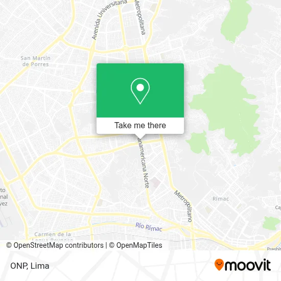
See ONP, Independen, on the map
Public Transit to ONP in Independen
Wondering how to get to ONP in Independen? Moovit helps you find the best way to get to ONP with step-by-step directions from the nearest public transit station.
Moovit provides free maps and live directions to help you navigate through your city. View schedules, routes, timetables, and find out how long does it take to get to ONP in real time.
Looking for the nearest stop or station to ONP? Check out this list of stops closest to your destination: Plaza Norte; Panamericana Norte; Tomás Valle; Pilas; Marco Polo.
Bus: 1005, 1016, 1168, 1179, 1180, 1183, 1235, 1468, 1476, 1326 SX, 1010, 1017, 1024, 1006, 1199, 1203, 2203, 2407, 1184, 1326, CR43, CR62, IO38.
Want to see if there’s another route that gets you there at an earlier time? Moovit helps you find alternative routes or times. Get directions from and directions to ONP easily from the Moovit App or Website.
We make riding to ONP easy, which is why over 1.5 million users, including users in Independen, trust Moovit as the best app for public transit. You don’t need to download an individual bus app or train app, Moovit is your all-in-one transit app that helps you find the best bus time or train time available.
For information on prices of bus, costs and ride fares to ONP, please check the Moovit app.
Use the app to navigate to popular places including to the airport, hospital, stadium, grocery store, mall, coffee shop, school, college, and university.
ONP Address: Mesa Redonda, 15311 Independencia street in Independen
- Aramis Salon & Spa,
- Safari Kids-Peluquería,
- The Color Factory-Figuras de Cerámica,
- Sunarp,
- Encuentros Pisco Bar,
- Argenper-Giros Internacionales,
- Alife by Magaly-Medicina Estética,
- Estudio Fotográfico El Album del Abuelo,
- Renzo Costa-Artículos de Cuero,
- Armaq,
- Argentaria-Plata,
- Euroidiomas,
- Caja Metropolitana,
- Duraplast-Productos de Plástico,
- Sole-Termas Eléctricas,
- Serpost Plaza Lima Norte,
- Subaru Plaza Lima Norte,
- Makro,
- Ilaria-Joyería,
- Epica
Places Near ONP (Independen)
- Av. Salaverry, Jesus Mari,
- Centro Comercial Plaza Norte, Independen,
- Mall Del Sur,
- Pontificia Universidad Católica del Perú - PUCP, San Miguel,
- Barranco, Barranco,
- Miraflores, Miraflores,
- Larcomar, Miraflores,
- Hospital Edgardo Rebagliati Martins, Jesus Mari,
- Av. La Marina, San Miguel,
- av arequipa, Lima,
- Circuito Mágico Del Agua, Lima,
- Real Plaza Puruchuco, Ate,
- Paradero Av.Brasil,
- Gamarra,
- Av. Abancay, Lima,
- Aeropuerto Internacional Jorge Chávez, Ventanilla,
- Parque Kennedy, Miraflores,
- Plaza San Miguel, San Miguel,
- Parque de las Leyendas, San Miguel,
- Jockey Plaza, Santiago D
How to get to popular places in Lima with public transit
Get around Independen by public transit!
Traveling around Independen has never been so easy. See step by step directions as you travel to any attraction, street or major public transit station. View bus and train schedules, arrival times, service alerts and detailed routes on a map, so you know exactly how to get to anywhere in Independen.
When traveling to any destination around Independen use Moovit's Live Directions with Get Off Notifications to know exactly where and how far to walk, how long to wait for your line, and how many stops are left. Moovit will alert you when it's time to get off — no need to constantly re-check whether yours is the next stop.
Wondering how to use public transit in Independen or how to pay for public transit in Independen? Moovit public transit app can help you navigate your way with public transit easily, and at minimum cost. It includes public transit fees, ticket prices, and costs. Looking for a map of Independen public transit lines? Moovit public transit app shows all public transit maps in Independen with all Bus, Metro and Ferry routes and stops on an interactive map.
Lima has 3 transit type(s), including: Bus, Metro and Ferry, operated by several transit agencies, including Metro de Lima Línea 2 , Metro de Lima, Corredor Rojo, Metropolitano, Metropolitano - Alimentadores, Corredor Morado, Corredor Azul, Rutas Tradicionales, Transportes y Servicios La Esperanza S.A., Las Flores S.A., Virgen de la Asunción S.A., Consorcio HAM, Transportes y Service Canadá S.A., ETUL4SA and ETUCHISA