Directions to O'Connor Dennis E (Marblehead) with public transportation
The following transit lines have routes that pass near O'Connor Dennis E
 Bus: 441, 442.
- Train: NEWBURYPORT/ROCKPORT.
How to get to O'Connor Dennis E by bus?
Click on the bus route to see step by step directions with maps, line arrival times and updated time schedules.
How to get to O'Connor Dennis E by train?
Click on the train route to see step by step directions with maps, line arrival times and updated time schedules.
Bus stop near O'Connor Dennis E in Marblehead
- Humphrey St @ Crossman Ave, 2 min walk,VIEW
Train station near O'Connor Dennis E in Marblehead
- Swampscott, 57 min walk,VIEW
Bus lines to O'Connor Dennis E in Marblehead
What are the closest stations to O'Connor Dennis E?
The closest stations to O'Connor Dennis E are:
- Humphrey St @ Crossman Ave is 121 yards away, 2 min walk.
- Swampscott is 4855 yards away, 57 min walk.
Which bus lines stop near O'Connor Dennis E?
These bus lines stop near O'Connor Dennis E: 441, 442.
Which train line stops near O'Connor Dennis E?
NEWBURYPORT/ROCKPORT (#27 | Rockport)
What’s the nearest bus station to O'Connor Dennis E in Marblehead?
The nearest bus station to O'Connor Dennis E in Marblehead is Humphrey St @ Crossman Ave. It’s a 2 min walk away.
What time is the first train to O'Connor Dennis E in Marblehead?
The NEWBURYPORT/ROCKPORT is the first train that goes to O'Connor Dennis E in Marblehead. It stops nearby at 5:27 AM.
What time is the last train to O'Connor Dennis E in Marblehead?
The NEWBURYPORT/ROCKPORT is the last train that goes to O'Connor Dennis E in Marblehead. It stops nearby at 12:20 AM.
What time is the first bus to O'Connor Dennis E in Marblehead?
The 442 is the first bus that goes to O'Connor Dennis E in Marblehead. It stops nearby at 5:19 AM.
What time is the last bus to O'Connor Dennis E in Marblehead?
The 442 is the last bus that goes to O'Connor Dennis E in Marblehead. It stops nearby at 1:03 AM.
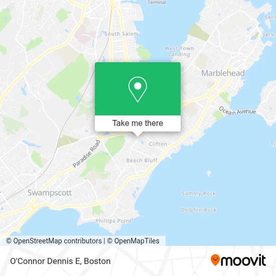
See O'Connor Dennis E, Marblehead, on the map
Public Transit to O'Connor Dennis E in Marblehead
Wondering how to get to O'Connor Dennis E in Marblehead? Moovit helps you find the best way to get to O'Connor Dennis E with step-by-step directions from the nearest public transit station.
Moovit provides free maps and live directions to help you navigate through your city. View schedules, routes, timetables, and find out how long does it take to get to O'Connor Dennis E in real time.
Looking for the nearest stop or station to O'Connor Dennis E? Check out this list of stops closest to your destination: Humphrey St @ Crossman Ave; Swampscott.
Bus: 441, 442.Train: NEWBURYPORT/ROCKPORT.
Want to see if there’s another route that gets you there at an earlier time? Moovit helps you find alternative routes or times. Get directions from and directions to O'Connor Dennis E easily from the Moovit App or Website.
We make riding to O'Connor Dennis E easy, which is why over 1.7 million users, including users in Marblehead, trust Moovit as the best app for public transit. You don’t need to download an individual bus app or train app, Moovit is your all-in-one transit app that helps you find the best bus time or train time available.
For information on prices of bus and train, costs and ride fares to O'Connor Dennis E, please check the Moovit app.
Use the app to navigate to popular places including to the airport, hospital, stadium, grocery store, mall, coffee shop, school, college, and university.
O'Connor Dennis E Address: 2 Brookhouse Dr street in Marblehead
- Understanding Cam Foundation,
- Marblehead MA Locksmith Store,
- Ruocco Group,
- Donald I. Rothenberg, DMD,
- Sandy B Fishing Charters,
- Presto Painting & Construction,
- Short Courses,
- Healy Alan S,
- North Shore Shuttle,
- Dr Alexander Angelov,
- Salem State College,
- Haul Away Today,
- Eastern Bank,
- Party City,
- Carepath Global Foundation, Inc.,
- Amazon Locker - Fouine,
- FedEx,
- Hilary W. Foutes - Realtor,
- Western Union,
- Shari Sagan Mcguirk
Places Near O'Connor Dennis E (Marblehead)
- Massachusetts General Hospital, Boston,
- Boston Convention & Exhibition Center, Boston,
- Cheers, Boston,
- North End, Boston,
- Mgm Music Hall, Boston,
- Seaport District, Boston,
- Museum Of Science, Boston,
- Isabella Stewart Gardner Museum, Boston,
- Td Garden, Boston,
- Boston Children's Hospital, Boston,
- Castle Island, Boston,
- Prudential Center, Boston,
- Boston Common, Boston,
- Leader Bank Pavilion (Leader Bank Pavillion), Boston,
- Wang Theater, Boston,
- Faneuil Hall, Boston,
- Boston Medical Center, Boston,
- Quincy Market, Boston,
- House Of Blues, Boston,
- Wilbur Theatre, Boston
How to get to popular places in Boston with public transit
Get around Marblehead by public transit!
Traveling around Marblehead has never been so easy. See step by step directions as you travel to any attraction, street or major public transit station. View bus and train schedules, arrival times, service alerts and detailed routes on a map, so you know exactly how to get to anywhere in Marblehead.
When traveling to any destination around Marblehead use Moovit's Live Directions with Get Off Notifications to know exactly where and how far to walk, how long to wait for your line, and how many stops are left. Moovit will alert you when it's time to get off — no need to constantly re-check whether yours is the next stop.
Wondering how to use public transit in Marblehead or how to pay for public transit in Marblehead? Moovit public transit app can help you navigate your way with public transit easily, and at minimum cost. It includes public transit fees, ticket prices, and costs. Looking for a map of Marblehead public transit lines? Moovit public transit app shows all public transit maps in Marblehead with all Bus, Train, Subway and Ferry routes and stops on an interactive map.
Boston has 4 transit type(s), including: Bus, Train, Subway and Ferry, operated by several transit agencies, including MBTA, Southeastern Regional Transit Authority, MetroWest Regional Transit Authority, Rhode Island Public Transit Authority, WRTA, Lowell Regional Transit Authority, Merrimack Valley Transit, Montachusett Regional Transit Authority, Cape Cod Regional Transit Authority, Brockton Area Transit Authority, Martha's Vineyard Transit Authority, the WAVE - Nantucket Regional Transit Authority, GATRA, Cape Ann Transportation Authority and Massport