Directions to O'Hagan Meyer (Boston) with public transportation
The following transit lines have routes that pass near O'Hagan Meyer
 Bus: 1, 39, 504, BB, 501.
- Train: FITCHBURG, HAVERHILL, FOXBORO EVENT SERVICE, FRAMINGHAM/WORCESTER, FRANKLIN/FOXBORO.
- Subway: GREEN LINE B, GREEN LINE C, GREEN LINE E, ORANGE LINE, GREEN LINE D.
How to get to O'Hagan Meyer by bus?
Click on the bus route to see step by step directions with maps, line arrival times and updated time schedules.
From Wollaston Beach, Quincy
120 minFrom Beth Israel Deaconess Hospital-Milton, Milton
86 minFrom Staybridge Suites Boston-Quincy, Quincy
97 minFrom Mount Auburn, Cambridge
45 minFrom Milton, MA, Milton
74 minFrom McLean Hospital, Belmont
68 minFrom Milton Academy, Milton
95 minFrom Revere, MA, Revere
73 minFrom Qea, Quincy
108 minFrom Malden, MA, Malden
71 min
How to get to O'Hagan Meyer by train?
Click on the train route to see step by step directions with maps, line arrival times and updated time schedules.
How to get to O'Hagan Meyer by subway?
Click on the subway route to see step by step directions with maps, line arrival times and updated time schedules.
Bus stops near O'Hagan Meyer in Boston
Subway station near O'Hagan Meyer in Boston
- Copley, 7 min walk,VIEW
Train station near O'Hagan Meyer in Boston
- Back Bay - South End, 9 min walk,VIEW
Bus lines to O'Hagan Meyer in Boston
- 39, Haymarket Via Forest Hills,VIEW
- GREEN LINE E SHUTTLE, Prudential (Shuttle),VIEW
- GREEN LINE E SHUTTLE, Park Street (Shuttle),VIEW
- 55, West Fenway,VIEW
- 57, Haymarket Via Kenmore,VIEW
- 501, Downtown via Copley (Express) - Brighton via Copley (Express),VIEW
- 504, Downtown via Copley (Express) - Watertown via Copley and Newton Corner (Express),VIEW
- GREEN LINE B SHUTTLE, Babcock Street - Back Bay,VIEW
- GREEN LINE B SHUTTLE, Boston College - Back Bay (Shuttle),VIEW
- GREEN LINE B SHUTTLE, Kenmore - Back Bay via Copley (Shuttle),VIEW
- GREEN LINE B SHUTTLE, Babcock Street - Back Bay via Copley (Shuttle),VIEW
- GREEN LINE D SHUTTLE, Brookline Hills - Back Bay (Shuttle),VIEW
- GREEN LINE SHUTTLE, Kenmore - Back Bay,VIEW
- GREEN LINE SHUTTLE, Kenmore - Copley,VIEW
- BB, Back Bay,VIEW
- 9, Kenmore Via Boston Latin,VIEW
- 10, Arlington via South Bay Center - City Point via South Bay Center,VIEW
- GREEN LINE B SHUTTLE, Boston University East - Back Bay,VIEW
- GREEN LINE C SHUTTLE, Saint Mary's Street - Back Bay,VIEW
- GREEN LINE SHUTTLE, Boston University East - Park Street,VIEW
What are the closest stations to O'Hagan Meyer?
The closest stations to O'Hagan Meyer are:
- Huntington Ave @ Prudential Station is 322 yards away, 6 min walk.
- Belvidere St @ Huntington Ave is 376 yards away, 7 min walk.
- Stuart St @ Dartmouth St is 457 yards away, 6 min walk.
- Announcement #4 - Back Bay To Airport is 487 yards away, 6 min walk.
- Huntington Ave @ Belvidere St is 527 yards away, 7 min walk.
- Copley is 551 yards away, 7 min walk.
- Boylston St @ Dartmouth St is 592 yards away, 8 min walk.
- Back Bay - South End is 693 yards away, 9 min walk.
Which bus lines stop near O'Hagan Meyer?
These bus lines stop near O'Hagan Meyer: 1, 39, 504, BB.
Which train lines stop near O'Hagan Meyer?
These train lines stop near O'Hagan Meyer: FITCHBURG, HAVERHILL.
Which subway lines stop near O'Hagan Meyer?
These subway lines stop near O'Hagan Meyer: GREEN LINE B, GREEN LINE C, GREEN LINE E, ORANGE LINE.
What’s the nearest subway station to O'Hagan Meyer in Boston?
The nearest subway station to O'Hagan Meyer in Boston is Copley. It’s a 7 min walk away.
What’s the nearest train station to O'Hagan Meyer in Boston?
The nearest train station to O'Hagan Meyer in Boston is Back Bay - South End. It’s a 9 min walk away.
What’s the nearest bus station to O'Hagan Meyer in Boston?
The nearest bus stations to O'Hagan Meyer in Boston are Huntington Ave @ Prudential Station, Stuart St @ Dartmouth St and Announcement #4 - Back Bay To Airport. The closest one is a 6 min walk away.
What time is the first subway to O'Hagan Meyer in Boston?
The GREEN LINE D is the first subway that goes to O'Hagan Meyer in Boston. It stops nearby at 5:03 AM.
What time is the last subway to O'Hagan Meyer in Boston?
The GREEN LINE D is the last subway that goes to O'Hagan Meyer in Boston. It stops nearby at 2:15 AM.
What time is the first train to O'Hagan Meyer in Boston?
The PROVIDENCE/STOUGHTON is the first train that goes to O'Hagan Meyer in Boston. It stops nearby at 4:25 AM.
What time is the last train to O'Hagan Meyer in Boston?
The LAKE SHORE LIMITED is the last train that goes to O'Hagan Meyer in Boston. It stops nearby at 8:26 PM.
What time is the first bus to O'Hagan Meyer in Boston?
The 57 is the first bus that goes to O'Hagan Meyer in Boston. It stops nearby at 4:51 AM.
What time is the last bus to O'Hagan Meyer in Boston?
The 10 is the last bus that goes to O'Hagan Meyer in Boston. It stops nearby at 1:15 AM.
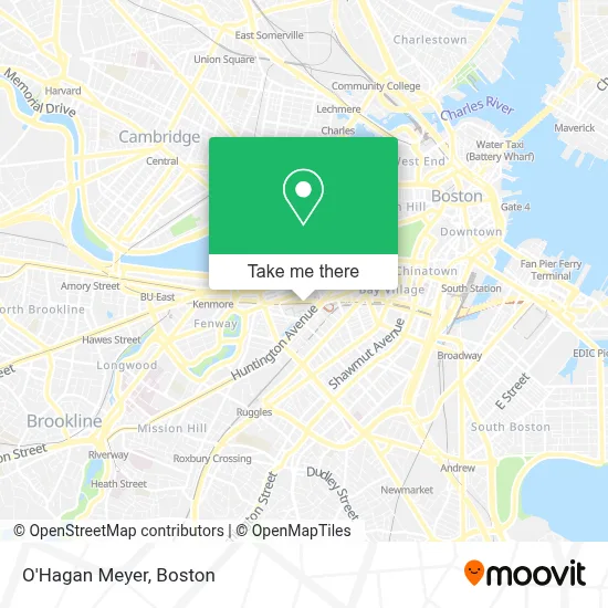
See O'Hagan Meyer, Boston, on the map
Public Transit to O'Hagan Meyer in Boston
Wondering how to get to O'Hagan Meyer in Boston? Moovit helps you find the best way to get to O'Hagan Meyer with step-by-step directions from the nearest public transit station.
Moovit provides free maps and live directions to help you navigate through your city. View schedules, routes, timetables, and find out how long does it take to get to O'Hagan Meyer in real time.
Looking for the nearest stop or station to O'Hagan Meyer? Check out this list of stops closest to your destination: Huntington Ave @ Prudential Station; Belvidere St @ Huntington Ave; Stuart St @ Dartmouth St; Announcement #4 - Back Bay To Airport; Huntington Ave @ Belvidere St; Copley; Boylston St @ Dartmouth St; Back Bay - South End.
Bus: 1, 39, 504, BB, 501, GREEN LINE B SHUTTLE, GREEN LINE B SHUTTLE, GREEN LINE B SHUTTLE, GREEN LINE E SHUTTLE, GREEN LINE E SHUTTLE, 9.Train: FITCHBURG, HAVERHILL, FOXBORO EVENT SERVICE, FRAMINGHAM/WORCESTER, FRANKLIN/FOXBORO, NEEDHAM, ORANGE LINE.Subway: GREEN LINE B, GREEN LINE C, GREEN LINE E, ORANGE LINE, GREEN LINE D.
Want to see if there’s another route that gets you there at an earlier time? Moovit helps you find alternative routes or times. Get directions from and directions to O'Hagan Meyer easily from the Moovit App or Website.
We make riding to O'Hagan Meyer easy, which is why over 1.7 million users, including users in Boston, trust Moovit as the best app for public transit. You don’t need to download an individual bus app or train app, Moovit is your all-in-one transit app that helps you find the best bus time or train time available.
For information on prices of subway, bus and train, costs and ride fares to O'Hagan Meyer, please check the Moovit app.
Use the app to navigate to popular places including to the airport, hospital, stadium, grocery store, mall, coffee shop, school, college, and university.
O'Hagan Meyer Address: 111 Huntington Ave Ste 2860 street in Boston
- Rapid7,
- Dental Partners of Boston at Prudential Center,
- Accenture,
- USPS (United States Postal Service),
- St Francis Chapel (Saint Francis Chapel),
- Laderach,
- Bond No 9 Boston,
- Fifth Third Bank the,
- Eversource,
- Strayboots (Stray Boots),
- Eddie V's,
- Cava,
- Microsoft Store Prudential Center,
- Hugo Boss (Boss Shop),
- Unicorn,
- Celine Boston Saks Fifth Avenue Leather Goods,
- Prudential Center,
- Louis Vuitton,
- Läuderach,
- Prudential Tunnel
Places Near O'Hagan Meyer (Boston)
- Boston Convention & Exhibition Center, Boston,
- Mgm Music Hall, Boston,
- Quincy Market, Boston,
- North End, Boston,
- Boston Children's Hospital, Boston,
- Leader Bank Pavilion (Leader Bank Pavillion), Boston,
- Wang Theater, Boston,
- Seaport District, Boston,
- Prudential Center, Boston,
- House Of Blues, Boston,
- Cheers, Boston,
- Isabella Stewart Gardner Museum, Boston,
- Massachusetts General Hospital, Boston,
- Wilbur Theatre, Boston,
- Boston Common, Boston,
- Castle Island, Boston,
- Faneuil Hall, Boston,
- Td Garden, Boston,
- Museum Of Science, Boston,
- Boston Medical Center, Boston
How to get to popular places in Boston with public transit
Get around Boston by public transit!
Traveling around Boston has never been so easy. See step by step directions as you travel to any attraction, street or major public transit station. View bus and train schedules, arrival times, service alerts and detailed routes on a map, so you know exactly how to get to anywhere in Boston.
When traveling to any destination around Boston use Moovit's Live Directions with Get Off Notifications to know exactly where and how far to walk, how long to wait for your line, and how many stops are left. Moovit will alert you when it's time to get off — no need to constantly re-check whether yours is the next stop.
Wondering how to use public transit in Boston or how to pay for public transit in Boston? Moovit public transit app can help you navigate your way with public transit easily, and at minimum cost. It includes public transit fees, ticket prices, and costs. Looking for a map of Boston public transit lines? Moovit public transit app shows all public transit maps in Boston with all Bus, Train, Subway and Ferry routes and stops on an interactive map.
Boston has 4 transit type(s), including: Bus, Train, Subway and Ferry, operated by several transit agencies, including MBTA, Southeastern Regional Transit Authority, MetroWest Regional Transit Authority, Rhode Island Public Transit Authority, WRTA, Lowell Regional Transit Authority, Merrimack Valley Transit, Montachusett Regional Transit Authority, Cape Cod Regional Transit Authority, Brockton Area Transit Authority, Martha's Vineyard Transit Authority, the WAVE - Nantucket Regional Transit Authority, GATRA, Cape Ann Transportation Authority and Massport
Public transit lines with stations closest to O'Hagan Meyer in Boston
Subway lines with stations closest to O'Hagan Meyer in Boston
Train lines with stations closest to O'Hagan Meyer in Boston
Bus lines with stations closest to O'Hagan Meyer in Boston
Stuart St @ Dartmouth St
- 501Downtown via Copley (Express) - Brighton via Copley (Express)
- 504Downtown via Copley (Express) - Watertown via Copley and Newton Corner (Express)
- GREEN LINE B SHUTTLEBabcock Street - Back Bay
- GREEN LINE B SHUTTLEBoston College - Back Bay (Shuttle)
- GREEN LINE B SHUTTLEKenmore - Back Bay via Copley (Shuttle)